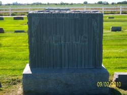
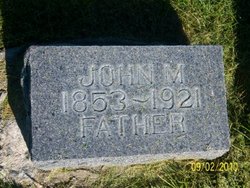
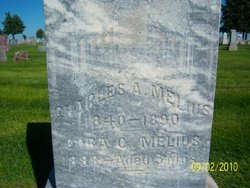
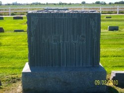
John Maurice Melius
| Birth | : | 30 Nov 1853 McConnellsburg, Fulton County, Pennsylvania, USA |
| Death | : | 1 Jul 1921 Cozad, Dawson County, Nebraska, USA |
| Burial | : | Oak Grove Cemetery, Lawton, Van Buren County, USA |
| Coordinate | : | 42.1707993, -85.8339005 |
| Plot | : | Section 3,plot 58, space 1 |
| Description | : | John Maurice Melius was born at McConnellsville, Pennsylvania, Nov 30, 1853. In Feb 1879, he moved to Nebraska on a homestead five miles NW of Cozad. He lived there for 42 years. He married Mary Ellen Bundy on March 2, 1880 and they had 11 children. He died after a lengthy illness on July 1, 1921..a true pioneer and early settler of Dawson county.Interment was in Cozad Cemetery. |
frequently asked questions (FAQ):
-
Where is John Maurice Melius's memorial?
John Maurice Melius's memorial is located at: Oak Grove Cemetery, Lawton, Van Buren County, USA.
-
When did John Maurice Melius death?
John Maurice Melius death on 1 Jul 1921 in Cozad, Dawson County, Nebraska, USA
-
Where are the coordinates of the John Maurice Melius's memorial?
Latitude: 42.1707993
Longitude: -85.8339005
Family Members:
Parent
Spouse
Siblings
Children
Flowers:
Nearby Cemetories:
1. Oak Grove Cemetery
Lawton, Van Buren County, USA
Coordinate: 42.1707993, -85.8339005
2. Chamberlin Cemetery
Lawton, Van Buren County, USA
Coordinate: 42.1349983, -85.8535995
3. Harwick Cemetery
Mattawan, Van Buren County, USA
Coordinate: 42.2153015, -85.8249969
4. Prospect Hill Cemetery
Paw Paw, Van Buren County, USA
Coordinate: 42.2019005, -85.8874969
5. Virgo Cemetery
Texas Township, Kalamazoo County, USA
Coordinate: 42.1782990, -85.7643967
6. Saint Marys Cemetery
Paw Paw, Van Buren County, USA
Coordinate: 42.2080994, -85.8852997
7. Bangs Cemetery
Paw Paw, Van Buren County, USA
Coordinate: 42.2207790, -85.8668450
8. Saint Marks Episcopal Church Columbarium
Paw Paw, Van Buren County, USA
Coordinate: 42.2208060, -85.8863340
9. Pioneer Cemetery
Paw Paw, Van Buren County, USA
Coordinate: 42.2225590, -85.8877020
10. Kern Cemetery
Porter Township, Van Buren County, USA
Coordinate: 42.1268997, -85.7683029
11. Clapp Cemetery
Paw Paw, Van Buren County, USA
Coordinate: 42.2259120, -85.8977010
12. Maple Grove Cemetery
Mattawan, Van Buren County, USA
Coordinate: 42.2369003, -85.7917023
13. Cole Cemetery
Texas Township, Kalamazoo County, USA
Coordinate: 42.1958240, -85.7314410
14. Cuddeback Cemetery
Paw Paw, Van Buren County, USA
Coordinate: 42.1753006, -85.9518967
15. Almena Cemetery
Paw Paw, Van Buren County, USA
Coordinate: 42.2638809, -85.8241614
16. Wildey Cemetery
Paw Paw, Van Buren County, USA
Coordinate: 42.2216988, -85.9567032
17. Anderson Cemetery
Decatur Township, Van Buren County, USA
Coordinate: 42.0764008, -85.8961029
18. West Oshtemo Cemetery
Oshtemo, Kalamazoo County, USA
Coordinate: 42.2760000, -85.8040000
19. Pleasant Valley Cemetery
Prairie Ronde Township, Kalamazoo County, USA
Coordinate: 42.0915030, -85.7290430
20. Hope Cemetery
Texas Corners, Kalamazoo County, USA
Coordinate: 42.1939011, -85.6857986
21. Harrison Cemetery
Decatur, Van Buren County, USA
Coordinate: 42.1070000, -85.9610000
22. Shaver Burial Ground
Schoolcraft, Kalamazoo County, USA
Coordinate: 42.1205480, -85.6917780
23. Luv Pet Cemetery
Decatur, Van Buren County, USA
Coordinate: 42.1131350, -85.9750070
24. Austin Cemetery
Paw Paw, Van Buren County, USA
Coordinate: 42.2807103, -85.9010842

