
| Birth | : | 4 Sep 1877 |
| Death | : | Jun 1930 Loup County, Nebraska, USA |
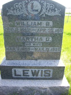
| Burial | : | Kent Cemetery, Taylor, Loup County, USA |
| Coordinate | : | 41.7416992, -99.3088989 |
| Inscription | : | Father |
| Description | : | Husband of Nora B. Mr. and Mrs. John Phillip Lewis were residents of Kent Community from March 1912 until Mr. Lewis died June, 1930 and Mrs. Lewis moved to Taylor in 1944. John Phillip Lewis was born September 4, 1876. Nora (Campain) Lewis was born June 9, 1880 near Silver Creek, in Merrick County. They were married in the home of her parents Mr. and Mrs John Campain near Silver Creek, December 25, 1900. A daughter Violet was born October 19, 1901, and they moved to a homestead... Read More |
frequently asked questions (FAQ):
-
Where is John Phillip Lewis's memorial?
John Phillip Lewis's memorial is located at: Kent Cemetery, Taylor, Loup County, USA.
-
When did John Phillip Lewis death?
John Phillip Lewis death on Jun 1930 in Loup County, Nebraska, USA
-
Where are the coordinates of the John Phillip Lewis's memorial?
Latitude: 41.7416992
Longitude: -99.3088989
Family Members:

Spouse

Children
Flowers:


Nearby Cemetories:
1. Kent Cemetery
Taylor, Loup County, USA
Coordinate: 41.7416992, -99.3088989
2. Taylor Cemetery
Taylor, Loup County, USA
Coordinate: 41.7571983, -99.3861008
3. Mount Hope Cemetery
Sargent, Custer County, USA
Coordinate: 41.6768990, -99.3855972
4. Saint Marys Cemetery
Sargent, Custer County, USA
Coordinate: 41.6768990, -99.4044037
5. Bohemian Brotherhood Cemetery
Elyria, Valley County, USA
Coordinate: 41.6618996, -99.1866989
6. Jack Shafer Memorial Cemetery
Burwell, Garfield County, USA
Coordinate: 41.8202200, -99.1835500
7. Parker Cemetery
Burwell, Garfield County, USA
Coordinate: 41.8203011, -99.1821976
8. Cottonwood Cemetery
Burwell, Garfield County, USA
Coordinate: 41.7681007, -99.1418991
9. West Union Cemetery
Sargent, Custer County, USA
Coordinate: 41.6763992, -99.4608002
10. Littlefield Cemetery
Burwell, Garfield County, USA
Coordinate: 41.8093987, -99.1389008
11. Boleszyn Cemetery
Elyria, Valley County, USA
Coordinate: 41.6691000, -99.1315000
12. Banner Cemetery
Burwell, Garfield County, USA
Coordinate: 41.8031006, -99.1235962
13. Longwood Cemetery
Comstock, Custer County, USA
Coordinate: 41.5966988, -99.2356033
14. Czech National Cemetery
Valley County, USA
Coordinate: 41.6250000, -99.1537000
15. Madison Square Cemetery
Taylor, Loup County, USA
Coordinate: 41.7694016, -99.5314026
16. Almeria Cemetery
Almeria, Loup County, USA
Coordinate: 41.8177986, -99.5128021
17. Potter Brown Cemetery
Burwell, Garfield County, USA
Coordinate: 41.7489000, -99.0668500
18. Saint Wenceslaus Catholic Cemetery
Valley County, USA
Coordinate: 41.6103000, -99.1336000
19. Somerford Cemetery
Sargent, Custer County, USA
Coordinate: 41.5793991, -99.4328003
20. Douglas Grove Cemetery
Comstock, Custer County, USA
Coordinate: 41.5489006, -99.2881012
21. Predmore Cemetery
Walworth, Custer County, USA
Coordinate: 41.6755981, -99.5674973
22. Round Park Cemetery
Valley County, USA
Coordinate: 41.5525017, -99.1825027
23. Fort Hartsuff Post Cemetery
Valley County, USA
Coordinate: 41.7225000, -99.0248000
24. West Side Cemetery
Garfield County, USA
Coordinate: 41.8128014, -99.0282974