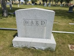
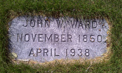
John W Ward
| Birth | : | 23 Nov 1850 Brighton, Kenosha County, Wisconsin, USA |
| Death | : | 26 Apr 1938 Choteau, Teton County, Montana, USA |
| Burial | : | Salem West Cemetery, Hitterdal, Clay County, USA |
| Coordinate | : | 46.9757300, -96.2600000 |
| Plot | : | Block 45 Lot 1, North 1/2 |
| Description | : | Choteau Acantha (MT), 28 April 1938 John W. Ward Passes in Sleep In the home that he founded in the community where he lived for 57 years, John W. Ward, 87, passed away in his sleep approximately 4 a.m. Tuesday morning. His son, Vincent, found him about 5 a.m. as he got up and went to his father's room. Thus came to an end the career of a man who came up the Missouri in a steamboat in 1881 and lived through the glamorous days of the Old West and witnessed all the changes down to the streamlined present. He had... Read More |
frequently asked questions (FAQ):
-
Where is John W Ward's memorial?
John W Ward's memorial is located at: Salem West Cemetery, Hitterdal, Clay County, USA.
-
When did John W Ward death?
John W Ward death on 26 Apr 1938 in Choteau, Teton County, Montana, USA
-
Where are the coordinates of the John W Ward's memorial?
Latitude: 46.9757300
Longitude: -96.2600000
Family Members:
Parent
Spouse
Siblings
Children
Flowers:
Nearby Cemetories:
1. Salem West Cemetery
Hitterdal, Clay County, USA
Coordinate: 46.9757300, -96.2600000
2. Salem East Cemetery
Hitterdal, Clay County, USA
Coordinate: 46.9744800, -96.2583300
3. Highland Grove Lutheran Cemetery
Highland Grove Township, Clay County, USA
Coordinate: 46.9518700, -96.2113500
4. Buffalo River Pioneer Cemetery
Cuba Township, Becker County, USA
Coordinate: 46.9650250, -96.1737160
5. Dale Immanuel Cemetery
Highland Grove Township, Clay County, USA
Coordinate: 46.9171982, -96.2169037
6. Lysne Cemetery
Cromwell Township, Clay County, USA
Coordinate: 46.9639015, -96.3752975
7. Dale Covenant Cemetery
Eglon Township, Clay County, USA
Coordinate: 46.8913994, -96.2485962
8. Keene Lutheran Cemetery
Keene Township, Clay County, USA
Coordinate: 47.0354400, -96.3650300
9. Creamery Cemetery
Ulen, Clay County, USA
Coordinate: 47.0785820, -96.2587730
10. Bethlehem Lutheran West Cemetery
Ulen Township, Clay County, USA
Coordinate: 47.0783600, -96.2803800
11. Hawley Cemetery
Hawley, Clay County, USA
Coordinate: 46.8819008, -96.3336029
12. Calvary Lutheran Cemetery
Ulen Township, Clay County, USA
Coordinate: 47.0907100, -96.2587100
13. Bethlehem Memorial Cemetery
Ulen Township, Clay County, USA
Coordinate: 47.0915900, -96.2588000
14. Atlanta Cemetery
Atlanta Township, Becker County, USA
Coordinate: 47.0522300, -96.1314440
15. Sliper Cemetery
Ulen Township, Clay County, USA
Coordinate: 47.0931015, -96.2656021
16. Eksjo Lutheran Church Cemetery
Lake Park Township, Becker County, USA
Coordinate: 46.8779300, -96.1630700
17. Spring Prairie Cemetery
Spring Prairie Township, Clay County, USA
Coordinate: 46.9319000, -96.4310989
18. Spring Prairie Hutterite Cemetery
Hawley, Clay County, USA
Coordinate: 46.9406738, -96.4486283
19. Lake Park Cemetery
Cuba Township, Becker County, USA
Coordinate: 46.8922005, -96.1038971
20. Saint Francis Xavier Catholic Cemetery
Cuba Township, Becker County, USA
Coordinate: 46.8922005, -96.1038971
21. Hegland Cemetery
Eglon Township, Clay County, USA
Coordinate: 46.8345604, -96.2715759
22. Baarstad Cemetery
Cuba Township, Becker County, USA
Coordinate: 46.9171982, -96.0691986
23. Solem Cemetery
Eglon Township, Clay County, USA
Coordinate: 46.8344800, -96.2191200
24. Oak Grove Cemetery
Lake Park, Becker County, USA
Coordinate: 46.8905983, -96.0852966

