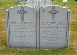
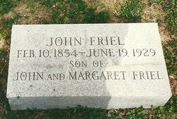
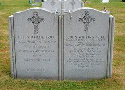
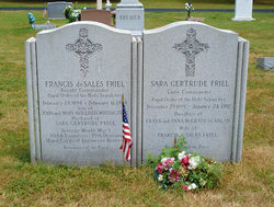
John Whiting Friel
| Birth | : | 3 Oct 1891 Centreville, Queen Anne's County, Maryland, USA |
| Death | : | 27 May 1970 |
| Burial | : | Saint Peter's Cemetery, Queenstown, Queen Anne's County, USA |
| Coordinate | : | 38.9785995, -76.1343994 |
| Description | : | The President of the United States of America, authorized by Act of Congress, July 9, 1918, takes pleasure in presenting the Distinguished Service Cross to Corporal John Whiting Friel (ASN: 2705793), United States Army, for extraordinary heroism in action while serving with Company K, 145th Infantry Regiment, 37th Division, A.E.F., near Eyne, Belgium, 2 November 1918. In full view of the enemy and under heavy artillery and machine-gun fire, Corporal Friel, with two other men, swam the Escaut River and assisted in the construction of a footbridge. The construction of this bridge aided materially in the later successful operations of... Read More |
frequently asked questions (FAQ):
-
Where is John Whiting Friel's memorial?
John Whiting Friel's memorial is located at: Saint Peter's Cemetery, Queenstown, Queen Anne's County, USA.
-
When did John Whiting Friel death?
John Whiting Friel death on 27 May 1970 in
-
Where are the coordinates of the John Whiting Friel's memorial?
Latitude: 38.9785995
Longitude: -76.1343994
Family Members:
Parent
Spouse
Siblings
Flowers:
Nearby Cemetories:
1. Saint Peter's Cemetery
Queenstown, Queen Anne's County, USA
Coordinate: 38.9785995, -76.1343994
2. John Wesley Church Cemetery
Carmichael, Queen Anne's County, USA
Coordinate: 38.9578018, -76.1243973
3. Bolingly Cemetery
Queenstown, Queen Anne's County, USA
Coordinate: 38.9932380, -76.1576900
4. Rhyanes Family Cemetery
Wye Mills, Talbot County, USA
Coordinate: 38.9609756, -76.0957718
5. Stagwell Cemetery
Carmichael, Queen Anne's County, USA
Coordinate: 38.9431040, -76.1431250
6. Wye of Carmichael Cemetery
Queen Anne's County, USA
Coordinate: 38.9411011, -76.1335983
7. Bryans Cemetery
Grasonville, Queen Anne's County, USA
Coordinate: 38.9631004, -76.1841965
8. Clover Fields Farm Cemetery
Queenstown, Queen Anne's County, USA
Coordinate: 38.9551960, -76.0896240
9. Gouldtown Cemetery
Queen Anne's County, USA
Coordinate: 39.0247002, -76.1380997
10. Grasonville Cemetery
Grasonville, Queen Anne's County, USA
Coordinate: 38.9592018, -76.1932983
11. Clayton Cemetery
Wye Mills, Talbot County, USA
Coordinate: 38.9297780, -76.1058167
12. Bryan Family Cemetery
Grasonville, Queen Anne's County, USA
Coordinate: 38.9362600, -76.1788400
13. Melfield Farm Cemetery
Centreville, Queen Anne's County, USA
Coordinate: 39.0287850, -76.1655810
14. Hermitage Tilghman Family Burial Grounds
Centreville, Queen Anne's County, USA
Coordinate: 39.0291990, -76.1687750
15. Old Wye Episcopal Church Cemetery
Wye Mills, Talbot County, USA
Coordinate: 38.9366989, -76.0800018
16. Bryantown cemetery
Grasonville, Queen Anne's County, USA
Coordinate: 38.9356300, -76.1876700
17. Perrys Corner Cemetery
Queen Anne's County, USA
Coordinate: 38.9352989, -76.1877975
18. Chesterfield Cemetery
Centreville, Queen Anne's County, USA
Coordinate: 39.0430984, -76.0714035
19. Noel Cemetery
Centreville, Queen Anne's County, USA
Coordinate: 39.0492066, -76.0707207
20. Turpin Family Cemetery
Centreville, Queen Anne's County, USA
Coordinate: 39.0444503, -76.0590911
21. Newton Road Cemetery
Cordova, Talbot County, USA
Coordinate: 38.9020538, -76.0510101
22. Hopkins-Stafford Family Cemetery
Skipton, Talbot County, USA
Coordinate: 38.8896488, -76.0609487
23. Kingsley Cemetery
Queen Anne's County, USA
Coordinate: 38.9672012, -76.2774963
24. Trumpington Farm Cemetery
Rock Hall, Kent County, USA
Coordinate: 39.0657400, -76.2286860

