
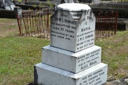

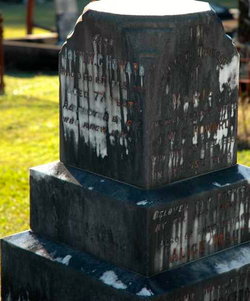
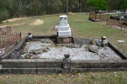
John William Cornelius Howard
| Birth | : | 1831 |
| Death | : | 15 Feb 1908 Coomera, Gold Coast City, Queensland, Australia |
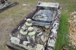
| Burial | : | Greensburg Cemetery, Greensburg, Knox County, USA |
| Coordinate | : | 40.2966800, -92.2127600 |
| Description | : | City of Gold Coast - Pacific Pines history "By 1873, John William Cornelius Howard of Coomera had acquired the land, which included the area situated between Saltwater Creek and Coombabah Creek. Howard owned the Riverside Sugar Mill at Coomera." |
frequently asked questions (FAQ):
-
Where is John William Cornelius Howard's memorial?
John William Cornelius Howard's memorial is located at: Greensburg Cemetery, Greensburg, Knox County, USA.
-
When did John William Cornelius Howard death?
John William Cornelius Howard death on 15 Feb 1908 in Coomera, Gold Coast City, Queensland, Australia
-
Where are the coordinates of the John William Cornelius Howard's memorial?
Latitude: 40.2966800
Longitude: -92.2127600
Family Members:
Spouse
Children


Flowers:


Nearby Cemetories:
1. Greensburg Cemetery
Greensburg, Knox County, USA
Coordinate: 40.2966800, -92.2127600
2. Frogge Cemetery
Scotland County, USA
Coordinate: 40.3205986, -92.2225037
3. Forrester Cemetery
Scotland County, USA
Coordinate: 40.3361015, -92.1949997
4. Fort Donaldson Cemetery
Scotland County, USA
Coordinate: 40.3464012, -92.2177963
5. Oak Chapel Cemetery
Bible Grove, Scotland County, USA
Coordinate: 40.3465700, -92.2024400
6. Hicks Cemetery
Tobin Township, Scotland County, USA
Coordinate: 40.3466500, -92.2025590
7. Donaldson Cemetery
Scotland County, USA
Coordinate: 40.3474998, -92.2110977
8. Saint Aloysius Cemetery
Baring, Knox County, USA
Coordinate: 40.2407990, -92.2110977
9. Cunningham Cemetery
Benton Township, Knox County, USA
Coordinate: 40.2888985, -92.1393967
10. Spilman Cemetery
Scotland County, USA
Coordinate: 40.3311930, -92.1501190
11. Slocum Cemetery
Greensburg, Knox County, USA
Coordinate: 40.2950000, -92.2980000
12. Sand Hill Cemetery
Sand Hill, Scotland County, USA
Coordinate: 40.3130989, -92.1250000
13. Matlick Cemetery
Sand Hill, Scotland County, USA
Coordinate: 40.3307690, -92.1308330
14. Thomas Loe Cemetery
Mount Pleasant Township, Scotland County, USA
Coordinate: 40.3668617, -92.2478394
15. South Bethel Cemetery
Sand Hill, Scotland County, USA
Coordinate: 40.3468710, -92.1361430
16. Edinburg Baptist Church Cemetery
Edinburg, Scotland County, USA
Coordinate: 40.3736110, -92.1920130
17. Pleasant Retreat Cemetery
Memphis, Scotland County, USA
Coordinate: 40.3804400, -92.2088500
18. Bible Grove Christian Church Cemetery
Bible Grove, Scotland County, USA
Coordinate: 40.3528000, -92.3010300
19. Bible Grove Church of Christ Cemetery
Bible Grove, Scotland County, USA
Coordinate: 40.3526900, -92.3055800
20. Millport Mennonite Cemetery
Millport, Knox County, USA
Coordinate: 40.2673690, -92.0953400
21. Pauline Cemetery
Rutledge, Scotland County, USA
Coordinate: 40.3093987, -92.0892029
22. Dancing Rabbit
Rutledge, Scotland County, USA
Coordinate: 40.3324900, -92.0962100
23. Millport Cemetery
Millport, Knox County, USA
Coordinate: 40.2670000, -92.0930000
24. Antioch Cemetery
Scotland County, USA
Coordinate: 40.3970700, -92.2369400