
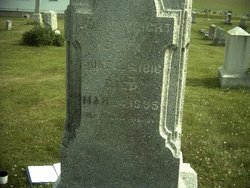
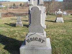
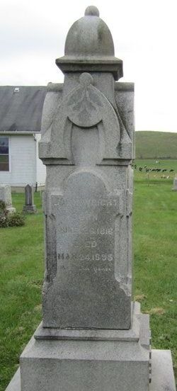
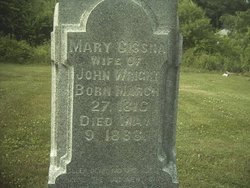
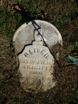
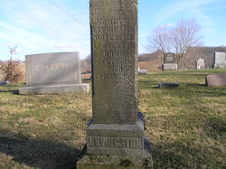
John Wright
| Birth | : | 26 Jun 1816 Coshocton County, Ohio, USA |
| Death | : | 24 Mar 1895 Licking County, Ohio, USA |
| Burial | : | Saint Marys Cemetery, Bronson, Branch County, USA |
| Coordinate | : | 41.8582993, -85.1939011 |
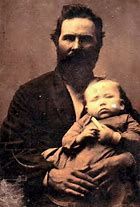
| Description | : | His parents and three oldest siblings were recorded in the 1810 census in Fauquier County, VA. From the birthplaces that he and his siblings later gave, 1815 is figured to be the year that the family moved to Pike Township in Coshocton County, OH. What a journey that must have been with five children! But there were quite a number of other families who made the journey about the same time. By 1820 there were seven children in the family, and by 1830, eleven still at home. In 1850 he and his wife and their seven children lived... Read More |
frequently asked questions (FAQ):
-
Where is John Wright's memorial?
John Wright's memorial is located at: Saint Marys Cemetery, Bronson, Branch County, USA.
-
When did John Wright death?
John Wright death on 24 Mar 1895 in Licking County, Ohio, USA
-
Where are the coordinates of the John Wright's memorial?
Latitude: 41.8582993
Longitude: -85.1939011
Family Members:
Parent
Spouse
Siblings
Children

Flowers:


Nearby Cemetories:
1. Saint Marys Cemetery
Bronson, Branch County, USA
Coordinate: 41.8582993, -85.1939011
2. Bronson Cemetery
Bronson, Branch County, USA
Coordinate: 41.8699340, -85.1858320
3. Snow Prairie Cemetery
Bethel, Branch County, USA
Coordinate: 41.8699989, -85.1408005
4. Curtis Cemetery
Bronson, Branch County, USA
Coordinate: 41.8039017, -85.1956024
5. North Gilead Cemetery
Gilead Township, Branch County, USA
Coordinate: 41.8039017, -85.1557999
6. York Cemetery
Batavia, Branch County, USA
Coordinate: 41.9009350, -85.1318550
7. Pleasant Hill Cemetery
Noble Township, Branch County, USA
Coordinate: 41.7961110, -85.2111110
8. Adams Cemetery
Bronson, Branch County, USA
Coordinate: 41.8405991, -85.2767029
9. Dutch Settlement Cemetery
Bronson, Branch County, USA
Coordinate: 41.8106003, -85.2632980
10. Matteson Cemetery
Matteson, Branch County, USA
Coordinate: 41.9406013, -85.2046967
11. South Gilead Cemetery
Bronson, Branch County, USA
Coordinate: 41.7733330, -85.1566670
12. Card Cemetery
Bethel Township, Branch County, USA
Coordinate: 41.8544006, -85.0693970
13. Batavia Cemetery
Batavia, Branch County, USA
Coordinate: 41.9202778, -85.0975000
14. Sanborn Cemetery
Burr Oak, St. Joseph County, USA
Coordinate: 41.8708000, -85.3305969
15. Burr Oak Township Cemetery
Burr Oak, St. Joseph County, USA
Coordinate: 41.8472214, -85.3319473
16. Trayer Cemetery
Bronson, Branch County, USA
Coordinate: 41.7705550, -85.2677770
17. South Colon Cemetery
Colon, St. Joseph County, USA
Coordinate: 41.9199982, -85.3114014
18. Ovid Cemetery
Ovid Township, Branch County, USA
Coordinate: 41.8688580, -85.0484920
19. East Gilead Cemetery
East Gilead, Branch County, USA
Coordinate: 41.7858330, -85.0825000
20. Eroh Cemetery
Fawn River Township, St. Joseph County, USA
Coordinate: 41.8081017, -85.3375015
21. Freedom Cemetery
Fawn River, St. Joseph County, USA
Coordinate: 41.8064003, -85.3371964
22. Tripp Cemetery
Batavia, Branch County, USA
Coordinate: 41.9425000, -85.0694440
23. Bartholomew Cemetery
Fawn River Township, St. Joseph County, USA
Coordinate: 41.8059600, -85.3476300
24. Mill Grove Cemetery
Orland, Steuben County, USA
Coordinate: 41.7327995, -85.1718979