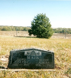
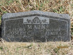
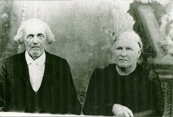
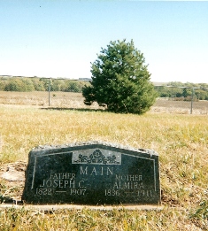
Joseph Chapin Main
| Birth | : | 22 Apr 1822 Tillotson, Crawford County, Pennsylvania, USA |
| Death | : | 15 Nov 1907 Liberty, Gage County, Nebraska, USA |
| Burial | : | Eusebia Cemetery, Prospect, Blount County, USA |
| Coordinate | : | 35.8325005, -83.7994003 |
| Description | : | Son of Nathan & Rabbecca; husband of Almira Rachael Partch Joseph was married to Almira Partch on March 20, 1853 by H. H. Springer Justice of the Peace in Claytion County, IA. When Nebraska was opened he homesteaded in Richardson County. When the free slave state issue arose in Kansas he bought a farm just across the Kansas state line. Joseph also participated in the conflict, and facilitate the road around Missouri for the pro free settlers. After the conflict he gave the land to his wife's youngest brother. The Kansas farm is where Almira' grandfather Warren... Read More |
frequently asked questions (FAQ):
-
Where is Joseph Chapin Main's memorial?
Joseph Chapin Main's memorial is located at: Eusebia Cemetery, Prospect, Blount County, USA.
-
When did Joseph Chapin Main death?
Joseph Chapin Main death on 15 Nov 1907 in Liberty, Gage County, Nebraska, USA
-
Where are the coordinates of the Joseph Chapin Main's memorial?
Latitude: 35.8325005
Longitude: -83.7994003
Family Members:
Parent
Spouse
Siblings
Children
Flowers:
Nearby Cemetories:
1. Eusebia Cemetery
Prospect, Blount County, USA
Coordinate: 35.8325005, -83.7994003
2. Carter Cemetery
Sevier County, USA
Coordinate: 35.8245640, -83.7962440
3. Prospect Cemetery
Walland, Blount County, USA
Coordinate: 35.8135986, -83.8011017
4. Providence Baptist Cemetery
Blount County, USA
Coordinate: 35.8483467, -83.7865753
5. Rest Haven Pet Cemetery
Seymour, Sevier County, USA
Coordinate: 35.8523110, -83.7775790
6. Cedar Grove Baptist Church Cemetery
Maryville, Blount County, USA
Coordinate: 35.8344002, -83.8469009
7. Nails Creek Cemetery
Blount County, USA
Coordinate: 35.8347015, -83.8486023
8. Ellejoy Baptist Church Cemetery
Ellejoy, Blount County, USA
Coordinate: 35.8102989, -83.7544022
9. Union Temple Cemetery
Blount County, USA
Coordinate: 35.7985992, -83.8339005
10. Bethlehem Cemetery
Maryville, Blount County, USA
Coordinate: 35.7881012, -83.8114014
11. Knob Creek Cemetery
Seymour, Sevier County, USA
Coordinate: 35.8375015, -83.7352982
12. Oak View Cemetery
Walland, Blount County, USA
Coordinate: 35.7839012, -83.8293991
13. Atchley Seymour Memory Gardens
Seymour, Sevier County, USA
Coordinate: 35.8688927, -83.7474670
14. Old Chilhowee Cemetery
Old Chilhowee, Blount County, USA
Coordinate: 35.7812800, -83.7707700
15. Cold Springs Cemetery
Walland, Blount County, USA
Coordinate: 35.7757988, -83.8181000
16. Chilhowee Cemetery
Seymour, Sevier County, USA
Coordinate: 35.8755989, -83.7485962
17. Cruze Cemetery
Knox County, USA
Coordinate: 35.8819008, -83.8452988
18. Slave Cemetery
Blount County, USA
Coordinate: 35.8241997, -83.8768997
19. Dripping Springs Cemetery
Seymour, Sevier County, USA
Coordinate: 35.8041300, -83.7286800
20. Logans Chapel Cemetery
Maryville, Blount County, USA
Coordinate: 35.8046989, -83.8731003
21. Central Point Baptist Church Cemetery
Blount County, USA
Coordinate: 35.8260994, -83.8855972
22. Headrick-Henry Cemetery
Blount County, USA
Coordinate: 35.7736015, -83.8491974
23. Trundles Crossroads Cemetery
Sevier County, USA
Coordinate: 35.8866997, -83.7324982
24. Ivy Hill Cemetery
Sevier County, USA
Coordinate: 35.8680992, -83.7136002

