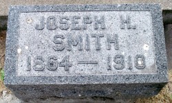
Joseph H. Smith
| Birth | : | 1864 |
| Death | : | 1910 Crete, Saline County, Nebraska, USA |
| Burial | : | Saint Charles Cemetery, Tolley, Renville County, USA |
| Coordinate | : | 48.7340012, -101.8345108 |
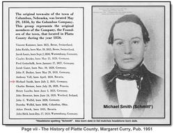
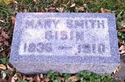
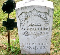
| Description | : | From the Plate County, NE. web site: http://www.usgennet.org/usa/ne/county/platte/vitals/vitals1910.html Joseph Smith, formerly a resident of Columbus, but who moved to Crete about a year ago, died at his home in that city last Wednesday evening. Four years ago he suffered a stroke of paralysis, which rendered him helpless on one side of his body. He leaves a wife and five children, and was a son of Mrs. Mary Gisin, and a brother of John J. Smith, and was a cousin of Mrs. Henry Rieder and Adam Smith of this city. He was brought to this city Thursday evneing and funeral services were held... Read More |
frequently asked questions (FAQ):
-
Where is Joseph H. Smith's memorial?
Joseph H. Smith's memorial is located at: Saint Charles Cemetery, Tolley, Renville County, USA.
-
When did Joseph H. Smith death?
Joseph H. Smith death on 1910 in Crete, Saline County, Nebraska, USA
-
Where are the coordinates of the Joseph H. Smith's memorial?
Latitude: 48.7340012
Longitude: -101.8345108
Family Members:
Parent
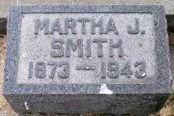
Spouse
Siblings
Children
Flowers:
Nearby Cemetories:
1. Saint Charles Cemetery
Tolley, Renville County, USA
Coordinate: 48.7340012, -101.8345108
2. Trinity Cemetery
Tolley, Renville County, USA
Coordinate: 48.7261009, -101.8341980
3. McKinney Cemetery
Tolley, Renville County, USA
Coordinate: 48.7594261, -101.7830963
4. Saint Johns United Lutheran Cemetery
Mohall, Renville County, USA
Coordinate: 48.7928429, -101.7149429
5. Evanger Lutheran Cemetery
Tolley, Renville County, USA
Coordinate: 48.8362990, -101.9006560
6. Greenfield Cemetery
Ward County, USA
Coordinate: 48.5974998, -101.8653030
7. Hamerly Lutheran Cemetery
Mohall, Renville County, USA
Coordinate: 48.8654700, -101.7270000
8. Trinity Lutheran Cemetery
Kenmare, Ward County, USA
Coordinate: 48.7335590, -102.0646290
9. Zion Lutheran Cemetery
Norma, Renville County, USA
Coordinate: 48.8499184, -101.9987030
10. Rose Hill Cemetery
Kenmare, Ward County, USA
Coordinate: 48.6804600, -102.0723200
11. Saint Agnes Catholic Cemetery
Kenmare, Ward County, USA
Coordinate: 48.6804500, -102.0737200
12. Gethsemane Cemetery
Carpio, Ward County, USA
Coordinate: 48.5747261, -101.7124481
13. Lakeview Cemetery
Kenmare, Ward County, USA
Coordinate: 48.6627998, -102.1016998
14. Grano Cemetery
Grano, Renville County, USA
Coordinate: 48.6136017, -101.6038971
15. Saint John Cemetery
Mohall, Renville County, USA
Coordinate: 48.9184380, -101.7382889
16. Pleasant View Cemetery
Norma, Renville County, USA
Coordinate: 48.9087219, -101.9672775
17. Prosperity Township Cemetery
Tolley, Renville County, USA
Coordinate: 48.9506200, -101.8462440
18. Spring Valley Mennonite Cemetery
Kenaston, Ward County, USA
Coordinate: 48.5904617, -102.0805817
19. Coulee Cemetery
Coulee, Mountrail County, USA
Coordinate: 48.5462723, -102.0065536
20. Donnybrook Community Cemetery
Donnybrook, Ward County, USA
Coordinate: 48.5171165, -101.8895264
21. Bethany Lutheran Cemetery
Burke County, USA
Coordinate: 48.7349080, -102.1683880
22. Loraine Cemetery
Loraine, Renville County, USA
Coordinate: 48.8672000, -101.5627000
23. Holbrook Cemetery
Donnybrook, Ward County, USA
Coordinate: 48.5119019, -101.8944016
24. Power Cemetery
Donnybrook, Ward County, USA
Coordinate: 48.5051627, -101.8884413

