
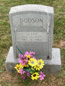
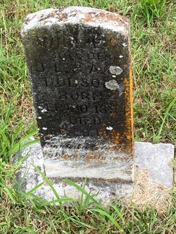
Joseph Lee Dodson
| Birth | : | 20 Dec 1874 Randolph County, Arkansas, USA |
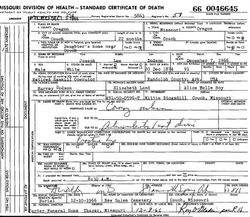
| Death | : | 7 Dec 1966 Oregon County, Missouri, USA |
| Burial | : | Los Osos Valley Memorial Park, Los Osos, San Luis Obispo County, USA |
| Coordinate | : | 35.3053017, -120.8011017 |
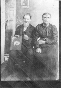
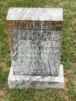
| Description | : | Known as Lee. Son of James Harvey Dodson and Elizabeth Jane (Land) Dodson. Married Alice Bell Roy 26/Nov/1893 at Shannon Co., MO. Married Elizabeth Smith in 1932. He was a wheat thresher in the summer and did sawmill work in the winter. OREGON COUNTY - PRESERVE YESTERDAY - ENRICH TOMORROW, p.124 |
frequently asked questions (FAQ):
-
Where is Joseph Lee Dodson's memorial?
Joseph Lee Dodson's memorial is located at: Los Osos Valley Memorial Park, Los Osos, San Luis Obispo County, USA.
-
When did Joseph Lee Dodson death?
Joseph Lee Dodson death on 7 Dec 1966 in Oregon County, Missouri, USA
-
Where are the coordinates of the Joseph Lee Dodson's memorial?
Latitude: 35.3053017
Longitude: -120.8011017
Family Members:
Parent

Spouse
Siblings
Children


Flowers:


Nearby Cemetories:
1. Los Osos Valley Memorial Park
Los Osos, San Luis Obispo County, USA
Coordinate: 35.3053017, -120.8011017
2. Canet Cemetery
San Luis Obispo County, USA
Coordinate: 35.3522840, -120.7901660
3. St. Peter’s By-the-Sea Episcopal Church Memo
Morro Bay, San Luis Obispo County, USA
Coordinate: 35.3628700, -120.8467400
4. San Luis Cemetery
San Luis Obispo, San Luis Obispo County, USA
Coordinate: 35.2644192, -120.6712830
5. Mission San Luis Obispo Cemetery
San Luis Obispo, San Luis Obispo County, USA
Coordinate: 35.2806600, -120.6645200
6. Old Mission Cemetery
San Luis Obispo, San Luis Obispo County, USA
Coordinate: 35.2670660, -120.6692150
7. Cayucos-Morro Bay District Cemetery
Cayucos, San Luis Obispo County, USA
Coordinate: 35.4371986, -120.8850021
8. Santa Margarita Cemetery
Santa Margarita, San Luis Obispo County, USA
Coordinate: 35.3913994, -120.5880966
9. Dove Cemetery
San Luis Obispo County, USA
Coordinate: 35.4482231, -120.6344299
10. Chapel of the Roses Cemetery
Atascadero, San Luis Obispo County, USA
Coordinate: 35.5027340, -120.6881430
11. Atascadero Pine Mountain Cemetery
Atascadero, San Luis Obispo County, USA
Coordinate: 35.4960835, -120.6565582
12. Saint Patrick's Cemetery
Arroyo Grande, San Luis Obispo County, USA
Coordinate: 35.1292740, -120.6002950
13. Arroyo Grande Cemetery
Arroyo Grande, San Luis Obispo County, USA
Coordinate: 35.1230011, -120.5930634
14. Halcyon Cemetery
Halcyon, San Luis Obispo County, USA
Coordinate: 35.1062000, -120.5994990
15. Saint Barnabas Memorial Garden
Arroyo Grande, San Luis Obispo County, USA
Coordinate: 35.1179910, -120.5706380
16. Adelaida Cemetery
Adelaida, San Luis Obispo County, USA
Coordinate: 35.5632085, -120.8956170
17. Saint John's Lutheran Church Columbarium
Arroyo Grande, San Luis Obispo County, USA
Coordinate: 35.1032070, -120.5808630
18. Templeton Cemetery
Templeton, San Luis Obispo County, USA
Coordinate: 35.5714455, -120.7022095
19. Willow Creek Mennonite Cemetery
Wilson Corner, San Luis Obispo County, USA
Coordinate: 35.5890410, -120.8215860
20. Saint Joseph of Cupertino Province Cemetery
San Luis Obispo County, USA
Coordinate: 35.0718803, -120.5263519
21. Ballagh Family Cemetery
Pozo, San Luis Obispo County, USA
Coordinate: 35.3695640, -120.4081780
22. Creston Cemetery
Creston, San Luis Obispo County, USA
Coordinate: 35.5328640, -120.5121450
23. Saint James Episcopal Church Inurnment Garden
Paso Robles, San Luis Obispo County, USA
Coordinate: 35.6283460, -120.6929780
24. Saint Pauls Episcopal Church Memorial Garden
Cambria, San Luis Obispo County, USA
Coordinate: 35.5575200, -121.0757200