

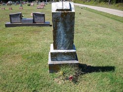
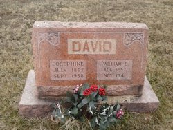
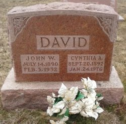
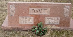
Josephine Virginia Hipes David
| Birth | : | 4 Jul 1867 Lawrenceton, Ste. Genevieve County, Missouri, USA |
| Death | : | 23 Sep 1958 Bonne Terre, St. Francois County, Missouri, USA |
| Burial | : | Weatherly Cemetery, Benton County, USA |
| Coordinate | : | 36.1455994, -88.1222000 |
| Description | : | Wife of William Edward David Daughter of William Hipes & Josephine Bequette |
frequently asked questions (FAQ):
-
Where is Josephine Virginia Hipes David's memorial?
Josephine Virginia Hipes David's memorial is located at: Weatherly Cemetery, Benton County, USA.
-
When did Josephine Virginia Hipes David death?
Josephine Virginia Hipes David death on 23 Sep 1958 in Bonne Terre, St. Francois County, Missouri, USA
-
Where are the coordinates of the Josephine Virginia Hipes David's memorial?
Latitude: 36.1455994
Longitude: -88.1222000
Family Members:
Parent
Spouse
Siblings

Children
Flowers:


Nearby Cemetories:
1. Weatherly Cemetery
Benton County, USA
Coordinate: 36.1455994, -88.1222000
2. Rushings Creek Cemetery
Camden, Benton County, USA
Coordinate: 36.1431340, -88.1096870
3. Williams Grove Cemetery
Camden, Benton County, USA
Coordinate: 36.1516660, -88.1450530
4. Dennis Rushing Cemetery
Big Sandy, Benton County, USA
Coordinate: 36.1391640, -88.0967380
5. Hudson-Willis Rushing Cemetery
Big Sandy, Benton County, USA
Coordinate: 36.1342690, -88.0903790
6. Moore Cemetery
Big Sandy, Benton County, USA
Coordinate: 36.1473000, -88.0852000
7. Bakers Chapel Cemetery
Big Sandy, Benton County, USA
Coordinate: 36.1772003, -88.1164017
8. Greer Cemetery
Camden, Benton County, USA
Coordinate: 36.1150910, -88.1450560
9. Francisco Cemetery
Henry County, USA
Coordinate: 36.1547012, -88.1802979
10. Liberty Community Cemetery
Liberty, Benton County, USA
Coordinate: 36.0974998, -88.1078033
11. Carter Cemetery
Henry County, USA
Coordinate: 36.1699982, -88.1757965
12. Carter Cemetery
Mansfield, Henry County, USA
Coordinate: 36.1744310, -88.1774710
13. Benton Memory Gardens
Camden, Benton County, USA
Coordinate: 36.0921940, -88.1048610
14. Beasley-Blanchard Cemetery
Benton County, USA
Coordinate: 36.1102982, -88.0643997
15. Prospect Church Cemetery
Camden, Benton County, USA
Coordinate: 36.1002170, -88.1682040
16. Hudson Cemetery
Camden, Benton County, USA
Coordinate: 36.0914770, -88.0870550
17. Cedar Grove Church of Christ Cemetery
Big Sandy, Benton County, USA
Coordinate: 36.1555280, -88.0420920
18. Beaverdam Campground Ancient Graveyard
Camden, Benton County, USA
Coordinate: 36.1108360, -88.0508710
19. Ramble Creek Cemetery
Big Sandy, Benton County, USA
Coordinate: 36.2036000, -88.0784750
20. Cedar Grove Methodist Cemetery
Camden, Benton County, USA
Coordinate: 36.1103070, -88.1943670
21. Perkins Cemetery
Camden, Benton County, USA
Coordinate: 36.0831000, -88.0839520
22. Lowry Cemetery
Henry County, USA
Coordinate: 36.2132988, -88.1519012
23. Post Oak Cemetery
Camden, Benton County, USA
Coordinate: 36.0735740, -88.1383100
24. French Cemetery
Henry County, USA
Coordinate: 36.2028008, -88.1800003