
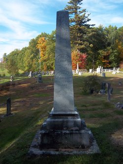
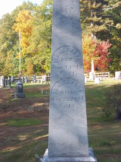
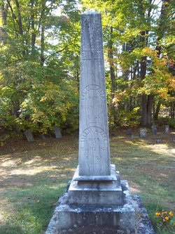
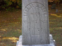
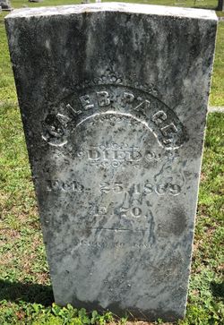
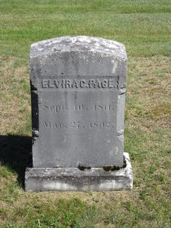
Joshua Page
| Birth | : | 25 Sep 1819 Benton, Grafton County, New Hampshire, USA |
| Death | : | 9 Jun 1843 Montague, Franklin County, Massachusetts, USA |
| Burial | : | Number 6 Cemetery, East Haverhill, Grafton County, USA |
| Coordinate | : | 44.0326400, -71.9518600 |
| Description | : | Drowned when skiff overturned while crossing the Connecticut River. Body recovered 17 June 1843 in Northampton, MA. Interred there until following winter. Moved and buried in East Haverhill, NH on 29 Feb 1844. |
frequently asked questions (FAQ):
-
Where is Joshua Page's memorial?
Joshua Page's memorial is located at: Number 6 Cemetery, East Haverhill, Grafton County, USA.
-
When did Joshua Page death?
Joshua Page death on 9 Jun 1843 in Montague, Franklin County, Massachusetts, USA
-
Where are the coordinates of the Joshua Page's memorial?
Latitude: 44.0326400
Longitude: -71.9518600
Family Members:
Parent
Siblings


Flowers:


Nearby Cemetories:
1. Number 6 Cemetery
East Haverhill, Grafton County, USA
Coordinate: 44.0326400, -71.9518600
2. East Haverhill Cemetery
East Haverhill, Grafton County, USA
Coordinate: 44.0289688, -71.9889297
3. Oliverian Road Cemetery
Benton, Grafton County, USA
Coordinate: 43.9978145, -71.9209265
4. Lund Cemetery
Warren, Grafton County, USA
Coordinate: 43.9882800, -71.9589200
5. Center Haverhill Cemetery
Center Haverhill, Grafton County, USA
Coordinate: 44.0770650, -71.9868740
6. Rodimon-Cross Cemetery
Piermont, Grafton County, USA
Coordinate: 43.9901100, -71.9924500
7. High Street Cemetery
Glencliff, Grafton County, USA
Coordinate: 43.9851100, -71.8913900
8. Abbott Cemetery
North Haverhill, Grafton County, USA
Coordinate: 44.0821730, -72.0186420
9. Ladd Street Cemetery
Haverhill, Grafton County, USA
Coordinate: 44.0439600, -72.0532800
10. West Cemetery
Benton, Grafton County, USA
Coordinate: 44.1033700, -71.9014000
11. East Cemetery
Benton, Grafton County, USA
Coordinate: 44.0985985, -71.8846970
12. Oxbow Cemetery
Newbury, Orange County, USA
Coordinate: 44.0881830, -72.0486670
13. East Piermont Cemetery
Piermont, Grafton County, USA
Coordinate: 43.9438890, -71.9689890
14. Brown Farmstead Cemetery
Benton, Grafton County, USA
Coordinate: 44.0778000, -71.8420830
15. Clay Hollow Cemetery
Piermont, Grafton County, USA
Coordinate: 43.9597220, -72.0333330
16. Horse Meadow Annex Cemetery
North Haverhill, Grafton County, USA
Coordinate: 44.1056820, -72.0408260
17. Swiftwater Cemetery
Bath, Grafton County, USA
Coordinate: 44.1303400, -71.9574300
18. Horse Meadow Cemetery
North Haverhill, Grafton County, USA
Coordinate: 44.1068880, -72.0405500
19. Pine Hill Cemetery
Warren, Grafton County, USA
Coordinate: 43.9370003, -71.8929977
20. Warren Village Cemetery
Warren, Grafton County, USA
Coordinate: 43.9326200, -71.8917600
21. Cedar Grove Cemetery
Piermont, Grafton County, USA
Coordinate: 43.9720300, -72.0813400
22. River Road Cemetery
Piermont, Grafton County, USA
Coordinate: 44.0019500, -72.1013600
23. South Lawn Cemetery
Piermont, Grafton County, USA
Coordinate: 43.9667600, -72.0812500
24. Pine Grove Cemetery
Woodsville, Grafton County, USA
Coordinate: 44.1380997, -72.0188980