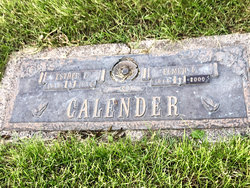
| Birth | : | 29 Mar 1909 Russell County, Kansas, USA |
| Death | : | 17 May 2005 Topeka, Shawnee County, Kansas, USA |
| Burial | : | St Michael and All Angels Churchyard, Ford, Northumberland Unitary Authority, England |
| Coordinate | : | 55.6301700, -2.0895430 |
| Plot | : | Garden of the Last Supper |
| Description | : | OBITUARY: Mrs. Katherine Funk Christman Mrs. Katherine Funk Christman, 96, of Topeka died Tues. evening, May 17, 2005. She was born March 29, 1909 in Russell County, KS the daughter of George and Katherine E. Bender Funk. Mrs. Christman was a member of Faith Lutheran Church. On Oct. 3, 1929 at Wellington, KS she was united in marriage to Earl J. Christman. He preceded her in death on May 2, 1995. Mrs.Christman was also preceded in death by a son, Claude Christman, in 1935. Surviving are two daughters, Shirley Turner and Vickie McMurdo both of Topeka; two sons: Duane Christman and Donald Christman both... Read More |
frequently asked questions (FAQ):
-
Where is Katherine Funk Christman's memorial?
Katherine Funk Christman's memorial is located at: St Michael and All Angels Churchyard, Ford, Northumberland Unitary Authority, England.
-
When did Katherine Funk Christman death?
Katherine Funk Christman death on 17 May 2005 in Topeka, Shawnee County, Kansas, USA
-
Where are the coordinates of the Katherine Funk Christman's memorial?
Latitude: 55.6301700
Longitude: -2.0895430
Family Members:
Parent
Spouse
Siblings
Flowers:
Nearby Cemetories:
1. St Michael and All Angels Churchyard
Ford, Northumberland Unitary Authority, England
Coordinate: 55.6301700, -2.0895430
2. St. Mary the Virgin Chapelyard
Etal, Northumberland Unitary Authority, England
Coordinate: 55.6481100, -2.1150200
3. St Paul's Churchyard
Branxton, Northumberland Unitary Authority, England
Coordinate: 55.6308820, -2.1726490
4. Flodden Field Cemetery
Branxton, Northumberland Unitary Authority, England
Coordinate: 55.6287730, -2.1765120
5. All Saints Churchyard
Duddo, Northumberland Unitary Authority, England
Coordinate: 55.6859800, -2.0862900
6. St John the Baptist Churchyard
Lowick, Northumberland Unitary Authority, England
Coordinate: 55.6501470, -1.9826250
7. St Mary & St Michael Churchyard
Doddington, Northumberland Unitary Authority, England
Coordinate: 55.5837211, -2.0083409
8. St Gregory Churchyard
Kirknewton, Northumberland Unitary Authority, England
Coordinate: 55.5658590, -2.1387780
9. St Helen's Churchyard
Cornhill-on-Tweed, Northumberland Unitary Authority, England
Coordinate: 55.6464840, -2.2264990
10. St. Anne's Churchyard
Ancroft, Northumberland Unitary Authority, England
Coordinate: 55.7000400, -1.9981800
11. Mindrum Churchyard
Mindrum, Northumberland Unitary Authority, England
Coordinate: 55.5937100, -2.2481000
12. Kyloe Cemetery
Kyloe, Northumberland Unitary Authority, England
Coordinate: 55.6570310, -1.9191950
13. Saint Nicholas Churchyard
Kyloe, Northumberland Unitary Authority, England
Coordinate: 55.6569000, -1.9188300
14. Holy Cross Churchyard
Chatton, Northumberland Unitary Authority, England
Coordinate: 55.5474907, -1.9105738
15. St Cuthbert Churchyard
Carham, Northumberland Unitary Authority, England
Coordinate: 55.6389230, -2.3238090
16. St. Peter's Parish Church
Chillingham, Northumberland Unitary Authority, England
Coordinate: 55.5273100, -1.9030830
17. Our Lady & St. Cuthbert's
Berwick-upon-Tweed, Northumberland Unitary Authority, England
Coordinate: 55.7695760, -1.9994210
18. Saint Mary's Churchyard
Belford, Northumberland Unitary Authority, England
Coordinate: 55.5992600, -1.8292900
19. Berwick Parish Church
Berwick-upon-Tweed, Northumberland Unitary Authority, England
Coordinate: 55.7721130, -2.0010390
20. St. Michael Churchyard
Ilderton, Northumberland Unitary Authority, England
Coordinate: 55.4904200, -1.9743800
21. Berwick-upon-Tweed Cemetery
Berwick-upon-Tweed, Northumberland Unitary Authority, England
Coordinate: 55.7799800, -2.0107500
22. St. Mary the Virgin Parish Churchyard
Holy Island, Northumberland Unitary Authority, England
Coordinate: 55.6694200, -1.8016450
23. Saint Hilda’s Churchyard
Lucker, Northumberland Unitary Authority, England
Coordinate: 55.5660400, -1.7597400
24. St. Michael and All Angels Churchyard
Ingram, Northumberland Unitary Authority, England
Coordinate: 55.4405530, -1.9706240


