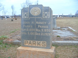
| Birth | : | 1820 |
| Death | : | 2 Jul 1913 |
| Burial | : | Garner Cemetery, Union County, USA |
| Coordinate | : | 34.8574982, -81.5350037 |
| Description | : | Marker says "Age about 93 years" The 1880 census lists her age as 50 and an estimated birth year of 1830. Unconfirmed: Katy's parents were John and Mary Jones Roberson. Mary Morris, also buried in this cemetery is thought to be Katy's sister. |
frequently asked questions (FAQ):
-
Where is Katherine “Katy” Roberson Garner's memorial?
Katherine “Katy” Roberson Garner's memorial is located at: Garner Cemetery, Union County, USA.
-
When did Katherine “Katy” Roberson Garner death?
Katherine “Katy” Roberson Garner death on 2 Jul 1913 in
-
Where are the coordinates of the Katherine “Katy” Roberson Garner's memorial?
Latitude: 34.8574982
Longitude: -81.5350037
Family Members:
Spouse
Children
Flowers:
Nearby Cemetories:
1. Garner Cemetery
Union County, USA
Coordinate: 34.8574982, -81.5350037
2. Spears Cemetery
Union County, USA
Coordinate: 34.8708000, -81.5381012
3. McKissick Cemetery
Union County, USA
Coordinate: 34.8492012, -81.5516968
4. Foster-Woolbright Cemetery
Union County, USA
Coordinate: 34.8403015, -81.5222015
5. Skull Shoals Baptist Church Cemetery
Gaffney, Cherokee County, USA
Coordinate: 34.8789780, -81.5297340
6. Going Cemetery
Union County, USA
Coordinate: 34.8457985, -81.5655975
7. Bethel Baptist Church Cemetery
Union County, USA
Coordinate: 34.8346180, -81.5670930
8. New Emanuel Chapel Baptist Church Cemetery
Kelton, Union County, USA
Coordinate: 34.8408190, -81.4938140
9. Emanuel Chapel Baptist Church Cemetery
Union, Union County, USA
Coordinate: 34.8407130, -81.4936770
10. Ebenezer A.M.E. Church Cemetery
Jonesville, Union County, USA
Coordinate: 34.8267300, -81.5671600
11. Gist-Giles-Pinckneyville Cemetery
Union County, USA
Coordinate: 34.8361015, -81.4906006
12. Mesopotamia United Methodist Church Cemetery
Cherokee County, USA
Coordinate: 34.8999560, -81.5398010
13. Mount Joy Baptist Church Cemetery
Kelton, Union County, USA
Coordinate: 34.8342310, -81.5804740
14. Smith Cemetery
Union County, USA
Coordinate: 34.8661003, -81.5892029
15. Reidsville Cemetery
Union County, USA
Coordinate: 34.8217010, -81.5008011
16. Pleasant Grove Cemetery
Cherokee County, USA
Coordinate: 34.8925018, -81.4993973
17. Bethany AME Church Cemetery
Jonesville, Union County, USA
Coordinate: 34.8330850, -81.5851980
18. Flat Rock Cemetery
Kelton, Union County, USA
Coordinate: 34.8614006, -81.5947037
19. Porter Cemetery
Union County, USA
Coordinate: 34.8302994, -81.5856018
20. Hames-Gault Cemetery
Union County, USA
Coordinate: 34.8492012, -81.5963974
21. Foster Chapel United Methodist Church Cemetery
Jonesville, Union County, USA
Coordinate: 34.8266983, -81.5849991
22. Pinckney Cemetery
Pinckneyville, Union County, USA
Coordinate: 34.8431015, -81.4685974
23. Askew Cemetery
Union County, USA
Coordinate: 34.8638992, -81.6066971
24. Mount Tabor Presbyterian Church Cemetery
Lockhart, Union County, USA
Coordinate: 34.8032990, -81.5018997


