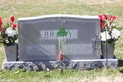
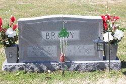
Kay Miriam Collins Brady
| Birth | : | 17 Sep 1937 Patrick County, Virginia, USA |
| Death | : | 7 Aug 2007 Winston-Salem, Forsyth County, North Carolina, USA |
| Burial | : | St. Mary's Churchyard, Erpingham, North Norfolk District, England |
| Coordinate | : | 52.8338580, 1.2626100 |
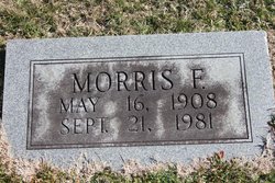
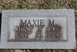
| Description | : | Mrs. Kay Miriam Collins Brady, 69, of Mt. Airy, widow of Robert Percy Brady, passed away Tuesday, August 7, 2007, at Wake Forest University Baptist Medical Center in Winston-Salem. Mrs. Brady was born September 17, 1937, in Patrick County, VA, to Morris Franklin and Maxie Montgomery Collins. She was a loving mother, grandmother, and great-grandmother who will be dearly missed by all who loved her, especially her friends at the Webb Center where she enjoyed playing Bingo. She attended Mt. Airy Pentecostal Holiness Church, where she was a member of the choir and was faithful in the women's auxiliary. Surviving... Read More |
frequently asked questions (FAQ):
-
Where is Kay Miriam Collins Brady's memorial?
Kay Miriam Collins Brady's memorial is located at: St. Mary's Churchyard, Erpingham, North Norfolk District, England.
-
When did Kay Miriam Collins Brady death?
Kay Miriam Collins Brady death on 7 Aug 2007 in Winston-Salem, Forsyth County, North Carolina, USA
-
Where are the coordinates of the Kay Miriam Collins Brady's memorial?
Latitude: 52.8338580
Longitude: 1.2626100
Family Members:
Parent
Spouse
Siblings
Flowers:
Nearby Cemetories:
1. St. Mary's Churchyard
Erpingham, North Norfolk District, England
Coordinate: 52.8338580, 1.2626100
2. Our Lady and St. Margaret's Churchyard
Calthorpe, North Norfolk District, England
Coordinate: 52.8391540, 1.2373828
3. St. Giles Churchyard
Colby, North Norfolk District, England
Coordinate: 52.8318190, 1.2945700
4. All Saints Churchyard
Alby with Thwaite, North Norfolk District, England
Coordinate: 52.8533000, 1.2555000
5. St. Ethelbert's Church Burial Ground
Alby with Thwaite, North Norfolk District, England
Coordinate: 52.8548760, 1.2701850
6. St. Botolph Churchyard
Banningham, North Norfolk District, England
Coordinate: 52.8170850, 1.2865060
7. St. Mary's Churchyard
Aldborough, North Norfolk District, England
Coordinate: 52.8575340, 1.2354660
8. St Andrew Churchyard
Blickling, Broadland District, England
Coordinate: 52.8095370, 1.2311760
9. Blickling Hall
Blickling, Broadland District, England
Coordinate: 52.8095474, 1.2310860
10. Silvergate Lane Cemetery
Blickling, Broadland District, England
Coordinate: 52.8075334, 1.2305140
11. St. Bartholomew Churchyard
Hanworth, North Norfolk District, England
Coordinate: 52.8664290, 1.2718830
12. St Andrew's Churchyard
Gunton, North Norfolk District, England
Coordinate: 52.8584910, 1.3097280
13. St. Michael and All Angels Churchyard
Aylsham, Broadland District, England
Coordinate: 52.7960690, 1.2506530
14. St Peter & St Paul's Church
Tuttington, Broadland District, England
Coordinate: 52.7962090, 1.3009760
15. Aylsham Cemetery
Aylsham, Broadland District, England
Coordinate: 52.7883400, 1.2540900
16. St Mary Churchyard
Itteringham, North Norfolk District, England
Coordinate: 52.8334650, 1.1826370
17. St. Andrews Church Burial Ground
Felmingham, North Norfolk District, England
Coordinate: 52.8139100, 1.3391320
18. St. Mary's Churchyard
Antingham, North Norfolk District, England
Coordinate: 52.8464655, 1.3436395
19. St. Mary Churchyard
Roughton, North Norfolk District, England
Coordinate: 52.8801901, 1.2976948
20. St Mary's Church
Mannington, North Norfolk District, England
Coordinate: 52.8418580, 1.1786460
21. St. Peter's Churchyard
Matlaske, North Norfolk District, England
Coordinate: 52.8683511, 1.1946365
22. St. Andrew's Churchyard
Metton, North Norfolk District, England
Coordinate: 52.8880460, 1.2670590
23. St. Andrew’s Churchyard
Little Barningham, North Norfolk District, England
Coordinate: 52.8547270, 1.1795150
24. St. Mary's Churchyard
Burgh Next Aylsham, Broadland District, England
Coordinate: 52.7775114, 1.2865926

