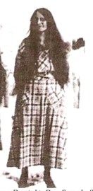
| Birth | : | 1 Jul 1915 Muddy, Big Horn County, Montana, USA |
| Death | : | 5 Mar 1980 Clinton, Custer County, Oklahoma, USA |
| Burial | : | Lame Deer Cemetery, Lame Deer, Rosebud County, USA |
| Coordinate | : | 45.6264000, -106.6619034 |
| Description | : | The Billings Gazette, Billings, Montana, 09 Mar 1980, Sun • Page 6 Langburn Henry Fisher LAME DEER -- Langburn Henry "Happy" Fisher, 64, died Wednesday in Clinton, Okla. Born in Lame Deer, he was a son of Eugene and Kitty Belle Spang Fisher. In 1933 he married Gladys Beartusk. Survivors include a son, Eugene of Lame Deer; daughters, Juanita Cain of Lame Deer, Nathel Show of Browning and Edith Cooper of Ronan, two brothers, Bernadine and Russell, both of Lame Deer, three sisters, Aliwitchie Fisher of Ashland, Helen Zimmer of Broadus and Virginia Amsden... Read More |
frequently asked questions (FAQ):
-
Where is Langburn Henry “Happy” Fisher's memorial?
Langburn Henry “Happy” Fisher's memorial is located at: Lame Deer Cemetery, Lame Deer, Rosebud County, USA.
-
When did Langburn Henry “Happy” Fisher death?
Langburn Henry “Happy” Fisher death on 5 Mar 1980 in Clinton, Custer County, Oklahoma, USA
-
Where are the coordinates of the Langburn Henry “Happy” Fisher's memorial?
Latitude: 45.6264000
Longitude: -106.6619034
Family Members:
Parent
Spouse
Siblings
Children
Flowers:
Nearby Cemetories:
1. Lame Deer Cemetery
Lame Deer, Rosebud County, USA
Coordinate: 45.6264000, -106.6619034
2. Muddy Creek Cemetery
Muddy, Big Horn County, USA
Coordinate: 45.5741997, -106.7406006
3. Lee Cemetery
Rosebud County, USA
Coordinate: 45.7792015, -106.5413971
4. Busby Cemetery
Busby, Big Horn County, USA
Coordinate: 45.5358009, -106.9505997
5. Two Moons Gravesite
Busby, Big Horn County, USA
Coordinate: 45.5308840, -106.9564430
6. Saint Labre Cemetery
Ashland, Rosebud County, USA
Coordinate: 45.6070930, -106.2836910
7. Brown Cemetery
Colstrip, Rosebud County, USA
Coordinate: 45.8321991, -106.4180984
8. Ashland Cemetery
Ashland, Rosebud County, USA
Coordinate: 45.5867170, -106.2645560
9. Colstrip Cemetery
Colstrip, Rosebud County, USA
Coordinate: 45.9096985, -106.6194000
10. Bean Cemetery
Rosebud County, USA
Coordinate: 45.8535995, -106.4011002
11. Willow Crossing Cemetery
Powder River County, USA
Coordinate: 45.5382996, -106.1931000
12. Birney Cemetery
Rosebud County, USA
Coordinate: 45.2846985, -106.5868988
13. Little Bighorn Battlefield National Monument
Little Big Horn Battle Site, Big Horn County, USA
Coordinate: 45.5703000, -107.4273500
14. Custer National Cemetery
Crow Agency, Big Horn County, USA
Coordinate: 45.5699000, -107.4318000
15. Garryowen Cemetery
Crow Agency, Big Horn County, USA
Coordinate: 45.5295868, -107.4309464
16. North Stacey Cemetery
Powder River County, USA
Coordinate: 45.7569008, -105.8814011
17. Crow Agency Cemetery
Crow Agency, Big Horn County, USA
Coordinate: 45.6044006, -107.4730988
18. Apsaalooke Veterans Cemetery
Crow Agency, Big Horn County, USA
Coordinate: 45.6055500, -107.4776900
19. Lodge Grass Cemetery
Lodge Grass, Big Horn County, USA
Coordinate: 45.3223340, -107.3785110
20. Forty Mile Colony Cemetery
Big Horn County, USA
Coordinate: 45.2856738, -107.3520215
21. Dufford Cemetery
Powder River County, USA
Coordinate: 45.1091995, -106.2316971
22. Twin Pine Cemetery
Sonnette, Powder River County, USA
Coordinate: 45.3665600, -105.8292100
23. Forsyth Cemetery
Forsyth, Rosebud County, USA
Coordinate: 46.2689018, -106.6528015
24. Howard Cemetery
Rosebud County, USA
Coordinate: 46.2621994, -106.9222031


