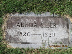
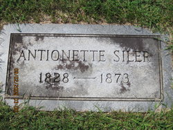
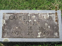
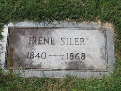
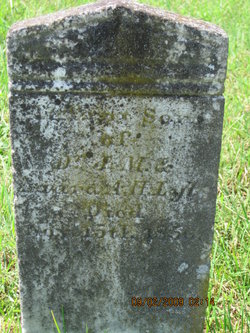
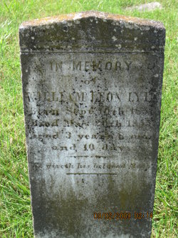
Laura Amelia Hill Siler Lyle
| Birth | : | 5 Sep 1824 Franklin, Macon County, North Carolina, USA |
| Death | : | 9 Apr 1866 Buncombe County, North Carolina, USA |
| Burial | : | East Gilead Cemetery, East Gilead, Branch County, USA |
| Coordinate | : | 41.7858330, -85.0825000 |
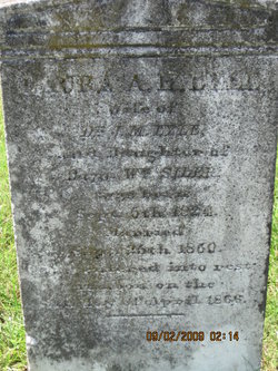
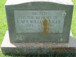
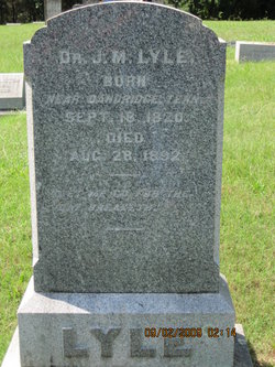
| Inscription | : | Wife of J. M. Lyle Daughter of Captain Wm. Siler Married Sept 25th 1850 |
frequently asked questions (FAQ):
-
Where is Laura Amelia Hill Siler Lyle's memorial?
Laura Amelia Hill Siler Lyle's memorial is located at: East Gilead Cemetery, East Gilead, Branch County, USA.
-
When did Laura Amelia Hill Siler Lyle death?
Laura Amelia Hill Siler Lyle death on 9 Apr 1866 in Buncombe County, North Carolina, USA
-
Where are the coordinates of the Laura Amelia Hill Siler Lyle's memorial?
Latitude: 41.7858330
Longitude: -85.0825000
Family Members:
Parent
Spouse
Siblings
Children
Flowers:
Nearby Cemetories:
1. East Gilead Cemetery
East Gilead, Branch County, USA
Coordinate: 41.7858330, -85.0825000
2. West Jamestown Cemetery
Jamestown, Steuben County, USA
Coordinate: 41.7447014, -85.0382996
3. South Gilead Cemetery
Bronson, Branch County, USA
Coordinate: 41.7733330, -85.1566670
4. North Gilead Cemetery
Gilead Township, Branch County, USA
Coordinate: 41.8039017, -85.1557999
5. Knauss Cemetery
Kinderhook, Branch County, USA
Coordinate: 41.7872009, -85.0002975
6. Waterhouse Cemetery
Kinderhook, Branch County, USA
Coordinate: 41.7961006, -84.9985962
7. Carleton Cemetery
Orland, Steuben County, USA
Coordinate: 41.7369890, -85.1403120
8. Card Cemetery
Bethel Township, Branch County, USA
Coordinate: 41.8544006, -85.0693970
9. Sorter Cemetery
Ovid Township, Branch County, USA
Coordinate: 41.8272220, -85.0052770
10. Greenlawn Cemetery
Orland, Steuben County, USA
Coordinate: 41.7338982, -85.1594009
11. Mill Grove Cemetery
Orland, Steuben County, USA
Coordinate: 41.7327995, -85.1718979
12. Curtis Cemetery
Bronson, Branch County, USA
Coordinate: 41.8039017, -85.1956024
13. Ovid Cemetery
Ovid Township, Branch County, USA
Coordinate: 41.8688580, -85.0484920
14. Peace Lutheran Church
Fremont, Steuben County, USA
Coordinate: 41.7298670, -84.9841800
15. Mundy Cemetery
Kinderhook, Branch County, USA
Coordinate: 41.7747002, -84.9586029
16. Lake Gage Cemetery
Angola, Steuben County, USA
Coordinate: 41.6927986, -85.0927963
17. Snow Prairie Cemetery
Bethel, Branch County, USA
Coordinate: 41.8699989, -85.1408005
18. Pleasant Hill Cemetery
Noble Township, Branch County, USA
Coordinate: 41.7961110, -85.2111110
19. Robinson Family Cemetery
Orland, Steuben County, USA
Coordinate: 41.6927030, -85.1412750
20. Bower Cemetery
Fremont, Steuben County, USA
Coordinate: 41.7458200, -84.9537370
21. Presbyterian Chapel of the Lakes Memorial Gardens
Angola, Steuben County, USA
Coordinate: 41.6846930, -85.0469690
22. Saint Marys Cemetery
Bronson, Branch County, USA
Coordinate: 41.8582993, -85.1939011
23. Lockwood Cemetery
Coldwater, Branch County, USA
Coordinate: 41.8837250, -85.0145170
24. Bronson Cemetery
Bronson, Branch County, USA
Coordinate: 41.8699340, -85.1858320

