
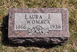
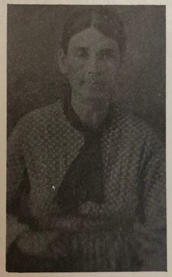
Laura Isabell Spoonemore Womack
| Birth | : | 26 Mar 1866 Missouri, USA |
| Death | : | 22 Aug 1936 Saint Joseph, Buchanan County, Missouri, USA |
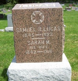
| Burial | : | Riverview Cemetery, Rock Rapids, Lyon County, USA |
| Coordinate | : | 43.4127998, -96.1643982 |
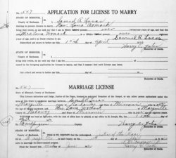
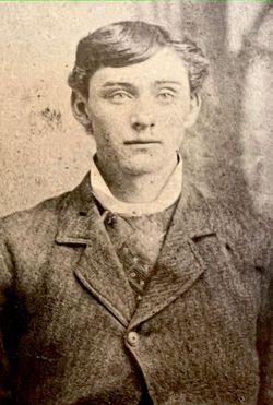
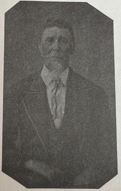
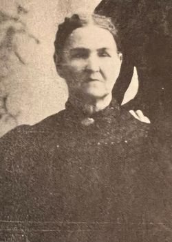
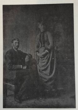
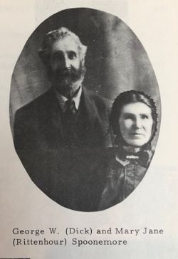
| Description | : | Died as LAURA I LUCAS but buried under her first married name of Womack. Laura is a daughter of David (b.PA) and unknown (Richman) Spoonemore (b.NC). She was a widow (S R Lucas) at the time of her death. residence: Ravenwood Informant: Hospital #2 Records, St Joseph Missouri Death Certificate Laura appears on the 1870 and 1880 Censuses with her parents, David and Mary Jane. She appears on the 1900 and 1910 Censuses with her (first) husband, Charles. 1920> Missouri> Nodaway [January] h> Laura Womack, 53y b.MO, DIV ..occupation: House work/out side s> Herman, 27y b.MO, occ: Laborer s> Loren, 22y b.MO, occ: Laborer s> Gleason, 18y b.MO, occ: Laborer 15... Read More |
frequently asked questions (FAQ):
-
Where is Laura Isabell Spoonemore Womack's memorial?
Laura Isabell Spoonemore Womack's memorial is located at: Riverview Cemetery, Rock Rapids, Lyon County, USA.
-
When did Laura Isabell Spoonemore Womack death?
Laura Isabell Spoonemore Womack death on 22 Aug 1936 in Saint Joseph, Buchanan County, Missouri, USA
-
Where are the coordinates of the Laura Isabell Spoonemore Womack's memorial?
Latitude: 43.4127998
Longitude: -96.1643982
Family Members:
Parent
Spouse
Siblings

Children
Flowers:


Nearby Cemetories:
1. Riverview Cemetery
Rock Rapids, Lyon County, USA
Coordinate: 43.4127998, -96.1643982
2. Holy Name Cemetery
Rock Rapids, Lyon County, USA
Coordinate: 43.4183006, -96.1864014
3. Apostolic Christian Faith Cemetery
Rock Rapids, Lyon County, USA
Coordinate: 43.4207918, -96.1854804
4. Ebenezer Cemetery
Rock County, USA
Coordinate: 43.5008163, -96.1517410
5. Apostolic Christian Cemetery
Lester, Lyon County, USA
Coordinate: 43.4061012, -96.3041992
6. Eastside Cemetery
Steen, Rock County, USA
Coordinate: 43.5141983, -96.2328033
7. Zion Cemetery
Lyon County, USA
Coordinate: 43.4324989, -95.9969025
8. Hope Reformed Church Cemetery
George, Lyon County, USA
Coordinate: 43.3296127, -96.0392609
9. Trinity Cemetery
Steen, Rock County, USA
Coordinate: 43.5224991, -96.2530975
10. Hillside Cemetery
Lester, Lyon County, USA
Coordinate: 43.4550018, -96.3305969
11. Christ Lutheran Church Cemetery
Alvord, Lyon County, USA
Coordinate: 43.3415000, -96.3120000
12. Saint Marys Cemetery
Alvord, Lyon County, USA
Coordinate: 43.3414001, -96.3131027
13. Evergreen Cemetery
George, Lyon County, USA
Coordinate: 43.3394012, -96.0164032
14. Bethel Reformed Cemetery
Lyon County, USA
Coordinate: 43.4621086, -95.9978027
15. First Baptist Church Cemetery
George, Lyon County, USA
Coordinate: 43.3755000, -95.9780000
16. Grand Prairie Cemetery
Ellsworth, Nobles County, USA
Coordinate: 43.5243988, -96.0421982
17. Garfield Township Cemetery
Lyon County, USA
Coordinate: 43.2689018, -96.1572037
18. Saint Marys Cemetery
Ellsworth, Nobles County, USA
Coordinate: 43.5218200, -96.0342000
19. Ashwood Cemetery
Rock County, USA
Coordinate: 43.5630989, -96.1121979
20. Hillside Cemetery
Doon, Lyon County, USA
Coordinate: 43.2728004, -96.2574997
21. Flowerfield Cemetery
Hills, Rock County, USA
Coordinate: 43.5289001, -96.3127975
22. First Presbyterian Church Cemetery
George, Lyon County, USA
Coordinate: 43.3160591, -95.9707260
23. United Reformed Cemetery
Hills, Rock County, USA
Coordinate: 43.5294100, -96.3572900
24. Bethlehem Lutheran Church Cemetery
Hills, Rock County, USA
Coordinate: 43.5294200, -96.3577300