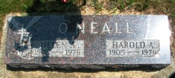
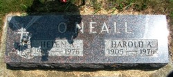
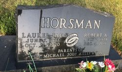
Laurel "Fae" O'Neall Horsman
| Birth | : | 7 Jun 1931 Plover, Pocahontas County, Iowa, USA |
| Death | : | 17 Oct 2020 Hartley, O'Brien County, Iowa, USA |
| Burial | : | Powhatan Cemetery, Plover, Pocahontas County, USA |
| Coordinate | : | 42.8557396, -94.5801773 |
| Description | : | Laurel "Fae" Horsman June 7, 1931 ~ October 17, 2020 Laurel Fae Horsman, 89, formerly of Wahpeton and Laurens, passed away on Saturday, October 17, 2020 at Community Healthcare in Hartley. A private family burial for Fae and her husband, the late Robert Horsman who preceded her in death in 2011, will be held in the Powhatan Cemetery in rural Rolfe, IA. In lieu of cards and memorial gifts the family recommends a donation to the Alzheimer’s Association. Fae was born on June 7, 1931 to Harold and Helen (Buck) O’Neall in Plover, IA.... Read More |
frequently asked questions (FAQ):
-
Where is Laurel "Fae" O'Neall Horsman's memorial?
Laurel "Fae" O'Neall Horsman's memorial is located at: Powhatan Cemetery, Plover, Pocahontas County, USA.
-
When did Laurel "Fae" O'Neall Horsman death?
Laurel "Fae" O'Neall Horsman death on 17 Oct 2020 in Hartley, O'Brien County, Iowa, USA
-
Where are the coordinates of the Laurel "Fae" O'Neall Horsman's memorial?
Latitude: 42.8557396
Longitude: -94.5801773
Family Members:
Parent
Spouse
Siblings
Flowers:
Nearby Cemetories:
1. Powhatan Cemetery
Plover, Pocahontas County, USA
Coordinate: 42.8557396, -94.5801773
2. Saint Margarets Cemetery
Rolfe, Pocahontas County, USA
Coordinate: 42.8164978, -94.5307465
3. Clinton-Garfield Cemetery
Rolfe, Pocahontas County, USA
Coordinate: 42.8055300, -94.5202500
4. Old Rolfe Cemetery
Rolfe, Pocahontas County, USA
Coordinate: 42.8403511, -94.4764175
5. Ellington Cemetery
Ellington Township, Palo Alto County, USA
Coordinate: 42.9377000, -94.6240400
6. Washington Cemetery
Havelock, Pocahontas County, USA
Coordinate: 42.8363250, -94.7091440
7. Lincoln Cemetery
West Bend, Palo Alto County, USA
Coordinate: 42.9596842, -94.5602466
8. Riverside Cemetery
West Bend, Palo Alto County, USA
Coordinate: 42.9512000, -94.5120000
9. Omer-Thorsen Farm Cemetery
Ottosen, Humboldt County, USA
Coordinate: 42.8735742, -94.4085743
10. McKnight Cemetery
Bode, Humboldt County, USA
Coordinate: 42.8635100, -94.4055600
11. Saint Mary's Cemetery
Rush Lake Township, Palo Alto County, USA
Coordinate: 42.9560000, -94.6980000
12. Calvary Cemetery
Pocahontas, Pocahontas County, USA
Coordinate: 42.7335000, -94.6597000
13. Summit Hill Cemetery
Pocahontas, Pocahontas County, USA
Coordinate: 42.7315000, -94.6595000
14. West Bend Cemetery
West Bend, Palo Alto County, USA
Coordinate: 42.9590000, -94.4548000
15. Saint Johns Catholic Cemetery
Gilmore City, Pocahontas County, USA
Coordinate: 42.7332993, -94.4672012
16. Marble Valley Cemetery
Gilmore City, Humboldt County, USA
Coordinate: 42.7458850, -94.4430150
17. Rush Lake Cemetery
Rush Lake Township, Palo Alto County, USA
Coordinate: 42.9497185, -94.7383270
18. Union Cemetery
Ottosen, Humboldt County, USA
Coordinate: 42.8879128, -94.3792496
19. Apostolic V Christian Cemetery
Kossuth County, USA
Coordinate: 42.9630870, -94.4238290
20. Riverside Cemetery
Fern Valley Township, Palo Alto County, USA
Coordinate: 43.0200000, -94.5220000
21. Laurens Cemetery
Laurens, Pocahontas County, USA
Coordinate: 42.8438988, -94.8330994
22. Garfield Township Cemetery
Kossuth County, USA
Coordinate: 42.9947000, -94.4080000
23. Calvary Cemetery
Laurens, Pocahontas County, USA
Coordinate: 42.8403015, -94.8368988
24. Mount Hope Cemetery
Unique, Humboldt County, USA
Coordinate: 42.7169250, -94.3740570


