| Birth | : | 10 Feb 1921 Stanley, Buchanan County, Iowa, USA |
| Death | : | 3 Feb 1993 Kirksville, Adair County, Missouri, USA |
| Burial | : | Rivercliff Cemetery, Mount Gilead, Morrow County, USA |
| Coordinate | : | 40.5475006, -82.8225021 |
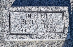
| Description | : | LaVerle Berniece "Millie" Atteberry, daughter of Maurice and Berniece (Kunkle) Steggall, was born February 10, 1921, in Stanley, Ia., and died Wednesday, February 3, 1993, in a Kirksville, Mo., hospital at the age of 71 years and 11 months. She was united in marriage to Robert H. Atteberry on July 16, 1944. He survives. Also surviving are two sons, Dale L. Atteberry, Danville, Ill., and Max E. Atteberry, Rochester, Mich.; three grandchildren, Robert E. Atteberry, Cynthia M. Atteberry, and Christopher D. Atteberry; three sisters, Darlene Sams, Knoxville, Tenn., Mardell Kirby, Lancaster, and Bette Ann Beeler, Lancaster; and one... Read More |
frequently asked questions (FAQ):
-
Where is LaVerle Berniece “Millie” Steggall Atteberry's memorial?
LaVerle Berniece “Millie” Steggall Atteberry's memorial is located at: Rivercliff Cemetery, Mount Gilead, Morrow County, USA.
-
When did LaVerle Berniece “Millie” Steggall Atteberry death?
LaVerle Berniece “Millie” Steggall Atteberry death on 3 Feb 1993 in Kirksville, Adair County, Missouri, USA
-
Where are the coordinates of the LaVerle Berniece “Millie” Steggall Atteberry's memorial?
Latitude: 40.5475006
Longitude: -82.8225021
Family Members:
Parent
Spouse
Siblings
Flowers:
Nearby Cemetories:
1. Rivercliff Cemetery
Mount Gilead, Morrow County, USA
Coordinate: 40.5475006, -82.8225021
2. Old Mount Gilead Presbyterian Cemetery
Mount Gilead, Morrow County, USA
Coordinate: 40.5459600, -82.8283300
3. Morrow County Home Cemetery
Mount Gilead, Morrow County, USA
Coordinate: 40.5658770, -82.8065160
4. Bingham Cemetery
Edison, Morrow County, USA
Coordinate: 40.5661011, -82.8403015
5. Quakerdom Cemetery
Mount Gilead, Morrow County, USA
Coordinate: 40.5167269, -82.8354570
6. Sunfish Cemetery
Mount Gilead, Morrow County, USA
Coordinate: 40.5741000, -82.7964300
7. Union Cemetery
Morrow County, USA
Coordinate: 40.5158900, -82.8426800
8. Hexsite Cemetery
Morrow County, USA
Coordinate: 40.5168991, -82.8550034
9. Bryn Zion Cemetery
Mount Gilead, Morrow County, USA
Coordinate: 40.5567300, -82.7682300
10. Hershner Cemetery
Mount Gilead, Morrow County, USA
Coordinate: 40.5893030, -82.8336760
11. Mosher Cemetery
Morrow County, USA
Coordinate: 40.5155983, -82.8613968
12. Kelly Cemetery
Gilead Township, Morrow County, USA
Coordinate: 40.5797530, -82.8624230
13. Kelly Family Cemetery #2
Chesterville, Morrow County, USA
Coordinate: 40.5328050, -82.7670350
14. Moffit Cemetery
Morrow County, USA
Coordinate: 40.6027985, -82.7983017
15. Kenney Cemetery
Cardington, Morrow County, USA
Coordinate: 40.4895048, -82.7879549
16. Mount Tabor Methodist Episcopal Cemetery
Mount Gilead, Morrow County, USA
Coordinate: 40.5958900, -82.7662900
17. Worden Cemetery
Morrow County, USA
Coordinate: 40.5758018, -82.8989029
18. Glendale Cemetery
Cardington, Morrow County, USA
Coordinate: 40.5036011, -82.8874969
19. Buck Cemetery
Fulton, Morrow County, USA
Coordinate: 40.4813995, -82.8221970
20. Asbury Cemetery
Fulton, Morrow County, USA
Coordinate: 40.4812910, -82.8223880
21. George Family Cemetery
Franklin Township, Morrow County, USA
Coordinate: 40.5164420, -82.7447810
22. Armstrong Cemetery
Washington Township, Morrow County, USA
Coordinate: 40.6144000, -82.8228960
23. Purvis Cemetery
Morrow County, USA
Coordinate: 40.5503006, -82.9139023
24. Bethel Cemetery
Cardington, Morrow County, USA
Coordinate: 40.5358900, -82.9204600


