| Memorials | : | 0 |
| Location | : | Chesterville, Morrow County, USA |
| Coordinate | : | 40.5328050, -82.7670350 |
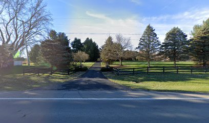
| Description | : | The cemetery is located on the west side of Mount Gilead-Fredericktown Road (Ohio State Route 95) about 0.7 miles southeast of its intersection with Pulaskiville Road (County Road 109) and Criswell Road (County Road 116). The cemetery is located in Franklin Township, Morrow County, Ohio, and is # 8641 (Kelly Cemetery #2) in “Ohio Cemeteries 1803-2003”, compiled by the Ohio Genealogical Society. The Morrow County GIS lists the cemetery as the Kelly Cemetery on parcel number F15-001-A0-243-00 with Handwerk Family Revocable Living Trust as owner (in 2022). |
frequently asked questions (FAQ):
-
Where is Kelly Family Cemetery #2?
Kelly Family Cemetery #2 is located at 5190 Mount Gilead-Fredericktown Road (Ohio State Route 95) Chesterville, Morrow County ,Ohio , 43338USA.
-
Kelly Family Cemetery #2 cemetery's updated grave count on graveviews.com?
0 memorials
-
Where are the coordinates of the Kelly Family Cemetery #2?
Latitude: 40.5328050
Longitude: -82.7670350
Nearby Cemetories:
1. George Family Cemetery
Franklin Township, Morrow County, USA
Coordinate: 40.5164420, -82.7447810
2. Bryn Zion Cemetery
Mount Gilead, Morrow County, USA
Coordinate: 40.5567300, -82.7682300
3. Blackbird Methodist Episcopal Church Cemetery
Harmony Township, Morrow County, USA
Coordinate: 40.4964500, -82.7482300
4. Pulaskiville Cemetery
Pulaskiville, Morrow County, USA
Coordinate: 40.5356200, -82.7112900
5. Rivercliff Cemetery
Mount Gilead, Morrow County, USA
Coordinate: 40.5475006, -82.8225021
6. Morrow County Home Cemetery
Mount Gilead, Morrow County, USA
Coordinate: 40.5658770, -82.8065160
7. Kenney Cemetery
Cardington, Morrow County, USA
Coordinate: 40.4895048, -82.7879549
8. Sunfish Cemetery
Mount Gilead, Morrow County, USA
Coordinate: 40.5741000, -82.7964300
9. Old Mount Gilead Presbyterian Cemetery
Mount Gilead, Morrow County, USA
Coordinate: 40.5459600, -82.8283300
10. Quakerdom Cemetery
Mount Gilead, Morrow County, USA
Coordinate: 40.5167269, -82.8354570
11. Union Cemetery
Morrow County, USA
Coordinate: 40.5158900, -82.8426800
12. Mount Tabor Methodist Episcopal Cemetery
Mount Gilead, Morrow County, USA
Coordinate: 40.5958900, -82.7662900
13. Bingham Cemetery
Edison, Morrow County, USA
Coordinate: 40.5661011, -82.8403015
14. Buck Cemetery
Fulton, Morrow County, USA
Coordinate: 40.4813995, -82.8221970
15. Asbury Cemetery
Fulton, Morrow County, USA
Coordinate: 40.4812910, -82.8223880
16. Hexsite Cemetery
Morrow County, USA
Coordinate: 40.5168991, -82.8550034
17. Mosher Cemetery
Morrow County, USA
Coordinate: 40.5155983, -82.8613968
18. Moffit Cemetery
Morrow County, USA
Coordinate: 40.6027985, -82.7983017
19. Yankee Street Presbyterian Cemetery
Chesterville, Morrow County, USA
Coordinate: 40.5192270, -82.6690611
20. Hershner Cemetery
Mount Gilead, Morrow County, USA
Coordinate: 40.5893030, -82.8336760
21. Center Corners Cemetery
Chesterville, Morrow County, USA
Coordinate: 40.5030000, -82.6725600
22. Chesterville Methodist Episcopal Cemetery
Chesterville, Morrow County, USA
Coordinate: 40.4798000, -82.6799780
23. Chesterville Presbyterian Cemetery
Chesterville, Morrow County, USA
Coordinate: 40.4798000, -82.6799780
24. Pleasant Grove Cemetery
West Point, Morrow County, USA
Coordinate: 40.6170000, -82.7474000

