


Lee Emanuel Esslinger
| Birth | : | 10 Aug 1902 Franklin County, Iowa, USA |
| Death | : | 22 Oct 1927 |
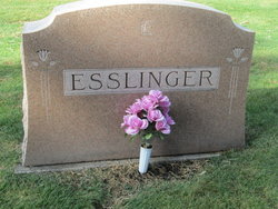
| Burial | : | Way Side Cemetery, Chapin, Franklin County, USA |
| Coordinate | : | 42.8293991, -93.2225037 |
| Description | : | Lee Esslinger Wounded and Succumbs Saturday at Hampton Death caused by blood clot on brain, say the doctors. This community was very deeply stirred last Saturday morning when word was received from the Hampton hospital that Lee E. Esslinger had passed away from effects of a gunshot wound receive the day before while he and friends were hunting pheasants. As the report reaches us Mr. Esslinger, in company with Mr. and Mrs. Chet DeMoss of this place, left here Friday afternoon to spend the afternoon hunting. Along about 4:00 in the afternoon, as they were proceeding along... Read More |
frequently asked questions (FAQ):
-
Where is Lee Emanuel Esslinger's memorial?
Lee Emanuel Esslinger's memorial is located at: Way Side Cemetery, Chapin, Franklin County, USA.
-
When did Lee Emanuel Esslinger death?
Lee Emanuel Esslinger death on 22 Oct 1927 in
-
Where are the coordinates of the Lee Emanuel Esslinger's memorial?
Latitude: 42.8293991
Longitude: -93.2225037
Family Members:
Parent

Flowers:


Nearby Cemetories:
1. Way Side Cemetery
Chapin, Franklin County, USA
Coordinate: 42.8293991, -93.2225037
2. Old Chapin Cemetery
Chapin, Franklin County, USA
Coordinate: 42.8232994, -93.2624969
3. Trinity Lutheran Cemetery
Hampton, Franklin County, USA
Coordinate: 42.7667007, -93.2518997
4. Zion Reformed Church Cemetery
Franklin County, USA
Coordinate: 42.8413887, -93.3188934
5. Hillside Cemetery
Sheffield, Franklin County, USA
Coordinate: 42.9006004, -93.2007980
6. Shobes Grove Cemetery
Franklin County, USA
Coordinate: 42.9000015, -93.2722168
7. Hampton Cemetery
Hampton, Franklin County, USA
Coordinate: 42.7452812, -93.1975021
8. Saint John Zion Cemetery
Sheffield, Franklin County, USA
Coordinate: 42.8969002, -93.1472015
9. Marion Center Cemetery
Latimer, Franklin County, USA
Coordinate: 42.7738991, -93.3178024
10. Hansell Cemetery
Franklin County, USA
Coordinate: 42.7666702, -93.1047211
11. West Fork Cemetery
Franklin County, USA
Coordinate: 42.8918991, -93.0836029
12. Saint Pauls Evangelical Lutheran Cemetery
Latimer, Franklin County, USA
Coordinate: 42.7652817, -93.3719406
13. Sacred Heart Cemetery
Rockwell, Cerro Gordo County, USA
Coordinate: 42.9592018, -93.1913986
14. Richland Lutheran Cemetery
Thornton, Cerro Gordo County, USA
Coordinate: 42.9086113, -93.3683319
15. Saint Johns Lutheran Cemetery
Hampton, Franklin County, USA
Coordinate: 42.7197189, -93.3397217
16. Pleasant Valley Township Cemetery
Swaledale, Cerro Gordo County, USA
Coordinate: 42.9505615, -93.3216705
17. Coulter Cemetery
Coulter, Franklin County, USA
Coordinate: 42.7388916, -93.3716736
18. Towle Cemetery
Geneva, Franklin County, USA
Coordinate: 42.6836014, -93.1785965
19. Rockwell Cemetery
Rockwell, Cerro Gordo County, USA
Coordinate: 42.9786000, -93.1919000
20. Lindenwood Cemetery
Geneva, Franklin County, USA
Coordinate: 42.6935997, -93.1235962
21. Saint Peter's Lutheran Church Cemetery
Coulter, Franklin County, USA
Coordinate: 42.7167015, -93.3803024
22. Harlan Cemetery
Dumont, Butler County, USA
Coordinate: 42.7663994, -93.0143967
23. Four Mile Grove Cemetery
Geneva, Franklin County, USA
Coordinate: 42.6949997, -93.0852966
24. Saint Patricks Catholic Cemetery
Dougherty, Cerro Gordo County, USA
Coordinate: 42.9227791, -93.0294418