


Lee Glidden
| Birth | : | 28 May 1922 Thomas County, Nebraska, USA |
| Death | : | 29 Jun 2012 Grand Island, Hall County, Nebraska, USA |
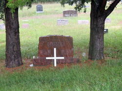
| Burial | : | Dunning Cemetery, Dunning, Blaine County, USA |
| Coordinate | : | 41.8213110, -100.0984530 |
| Description | : | Lee Glidden, 90, of St. Paul, NE. died Friday, June 29, 2012 at the Nebraska Veterans Home in Grand Island, NE. Lee was born May 28, 1922 at Thomas County, NE. to Frank T. and Iva May (Rarick) Glidden. Lee grew up on the family homestead in Thomas County, NE. He attended county school and then graduated from Dunning (NE.) High School in 1938. He worked as a Bunkhouse Cowboy for several sand-hill ranches. Lee enlisted into the United States Navy Reserves on January 20, 1943 as an aviation cadet and served as a fighter pilot of a carrier, Pacific Theater.... Read More |
frequently asked questions (FAQ):
-
Where is Lee Glidden's memorial?
Lee Glidden's memorial is located at: Dunning Cemetery, Dunning, Blaine County, USA.
-
When did Lee Glidden death?
Lee Glidden death on 29 Jun 2012 in Grand Island, Hall County, Nebraska, USA
-
Where are the coordinates of the Lee Glidden's memorial?
Latitude: 41.8213110
Longitude: -100.0984530
Family Members:
Parent

Spouse

Siblings
Flowers:


Nearby Cemetories:
1. Dunning Cemetery
Dunning, Blaine County, USA
Coordinate: 41.8213110, -100.0984530
2. Hawley Flats Cemetery
Blaine County, USA
Coordinate: 42.0003014, -100.0203018
3. Brewster Cemetery
Brewster, Blaine County, USA
Coordinate: 41.9291992, -99.8419037
4. Grandview Cemetery
Anselmo, Custer County, USA
Coordinate: 41.6255962, -99.8944652
5. Purdum Cemetery
Purdum, Blaine County, USA
Coordinate: 42.0638190, -100.2574890
6. German Valley Cemetery
Blaine County, USA
Coordinate: 42.0116997, -99.8313980
7. Saint Anselms Cemetery
Anselmo, Custer County, USA
Coordinate: 41.6157990, -99.8442001
8. Valley View Cemetery
Brown County, USA
Coordinate: 42.1217003, -100.0488968
9. Victoria Creek Cemetery
Anselmo, Custer County, USA
Coordinate: 41.6255000, -99.7510000
10. New Hope Cemetery
Merna, Custer County, USA
Coordinate: 41.5772018, -99.7833023
11. Ortello Cemetery
Merna, Custer County, USA
Coordinate: 41.5113983, -99.9024963
12. Giles Cemetery
Cherry County, USA
Coordinate: 42.1603012, -100.1828003
13. Cliff Table Cemetery
Merna, Custer County, USA
Coordinate: 41.4694100, -99.9626800
14. Powell Canyon Cemetery
Custer County, USA
Coordinate: 41.4543991, -100.1280975
15. Saint Andrews Catholic Cemetery
Custer County, USA
Coordinate: 41.5097008, -99.8253021
16. Hillcrest Cemetery
Thedford, Thomas County, USA
Coordinate: 41.9673000, -100.5756000
17. Moulton Cemetery
Loup County, USA
Coordinate: 41.8574982, -99.5852966
18. Gates Cemetery
Gates, Custer County, USA
Coordinate: 41.6492004, -99.6361008
19. Lillian Cemetery
Lillian, Custer County, USA
Coordinate: 41.5925000, -99.6500000
20. Kilfoil Cemetery
Merna, Custer County, USA
Coordinate: 41.4883003, -99.7878036
21. Arnold Cemetery
Arnold, Custer County, USA
Coordinate: 41.4089012, -100.1903000
22. Predmore Cemetery
Walworth, Custer County, USA
Coordinate: 41.6755981, -99.5674973
23. Madison Square Cemetery
Taylor, Loup County, USA
Coordinate: 41.7694016, -99.5314026
24. Almeria Cemetery
Almeria, Loup County, USA
Coordinate: 41.8177986, -99.5128021