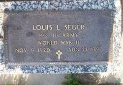
| Birth | : | 9 Apr 1926 Stuart, Holt County, Nebraska, USA |
| Death | : | 20 Feb 2014 Kearney, Buffalo County, Nebraska, USA |
| Burial | : | St. Andrews Church Burial Ground, Felmingham, North Norfolk District, England |
| Coordinate | : | 52.8139100, 1.3391320 |
| Plot | : | Section 2, Row 8 |
| Inscription | : | Parents of Daryl, Alan, Patti, Mary Jo |
| Description | : | KEARNEY — Lenora M. Dobry, 87, of Kearney died Thursday, Feb. 20, 2014, at Prairie View Gardens. Services will be at 10 a.m. Monday at Horner Lieske McBride & Kuhl Funeral and Cremation Services with the Rev. Gary Main officiating. Burial will be at Sumner Cemetery. Visitation will be from 3-5 p.m. Sunday at the funeral home and before services Monday. The family will be present during visitation Sunday. She was born April 9, 1926, in Stewart to John and Eva (Campbell) Seger. On July 17, 1946, she married Vladimir "Pat" Dobry in Marysville, Kan. He preceded her in death. ---------- Survivors include her sons, Daryl... Read More |
frequently asked questions (FAQ):
-
Where is Lenora Mae Seger Dobry's memorial?
Lenora Mae Seger Dobry's memorial is located at: St. Andrews Church Burial Ground, Felmingham, North Norfolk District, England.
-
When did Lenora Mae Seger Dobry death?
Lenora Mae Seger Dobry death on 20 Feb 2014 in Kearney, Buffalo County, Nebraska, USA
-
Where are the coordinates of the Lenora Mae Seger Dobry's memorial?
Latitude: 52.8139100
Longitude: 1.3391320
Family Members:
Parent
Spouse
Siblings
Flowers:
Nearby Cemetories:
1. St. Andrews Church Burial Ground
Felmingham, North Norfolk District, England
Coordinate: 52.8139100, 1.3391320
2. St Peter & St Paul's Church
Tuttington, Broadland District, England
Coordinate: 52.7962090, 1.3009760
3. Saint Nicholas Churchyard
North Walsham, North Norfolk District, England
Coordinate: 52.8216050, 1.3873600
4. St. Botolph Churchyard
Banningham, North Norfolk District, England
Coordinate: 52.8170850, 1.2865060
5. St. Giles Churchyard
Colby, North Norfolk District, England
Coordinate: 52.8318190, 1.2945700
6. St. Mary's Churchyard
Antingham, North Norfolk District, England
Coordinate: 52.8464655, 1.3436395
7. North Walsham New Cemetery
North Walsham, North Norfolk District, England
Coordinate: 52.8242410, 1.3913360
8. St Giles Churchyard
Bradfield, North Norfolk District, England
Coordinate: 52.8493740, 1.3667290
9. St Andrew's Churchyard
Gunton, North Norfolk District, England
Coordinate: 52.8584910, 1.3097280
10. St. Mary's Churchyard
Burgh Next Aylsham, Broadland District, England
Coordinate: 52.7775114, 1.2865926
11. St. Mary's Churchyard
Erpingham, North Norfolk District, England
Coordinate: 52.8338580, 1.2626100
12. Garendon Abbey
Shepshed, Charnwood Borough, England
Coordinate: 52.7711000, 1.2951000
13. St. Michael & All Angels Churchyard
Oxnead, Broadland District, England
Coordinate: 52.7680820, 1.3042030
14. St. Peter's Churchyard
Brampton, Broadland District, England
Coordinate: 52.7733970, 1.2891100
15. St. Andrew Churchyard
Lamas, Broadland District, England
Coordinate: 52.7598010, 1.3262770
16. Quaker Burial Ground
Lamas, Broadland District, England
Coordinate: 52.7584960, 1.3235840
17. St. Michael and All Angels Churchyard
Aylsham, Broadland District, England
Coordinate: 52.7960690, 1.2506530
18. Aylsham Cemetery
Aylsham, Broadland District, England
Coordinate: 52.7883400, 1.2540900
19. St. Ethelbert's Church Burial Ground
Alby with Thwaite, North Norfolk District, England
Coordinate: 52.8548760, 1.2701850
20. St Andrew Churchyard
Buxton, Broadland District, England
Coordinate: 52.7557360, 1.3083760
21. All Saints Churchyard
Alby with Thwaite, North Norfolk District, England
Coordinate: 52.8533000, 1.2555000
22. St Andrew Churchyard
Blickling, Broadland District, England
Coordinate: 52.8095370, 1.2311760
23. Blickling Hall
Blickling, Broadland District, England
Coordinate: 52.8095474, 1.2310860
24. Silvergate Lane Cemetery
Blickling, Broadland District, England
Coordinate: 52.8075334, 1.2305140


