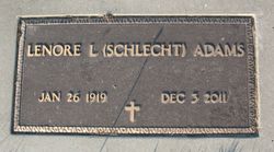
Lenore Louise “Blondie” Schlecht Adams
| Birth | : | 26 Jan 1919 Beemer, Cuming County, Nebraska, USA |
| Death | : | 3 Dec 2011 Wisner, Cuming County, Nebraska, USA |
| Burial | : | Forks Cemetery, Stockertown, Northampton County, USA |
| Coordinate | : | 40.7524000, -75.2507700 |
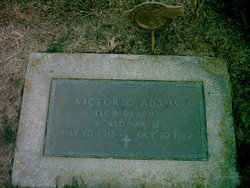
| Description | : | Lenore passed away on Saturday, December 3, 2011 at the Wisner Care Center in Wisner, NE. Lenore Louise Adams was born January 26, 1919 at Beemer, NE to Paul and Anna (Brockman) Schlecht. She was baptized on February 9, 1919 and later confirmed on March 27, 1932 at St. John's Lutheran Church, rural Beemer, NE. Lenore attended St. John's Parochial School and Wisner High School, graduating in 1937. While in high school, she worked for her room and board for Dr. Gayle and Lillian McMaster. On April 27, 1942, she was united in marriage to Victor Adams at Papillion, NE. Blondie... Read More |
frequently asked questions (FAQ):
-
Where is Lenore Louise “Blondie” Schlecht Adams's memorial?
Lenore Louise “Blondie” Schlecht Adams's memorial is located at: Forks Cemetery, Stockertown, Northampton County, USA.
-
When did Lenore Louise “Blondie” Schlecht Adams death?
Lenore Louise “Blondie” Schlecht Adams death on 3 Dec 2011 in Wisner, Cuming County, Nebraska, USA
-
Where are the coordinates of the Lenore Louise “Blondie” Schlecht Adams's memorial?
Latitude: 40.7524000
Longitude: -75.2507700
Family Members:
Parent
Spouse
Children
Flowers:
Nearby Cemetories:
1. Forks Cemetery
Stockertown, Northampton County, USA
Coordinate: 40.7524000, -75.2507700
2. Belfast Union Cemetery
Belfast, Northampton County, USA
Coordinate: 40.7818985, -75.2822037
3. God's Acre
Schoeneck, Northampton County, USA
Coordinate: 40.7557900, -75.3081000
4. BNai Abraham Cemetery
Forks Township, Northampton County, USA
Coordinate: 40.7067000, -75.2496000
5. Congregation Children of Israel Cemetery
Easton, Northampton County, USA
Coordinate: 40.7063000, -75.2478000
6. Arndts and Messinger Cemetery
Forks Township, Northampton County, USA
Coordinate: 40.7056007, -75.2485962
7. Saint Johns Lutheran Church Columbarium
Nazareth, Northampton County, USA
Coordinate: 40.7379880, -75.3098130
8. Saint Johns Cemetery
Nazareth, Northampton County, USA
Coordinate: 40.7344017, -75.3091965
9. Greenwood Cemetery
Nazareth, Northampton County, USA
Coordinate: 40.7486000, -75.3161011
10. Nazareth Moravian Cemetery
Nazareth, Northampton County, USA
Coordinate: 40.7430992, -75.3178024
11. Holy Family Church Cemetery Lower
Nazareth, Northampton County, USA
Coordinate: 40.7432650, -75.3199500
12. Holy Family Cemetery
Nazareth, Northampton County, USA
Coordinate: 40.7463989, -75.3218994
13. Moravian Indian Tower Cemetery
Nazareth, Northampton County, USA
Coordinate: 40.7474000, -75.3227000
14. Zion Evangelical Cemetery
Nazareth, Northampton County, USA
Coordinate: 40.7540320, -75.3274760
15. Gracedale Cemetery
Nazareth, Northampton County, USA
Coordinate: 40.7510000, -75.3287000
16. Easton Heights Cemetery
Easton, Northampton County, USA
Coordinate: 40.6968994, -75.2236023
17. Easton Cemetery
Easton, Northampton County, USA
Coordinate: 40.6967010, -75.2189026
18. Northampton Memorial Shrine
Palmer Township, Northampton County, USA
Coordinate: 40.6883011, -75.2677994
19. German Reformed Church Cemetery
Easton, Northampton County, USA
Coordinate: 40.6922000, -75.2138000
20. Trinity Episcopal Memorial Garden
Easton, Northampton County, USA
Coordinate: 40.6930730, -75.2083260
21. Benders Mennonite Church Cemetery
Pen Argyl, Northampton County, USA
Coordinate: 40.8199310, -75.2520190
22. Fairmount Cemetery
Phillipsburg, Warren County, USA
Coordinate: 40.6997032, -75.1925812
23. Holy Cross Lutheran Cemetery
Bushkill Center, Northampton County, USA
Coordinate: 40.7940200, -75.3240200
24. Scotch-Irish Presbyterian Cemetery
Martins Creek, Northampton County, USA
Coordinate: 40.7870900, -75.1703200


