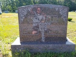
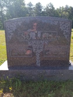
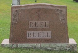
Léonie Ruel Sorrell
| Birth | : | 25 Dec 1874 Saint-Leon-de-Standon, Chaudiere-Appalaches Region, Quebec, Canada |
| Death | : | 11 Sep 1939 Dover, Strafford County, New Hampshire, USA |
| Burial | : | Green Grove Cemetery, Ashland, Grafton County, USA |
| Coordinate | : | 43.6975400, -71.6401500 |
| Description | : | Marie Léonie Ruel, daughter of Laurent Ruel and Angèle Pouliot, was a native of Saint Léon de Standon, Dorchester, Québec, Canada. She was baptized there on 30 Dec 1874. Her father died in 1882, after which her family immigrated to the United States, and settled in Grafton County, New Hampshire. Léonie married Louis Sorrell, son of Marcel and Flavie Sorrell, on 30 May 1888, when she was just 13 years old. She died at age 64 and was interred in Green Grove Cemetery in Ashland, Grafton, New Hampshire on 13 Sep 1939. Sources include the Drouin collection, census records, and New... Read More |
frequently asked questions (FAQ):
-
Where is Léonie Ruel Sorrell's memorial?
Léonie Ruel Sorrell's memorial is located at: Green Grove Cemetery, Ashland, Grafton County, USA.
-
When did Léonie Ruel Sorrell death?
Léonie Ruel Sorrell death on 11 Sep 1939 in Dover, Strafford County, New Hampshire, USA
-
Where are the coordinates of the Léonie Ruel Sorrell's memorial?
Latitude: 43.6975400
Longitude: -71.6401500
Family Members:
Parent
Spouse
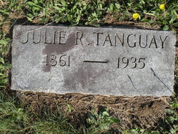
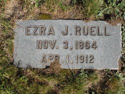
Siblings
Children
Flowers:
Nearby Cemetories:
1. Green Grove Cemetery
Ashland, Grafton County, USA
Coordinate: 43.6975400, -71.6401500
2. Ashland Episcopal Church Cemetery
Ashland, Grafton County, USA
Coordinate: 43.6963650, -71.6315670
3. Thompson Street Cemetery
Ashland, Grafton County, USA
Coordinate: 43.6975100, -71.6294000
4. Mooney Cemetery
Ashland, Grafton County, USA
Coordinate: 43.7019440, -71.6269440
5. Baker Cemetery
Ashland, Grafton County, USA
Coordinate: 43.6941990, -71.6254580
6. Kenfield Cemetery
Bridgewater, Grafton County, USA
Coordinate: 43.6837070, -71.6503550
7. Clark Cemetery
Ashland, Grafton County, USA
Coordinate: 43.7133330, -71.6113890
8. Howe-Clark Cemetery
Grafton County, USA
Coordinate: 43.7133330, -71.6113890
9. Webster-Cross Cemetery
Bridgewater, Grafton County, USA
Coordinate: 43.6715300, -71.6531200
10. Chandler Cemetery
New Hampton, Belknap County, USA
Coordinate: 43.6761110, -71.6147220
11. Union Cemetery
Bridgewater, Grafton County, USA
Coordinate: 43.7093500, -71.6763500
12. Ephraim Smith Cemetery
New Hampton, Belknap County, USA
Coordinate: 43.6708670, -71.6242670
13. Hicks Hill Cemetery
Ashland, Grafton County, USA
Coordinate: 43.7277780, -71.6313890
14. Nathaniel Robinson Cemetery
New Hampton, Belknap County, USA
Coordinate: 43.6658734, -71.6438178
15. Mitchell Family Cemetery
Bridgewater, Grafton County, USA
Coordinate: 43.7052780, -71.6838890
16. Owl Brook Cemetery
Ashland, Grafton County, USA
Coordinate: 43.7333200, -71.6300100
17. Young Cemetery
New Hampton, Belknap County, USA
Coordinate: 43.6650000, -71.6155560
18. Jackson Cemetery
New Hampton, Belknap County, USA
Coordinate: 43.6787830, -71.5935670
19. McCutcheon Cemetery
Bridgewater, Grafton County, USA
Coordinate: 43.6636110, -71.6702780
20. Lower Intervale Cemetery
Plymouth, Grafton County, USA
Coordinate: 43.7316100, -71.6733800
21. James Huckins Cemetery
New Hampton, Belknap County, USA
Coordinate: 43.6638650, -71.6055770
22. Fogg Cemetery
New Hampton, Belknap County, USA
Coordinate: 43.6908330, -71.5827780
23. Old Home Cemetery
Bridgewater, Grafton County, USA
Coordinate: 43.6769440, -71.6933330
24. Plaisted Cemetery
New Hampton, Belknap County, USA
Coordinate: 43.6889000, -71.5794000

