| Birth | : | 13 Jul 1926 Hooker, Turner County, South Dakota, USA |
| Death | : | 2 Feb 2013 Vermillion, Clay County, South Dakota, USA |
| Burial | : | Pleasant Valley Cemetery, Westerville, Clay County, USA |
| Coordinate | : | 42.9247017, -97.0124969 |
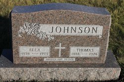
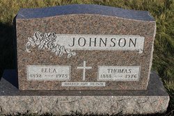
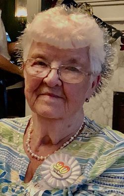
| Description | : | Lester Johnson, 86, of Wakonda, SD passed away Saturday, February 2 at the Sanford Vermillion Hospital. Lester was born July 13, 1926 in Hooker, SD to Thomas and Ella (Andahl) Johnson. He graduated from the Centerville High School and attended South Dakota State University and also served in the Army during WWII. He married Beverly Oursland on June 4, 1950 in Volin, SD and the couple farmed and raised livestock for many years. He was preceded in death by his parents, a brother Arnold and an infant brother. He is survived by his wife Beverly of Wakonda, three sons; Dennis (Donna) Johnson of... Read More |
frequently asked questions (FAQ):
-
Where is Lester Johnson's memorial?
Lester Johnson's memorial is located at: Pleasant Valley Cemetery, Westerville, Clay County, USA.
-
When did Lester Johnson death?
Lester Johnson death on 2 Feb 2013 in Vermillion, Clay County, South Dakota, USA
-
Where are the coordinates of the Lester Johnson's memorial?
Latitude: 42.9247017
Longitude: -97.0124969
Family Members:
Parent
Siblings
Flowers:
Nearby Cemetories:
1. Pleasant Valley Cemetery
Westerville, Clay County, USA
Coordinate: 42.9247017, -97.0124969
2. Mortvedt Cemetery
Clay County, USA
Coordinate: 42.9169006, -97.0028000
3. Bethel Baptist Cemetery
Wakonda, Clay County, USA
Coordinate: 42.9393570, -97.0433520
4. New Lodi Cemetery
Lodi, Clay County, USA
Coordinate: 42.9530983, -97.0417023
5. Saint Patricks Catholic Cemetery
Wakonda, Clay County, USA
Coordinate: 42.9672012, -97.0516968
6. Old Lodi Cemetery
Lodi, Clay County, USA
Coordinate: 42.9757996, -96.9907990
7. Spirit Mound Cemetery
Clay County, USA
Coordinate: 42.8885994, -96.9424973
8. Dalesburg Lutheran Cemetery
Vermillion, Clay County, USA
Coordinate: 42.9389424, -96.9242594
9. Clay Creek Cemetery
Clay County, USA
Coordinate: 42.8516998, -96.9788971
10. Clay Point Cemetery
Prairie Center Township, Clay County, USA
Coordinate: 42.8987700, -96.9065600
11. Union Cemetery
Wakonda, Clay County, USA
Coordinate: 42.9827995, -97.1222000
12. Taylor Cemetery
Clay County, USA
Coordinate: 42.8372002, -97.0785980
13. CJ Anderson Homestead
Riverside Township, Clay County, USA
Coordinate: 43.0214180, -96.9675540
14. Dalesburg Baptist Cemetery
Dalesburg, Clay County, USA
Coordinate: 42.9675102, -96.8850403
15. Meckling Cemetery
Meckling, Clay County, USA
Coordinate: 42.8252983, -97.0919037
16. Riverside-Barton Cemetery
Clay County, USA
Coordinate: 43.0402985, -96.9725037
17. Volin Cemetery
Volin, Yankton County, USA
Coordinate: 42.9672012, -97.1707993
18. Saint Peter Greenfield Cemetery
Vermillion, Clay County, USA
Coordinate: 42.8608017, -96.8644028
19. Gayville Community Cemetery
Gayville, Yankton County, USA
Coordinate: 42.8950005, -97.1800003
20. Rockfield Cemetery
Clay County, USA
Coordinate: 42.9397011, -96.8302994
21. Komstad Cemetery
Dalesburg, Clay County, USA
Coordinate: 43.0417938, -96.9058914
22. Evergreen Cemetery
Meckling, Clay County, USA
Coordinate: 42.7896996, -97.0903015
23. Saint Columbkill Cemetery
Wakonda, Clay County, USA
Coordinate: 43.0642014, -97.0828018
24. Trinity Danish Lutheran Church Cemetery
Gayville, Yankton County, USA
Coordinate: 42.8222008, -97.1605988


