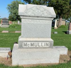
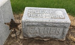
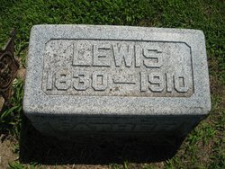
Lewis D McMullin
| Birth | : | 13 Mar 1830 Jefferson County, Ohio, USA |
| Death | : | 18 Feb 1910 Red Oak, Montgomery County, Iowa, USA |
| Burial | : | De Aar Old Cemetery, De Aar, Pixley ka Seme District Municipality, South Africa |
| Coordinate | : | -30.6443700, 24.0172300 |
| Plot | : | Original Section #90 (North Original Section, Row 13) |
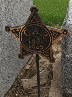
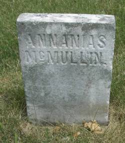
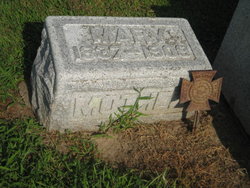
| Inscription | : | McMULLEN, Lewis D. * 13 Mar 1830 - 19 Mar 1910 Co.G 30 IL Inf CW-GAR Emerson Cemetery |
| Description | : | Tabor Beacon March 24, 1910 L. D. McMullin of Emerson, a pioneer resident of Iowa, aged 80 yrs. Died of pneumonia at the home of his daughter Mrs. C. J. Pratt of Red Oak at 8 Sat. AM after an illness of only a few days. Mr. McMullin is survived by nine children with one of whom W. J. McMullin of Red Oak, he made his home. At the time he was taken ill, he was visiting with his daughter at Red Oak. The body was taken to Emerson for burial, funeral services being held Monday PM at 2 from the... Read More |
frequently asked questions (FAQ):
-
Where is Lewis D McMullin's memorial?
Lewis D McMullin's memorial is located at: De Aar Old Cemetery, De Aar, Pixley ka Seme District Municipality, South Africa.
-
When did Lewis D McMullin death?
Lewis D McMullin death on 18 Feb 1910 in Red Oak, Montgomery County, Iowa, USA
-
Where are the coordinates of the Lewis D McMullin's memorial?
Latitude: -30.6443700
Longitude: 24.0172300
Family Members:
Parent
Spouse
Siblings
Children
Flowers:
Nearby Cemetories:
1. De Aar Old Cemetery
De Aar, Pixley ka Seme District Municipality, South Africa
Coordinate: -30.6443700, 24.0172300
2. Caroluspoort Cemetery
De Aar, Pixley ka Seme District Municipality, South Africa
Coordinate: -30.6374338, 24.0251138
3. De Aar East Cemetery
De Aar, Pixley ka Seme District Municipality, South Africa
Coordinate: -30.6458300, 24.0292100
4. Nonzwakazi Cemetery
De Aar, Pixley ka Seme District Municipality, South Africa
Coordinate: -30.6724272, 24.0330700
5. Burgerville Farm Cemetery
De Aar, Pixley ka Seme District Municipality, South Africa
Coordinate: -30.7231700, 24.3382100
6. Deelfontein Cemetery
Deelfontein, Pixley ka Seme District Municipality, South Africa
Coordinate: -30.9962000, 23.7926700
7. Britstown Garden of Remembrance
Britstown, Pixley ka Seme District Municipality, South Africa
Coordinate: -30.5894699, 23.5020284
8. NG Kerk - Philipstown Begraafplaas
Philipstown, Pixley ka Seme District Municipality, South Africa
Coordinate: -30.4357049, 24.4794399
9. Cypherput Farm Cemetery
Pixley ka Seme District Municipality, South Africa
Coordinate: -30.6197200, 24.5441200
10. NG Kerk - Hanover Kerhof
Hanover, Pixley ka Seme District Municipality, South Africa
Coordinate: -31.0665725, 24.4414123
11. Hanover Cemetery
Hanover, Pixley ka Seme District Municipality, South Africa
Coordinate: -31.0731284, 24.4393225
12. Strydenburg Municiple Cemetery
Strydenburg, Pixley ka Seme District Municipality, South Africa
Coordinate: -29.9475770, 23.6734293
13. NG Kerk - Strydenburg Muur van Herinnering
Strydenburg, Pixley ka Seme District Municipality, South Africa
Coordinate: -29.9424330, 23.6765330
14. Strydenburg West Cemetery
Strydenburg, Pixley ka Seme District Municipality, South Africa
Coordinate: -29.9452439, 23.6630829
15. NG Kerk - Rickmond Kerkhof
Richmond, Pixley ka Seme District Municipality, South Africa
Coordinate: -31.4132170, 23.9466500
16. Richmond Old Cemetery
Richmond, Pixley ka Seme District Municipality, South Africa
Coordinate: -31.4170200, 23.9461100
17. NG Kerk - Richmond New Cemetery
Richmond, Pixley ka Seme District Municipality, South Africa
Coordinate: -31.4173433, 23.9346223
18. Richmond Cemetery
Richmond, Pixley ka Seme District Municipality, South Africa
Coordinate: -31.4183579, 23.9344954
19. Petrusville Cemetery
Petrusville, Pixley ka Seme District Municipality, South Africa
Coordinate: -30.0771089, 24.6420412
20. Petrusville Old Cemetery
Petrusville, Pixley ka Seme District Municipality, South Africa
Coordinate: -30.0779600, 24.6599500
21. Colesberg British Military Cemetery
Colesberg, Pixley ka Seme District Municipality, South Africa
Coordinate: -30.5000000, 25.0000000
22. Orania Cemetery
Orania, Pixley ka Seme District Municipality, South Africa
Coordinate: -29.8184587, 24.4020535
23. Liebenbergspan Farm Burial Ground
Hopetown, Pixley ka Seme District Municipality, South Africa
Coordinate: -29.7608100, 24.3231100
24. Colesberg Cemetery
Colesberg, Pixley ka Seme District Municipality, South Africa
Coordinate: -30.7164160, 25.1004070

