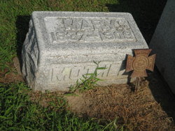
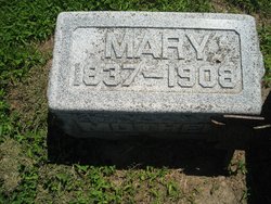
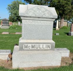
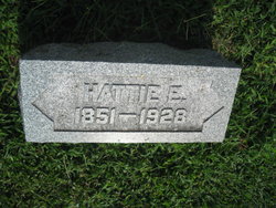
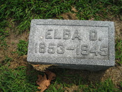
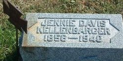
Mary Catherine Davis McMullin
| Birth | : | 12 Apr 1837 Floyd County, Indiana, USA |
| Death | : | 14 Apr 1908 Emerson, Mills County, Iowa, USA |
| Burial | : | St. Edmund's Churchyard, Taverham, Broadland District, England |
| Coordinate | : | 52.6789990, 1.1949460 |
| Plot | : | Original Section #90 |
| Description | : | The funeral services of Mrs. L. D. McMullen, whose death at Emerson was briefly mentioned in Friday's Tribune, was held Friday afternoon at the Emerson Presbyterian Church, Rev. McClelland, of Corning, officiating, assisted by Rev. Linn. Mrs. Mary McMullin, whose maiden name was Davis, was born in Floyd county, Ind., April 12, 1837. In early childhood she removed with her parents to Henderson county, Illinois, where she grew to womanhood and was married to Mr. McMullen. About 1867 Mr. and Mrs. McMullen came to Mills county and settled on the farm North of Hastins, where they resided until 3 years ago when... Read More |
frequently asked questions (FAQ):
-
Where is Mary Catherine Davis McMullin's memorial?
Mary Catherine Davis McMullin's memorial is located at: St. Edmund's Churchyard, Taverham, Broadland District, England.
-
When did Mary Catherine Davis McMullin death?
Mary Catherine Davis McMullin death on 14 Apr 1908 in Emerson, Mills County, Iowa, USA
-
Where are the coordinates of the Mary Catherine Davis McMullin's memorial?
Latitude: 52.6789990
Longitude: 1.1949460
Family Members:
Parent
Spouse
Siblings
Children
Flowers:
Nearby Cemetories:
1. St. Edmund's Churchyard
Taverham, Broadland District, England
Coordinate: 52.6789990, 1.1949460
2. St. Margaret's Churchyard
Drayton, Broadland District, England
Coordinate: 52.6773010, 1.2241980
3. St. Edmund's Churchyard
Costessey, South Norfolk District, England
Coordinate: 52.6660400, 1.2183410
4. Costessey Baptist Churchyard
Costessey, South Norfolk District, England
Coordinate: 52.6600122, 1.2116993
5. Our Lady & St. Walstan Churchyard
Costessey, South Norfolk District, England
Coordinate: 52.6583200, 1.2119300
6. St. Peter's Churchyard
Ringland, Broadland District, England
Coordinate: 52.6822900, 1.1552400
7. Costessey Parish Cemetery
Costessey, South Norfolk District, England
Coordinate: 52.6495927, 1.2040157
8. St Margaret Churchyard
Felthorpe, Broadland District, England
Coordinate: 52.7099700, 1.2105700
9. All Saints Churchyard
Horsford, Broadland District, England
Coordinate: 52.6913720, 1.2494360
10. St Margaret's Church
Morton on the Hill, Broadland District, England
Coordinate: 52.6987710, 1.1450960
11. Baptist Chapel Churchyard
Felthorpe, Broadland District, England
Coordinate: 52.7150000, 1.2008950
12. St. Peter's Churchyard
Easton, South Norfolk District, England
Coordinate: 52.6543660, 1.1478070
13. St. Andrew's Churchyard
Attlebridge, Broadland District, England
Coordinate: 52.7075040, 1.1504910
14. St Michael's Church
Bowthorpe, City of Norwich, England
Coordinate: 52.6359300, 1.2163600
15. St. Mary's New Burial Ground
Hellesdon, Broadland District, England
Coordinate: 52.6495480, 1.2520370
16. St. Mary's Churchyard
Hellesdon, Broadland District, England
Coordinate: 52.6486720, 1.2515280
17. All Saints Churchyard
Weston Longville, Broadland District, England
Coordinate: 52.6993460, 1.1262510
18. All Saints Churchyard
Weston Longville, Broadland District, England
Coordinate: 52.6990630, 1.1257670
19. St. Mary and St. Walstan Churchyard
Bawburgh, South Norfolk District, England
Coordinate: 52.6327480, 1.1796530
20. St Andrew's Churchyard
Honingham, Broadland District, England
Coordinate: 52.6573170, 1.1244600
21. Horsham St. Faith cemetery
Horsham St Faith, Broadland District, England
Coordinate: 52.6870250, 1.2758110
22. St. Mary and St. Andrew Churchyard
Horsham St Faith, Broadland District, England
Coordinate: 52.6880970, 1.2771330
23. Horsham St. Faith Priory
Horsham St Faith, Broadland District, England
Coordinate: 52.6888310, 1.2783290
24. Colney Woodland Burial Park
Colney, South Norfolk District, England
Coordinate: 52.6254580, 1.1991560

