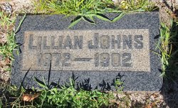
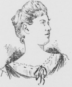
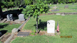
Lillian Antonia “Lillie” Reed Johns
| Birth | : | 1872 Knights Landing, Yolo County, California, USA |
| Death | : | 2 Oct 1902 New York, USA |
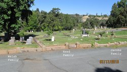
| Burial | : | Mount Pleasant Cemetery, Wales Township, St. Clair County, USA |
| Coordinate | : | 42.9461120, -82.6497760 |
| Plot | : | W 1/2 370-1 |
| Description | : | THE DAY'S DEAD New York, Oct. 2 Mrs. Lillian Johns, daughter of the late Charles F. Reed of California, founder of the Carmencita Ranch on the Sacramento River, died today as the result of an operation. Mrs. Johns was ambitious to become a member of the theatrical profession, and with the consent of her husband, A. C. Johns, was about to appear here with Mrs. LeMoyne's Company. She was a niece of the late Mrs. Paran Stevens. [SF Call, 10-3-1902] Spouse: Arthur Johns ~~~~~~~~~~~~~~~~~~~~~~ Johns-Reed Wedding Cards are out announcing the wedding on Saturday last, at noon, of Miss Lillian Antonia Reed, the youngest daughter... Read More |
frequently asked questions (FAQ):
-
Where is Lillian Antonia “Lillie” Reed Johns's memorial?
Lillian Antonia “Lillie” Reed Johns's memorial is located at: Mount Pleasant Cemetery, Wales Township, St. Clair County, USA.
-
When did Lillian Antonia “Lillie” Reed Johns death?
Lillian Antonia “Lillie” Reed Johns death on 2 Oct 1902 in New York, USA
-
Where are the coordinates of the Lillian Antonia “Lillie” Reed Johns's memorial?
Latitude: 42.9461120
Longitude: -82.6497760
Family Members:
Parent
Siblings
Flowers:
Nearby Cemetories:
1. Mount Pleasant Cemetery
Wales Township, St. Clair County, USA
Coordinate: 42.9461120, -82.6497760
2. Caswell Cemetery
Kimball, St. Clair County, USA
Coordinate: 42.9583015, -82.6072006
3. Wales Center Cemetery
Goodells, St. Clair County, USA
Coordinate: 42.9835380, -82.6553390
4. Lambs Cemetery
Wales Township, St. Clair County, USA
Coordinate: 42.9364400, -82.7080500
5. Williams Cemetery
Smiths Creek, St. Clair County, USA
Coordinate: 42.8986390, -82.6203630
6. Kimball Township Cemetery
Kimball, St. Clair County, USA
Coordinate: 42.9480360, -82.5624700
7. Saint Philip Neri Cemetery
Columbus, St. Clair County, USA
Coordinate: 42.8917809, -82.7109604
8. Mallory Cemetery
Kimball, St. Clair County, USA
Coordinate: 42.9068336, -82.5623627
9. Kenockee Cemetery
Emmett, St. Clair County, USA
Coordinate: 42.9942017, -82.7300034
10. Rattle Run Cemetery
Saint Clair, St. Clair County, USA
Coordinate: 42.8647003, -82.5986023
11. Kinney Cemetery
Wadhams, St. Clair County, USA
Coordinate: 43.0018997, -82.5535965
12. Ruby Cemetery
Ruby, St. Clair County, USA
Coordinate: 43.0377998, -82.5988998
13. Kittridge Cemetery
Columbus, St. Clair County, USA
Coordinate: 42.8382988, -82.6710968
14. Memphis Cemetery
Memphis, Macomb County, USA
Coordinate: 42.8796997, -82.7692032
15. Saint Marys Cemetery
Marysville, St. Clair County, USA
Coordinate: 42.9028015, -82.5113983
16. Smith Blackstock Road Cemetery
Kimball, St. Clair County, USA
Coordinate: 42.9058930, -82.5096090
17. Harrington Cemetery
Port Huron Township, St. Clair County, USA
Coordinate: 43.0030840, -82.4949480
18. Columbus Cemetery
Columbus, St. Clair County, USA
Coordinate: 42.8246994, -82.7014008
19. Woodland Cemetery
Port Huron, St. Clair County, USA
Coordinate: 42.9820000, -82.4790000
20. Spring Hill Cemetery
Avoca, St. Clair County, USA
Coordinate: 43.0780983, -82.6567001
21. Clarkes Cemetery
China Township, St. Clair County, USA
Coordinate: 42.9393300, -82.8333100
22. Lown Cemetery
Riley Center, St. Clair County, USA
Coordinate: 42.9397500, -82.8373590
23. Riverlawn Cemetery
Marysville, St. Clair County, USA
Coordinate: 42.8913994, -82.4764023
24. Bowman Cemetery
Saint Clair, St. Clair County, USA
Coordinate: 42.8469009, -82.5141983

