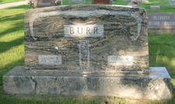
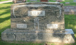
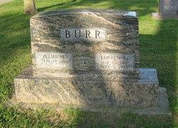
Lillian Beryl Holdeman Burr
| Birth | : | 12 Oct 1889 Lone Tree, Johnson County, Iowa, USA |
| Death | : | 11 Jan 1957 Danville, Hendricks County, Indiana, USA |
| Burial | : | Kamo Cemetery, Kamo, Whangārei District, New Zealand |
| Coordinate | : | -35.6930990, 174.2916260 |
| Plot | : | Sec O/Lot 27/Sp 3 |
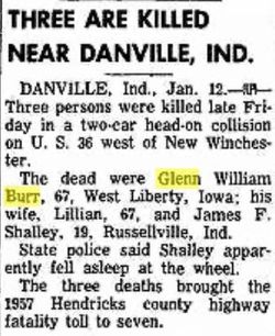
| Description | : | Iowa City Press-Citizen, Saturday, January 12, 1957 WEST LIBERTY--- Mr. and Mrs. Glenn W. Burr, both 67, were killed Friday in a two-car crash near Danville, Ind., as they were enroute to Shelbyville, Ind., to visit a daughter. The couple had lived on a farm six miles west of here in Johnson county on Highway 6 since 1914. Also killed was Franklin Shalley, 19, of Russellville, Ind., driver of the other car involved. Authorities in Indiana reported, according to the Associated Press, that Shalley’s car veered into the path of the Burr auto. It was reported that the Indiana youth, returning from his... Read More |
frequently asked questions (FAQ):
-
Where is Lillian Beryl Holdeman Burr's memorial?
Lillian Beryl Holdeman Burr's memorial is located at: Kamo Cemetery, Kamo, Whangārei District, New Zealand.
-
When did Lillian Beryl Holdeman Burr death?
Lillian Beryl Holdeman Burr death on 11 Jan 1957 in Danville, Hendricks County, Indiana, USA
-
Where are the coordinates of the Lillian Beryl Holdeman Burr's memorial?
Latitude: -35.6930990
Longitude: 174.2916260
Family Members:
Parent
Spouse
Siblings
Children
Flowers:
Nearby Cemetories:
1. Kamo Cemetery
Kamo, Whangārei District, New Zealand
Coordinate: -35.6930990, 174.2916260
2. Mission Ground Cemetery
Whangārei, Whangārei District, New Zealand
Coordinate: -35.7214700, 174.3131100
3. St. James the Apostle Anglican Church Cemetery
Whangārei, Whangārei District, New Zealand
Coordinate: -35.6752000, 174.2569000
4. Whangarei Falls
Tikipunga, Whangārei District, New Zealand
Coordinate: -35.6848452, 174.3362929
5. Whangarei District War Memorial
Whangārei District, New Zealand
Coordinate: -35.7223173, 174.3205943
6. Kaurihohore Cemetery
Whangārei, Whangārei District, New Zealand
Coordinate: -35.6446720, 174.2902210
7. Clarke Family Cemetery
Whangārei, Whangārei District, New Zealand
Coordinate: -35.7426112, 174.2721330
8. Clotworthy Cemetery
Whangārei District, New Zealand
Coordinate: -35.7100000, 174.3590000
9. Maunu Cemetery
Whangārei, Whangārei District, New Zealand
Coordinate: -35.7444100, 174.2573200
10. Whareora Cemetery
Whangārei, Whangārei District, New Zealand
Coordinate: -35.6974100, 174.3862100
11. Onerahi Cemetery
Whangārei, Whangārei District, New Zealand
Coordinate: -35.7582100, 174.3680640
12. Pakikaikutu Māori Cemetery
Onerahi, Whangārei District, New Zealand
Coordinate: -35.7676200, 174.4064100
13. Mangere Falls
Kokopu, Whangārei District, New Zealand
Coordinate: -35.7001952, 174.1390070
14. Otonga Cemetery
Whangārei, Whangārei District, New Zealand
Coordinate: -35.5591600, 174.2949700
15. Marua Cemetery
Whangārei, Whangārei District, New Zealand
Coordinate: -35.5662240, 174.3677990
16. Mangapai Cemetery
Mangapai, Whangārei District, New Zealand
Coordinate: -35.8435970, 174.2871730
17. Takahiwai Marae Cemetery
Takahiwai, Whangārei District, New Zealand
Coordinate: -35.8379230, 174.4204920
18. Hukerenui Cemetery
Whangārei, Whangārei District, New Zealand
Coordinate: -35.5210700, 174.2010900
19. Ngunguru Cemetery
Ngunguru, Whangārei District, New Zealand
Coordinate: -35.6240680, 174.5100340
20. Whananaki Cemetery
Whananaki South, Whangārei District, New Zealand
Coordinate: -35.5283320, 174.4606700
21. Tau Henare Marae Urupā
Whangārei District, New Zealand
Coordinate: -35.6198870, 174.0192130
22. Tau Henare Marae Urupā
Whangārei District, New Zealand
Coordinate: -35.6198870, 174.0192130
23. Towai Cemetery
Towai, Far North District, New Zealand
Coordinate: -35.4990330, 174.1259310
24. Pipiwai Cemetery
Whangārei District, New Zealand
Coordinate: -35.6227520, 174.0127010


