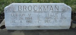
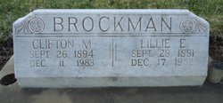
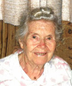
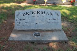
Lillie Ettie Traeger Brockman
| Birth | : | 28 Sep 1891 |
| Death | : | 17 Dec 1952 Butte County, California, USA |
| Burial | : | Oak Grove Cemetery, Grand Rapids, Kent County, USA |
| Coordinate | : | 42.9136009, -85.6314011 |
| Plot | : | Sec 32 Lot 3663 sp 1 |
| Description | : | Birth and death dates and locations from California Death Index Records. 61-year-old Lillie Etta Brockman was interred, per the Chico Cemetery Association Records, in the plot noted, on December 20, 1952. |
frequently asked questions (FAQ):
-
Where is Lillie Ettie Traeger Brockman's memorial?
Lillie Ettie Traeger Brockman's memorial is located at: Oak Grove Cemetery, Grand Rapids, Kent County, USA.
-
When did Lillie Ettie Traeger Brockman death?
Lillie Ettie Traeger Brockman death on 17 Dec 1952 in Butte County, California, USA
-
Where are the coordinates of the Lillie Ettie Traeger Brockman's memorial?
Latitude: 42.9136009
Longitude: -85.6314011
Family Members:
Parent
Spouse
Siblings
Children
Flowers:
Nearby Cemetories:
1. Oak Grove Cemetery
Grand Rapids, Kent County, USA
Coordinate: 42.9136009, -85.6314011
2. Woodlawn Cemetery
Grand Rapids, Kent County, USA
Coordinate: 42.9160995, -85.6303024
3. Garfield Park Cemetery
Grand Rapids, Kent County, USA
Coordinate: 42.9221992, -85.6307983
4. Maple Grove Cemetery
Kentwood, Kent County, USA
Coordinate: 42.9033300, -85.6203400
5. Rest Lawn Memorial Park
Grand Rapids, Kent County, USA
Coordinate: 42.9007988, -85.6438980
6. Grace Episcopal Church Columbarium
Grand Rapids, Kent County, USA
Coordinate: 42.9413390, -85.6242730
7. Oakhill Cemetery
Grand Rapids, Kent County, USA
Coordinate: 42.9411011, -85.6517029
8. Saint Andrews Catholic Cemetery
Grand Rapids, Kent County, USA
Coordinate: 42.9463997, -85.6567001
9. Resurrection Cemetery
Wyoming, Kent County, USA
Coordinate: 42.8905983, -85.6819000
10. Pine Hill Cemetery
Kentwood, Kent County, USA
Coordinate: 42.8675003, -85.6363983
11. Fulton Street Cemetery
Grand Rapids, Kent County, USA
Coordinate: 42.9639200, -85.6486400
12. Central Reformed Church Crypt
Grand Rapids, Kent County, USA
Coordinate: 42.9634410, -85.6563430
13. Westminster Presbyterian Church Columbarium
Grand Rapids, Kent County, USA
Coordinate: 42.9619070, -85.6646760
14. First United Methodist Church Columbarium
Grand Rapids, Kent County, USA
Coordinate: 42.9634200, -85.6633300
15. Holy Trinity Columbarium
Wyoming, Kent County, USA
Coordinate: 42.8669010, -85.6847490
16. Martin Cemetery
Grand Rapids, Kent County, USA
Coordinate: 42.9458008, -85.5607986
17. Graceland Memorial Park and Mausoleum
Grand Rapids, Kent County, USA
Coordinate: 42.9481010, -85.5618973
18. Chapel Hill Memorial Gardens
Cascade Township, Kent County, USA
Coordinate: 42.9089012, -85.5464020
19. Gerald R Ford Museum
Grand Rapids, Kent County, USA
Coordinate: 42.9668140, -85.6771000
20. Teeple Cemetery (Defunct)
Cascade Township, Kent County, USA
Coordinate: 42.9134300, -85.5357790
21. Blain Cemetery
Cutlerville, Kent County, USA
Coordinate: 42.8414001, -85.6335983
22. Frederik Meijer Gardens and Sculpture Park
Grand Rapids, Kent County, USA
Coordinate: 42.9794880, -85.5897510
23. Dutton Cemetery
Dutton, Kent County, USA
Coordinate: 42.8366670, -85.5841670
24. Fairplains Cemetery
Grand Rapids, Kent County, USA
Coordinate: 43.0005989, -85.6421967


