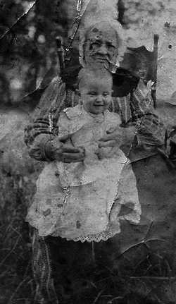
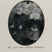
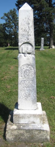
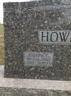
Lodema Kathrina Kinsley Howery
| Birth | : | 17 Jan 1813 Rochester, Monroe County, New York, USA |
| Death | : | 8 Jun 1910 La Porte City, Black Hawk County, Iowa, USA |
| Burial | : | Emo Municipal Cemetery, Emo, Rainy River District, Canada |
| Coordinate | : | 48.6425790, -93.8286800 |
| Description | : | WATERLOO REPORTER Friday, June 10, 1910 OLD AGE CLAIMS DUE GRANDMA HOWREY PASSES AWAY AFTER NEAR CENTURY OF ACTIVE LIFE Probably Oldest Person in Blackhawk County, Being Ninety-Eight years old. La Porte City Progress: The oldest person in Spring Creek township and probably in Black Hawk county was Mrs. L. Howrey, mother of Calvan Howrey, who passed away Wednesday afternoon about 3:00 o'clock, death being due to no particular ailment, only old age claiming its due. Until about a month ago her health was good and with her bright mind and clear memory she has reviewed incidents of her long and eventful life, which it... Read More |
frequently asked questions (FAQ):
-
Where is Lodema Kathrina Kinsley Howery's memorial?
Lodema Kathrina Kinsley Howery's memorial is located at: Emo Municipal Cemetery, Emo, Rainy River District, Canada.
-
When did Lodema Kathrina Kinsley Howery death?
Lodema Kathrina Kinsley Howery death on 8 Jun 1910 in La Porte City, Black Hawk County, Iowa, USA
-
Where are the coordinates of the Lodema Kathrina Kinsley Howery's memorial?
Latitude: 48.6425790
Longitude: -93.8286800
Family Members:
Spouse
Children
Flowers:
Nearby Cemetories:
1. Emo Municipal Cemetery
Emo, Rainy River District, Canada
Coordinate: 48.6425790, -93.8286800
2. Indus Cemetery
Indus, Koochiching County, USA
Coordinate: 48.6253610, -93.8428090
3. Burriss Municipal Cemetery
Burriss, Rainy River District, Canada
Coordinate: 48.6780400, -93.6887900
4. Chapple Cemetery
Barwick, Rainy River District, Canada
Coordinate: 48.6862320, -93.9848570
5. Pineview Cemetery
Chapple, Rainy River District, Canada
Coordinate: 48.6629260, -94.0060510
6. Pineview Conservative Mennonite Church Cemetery
Barwick, Rainy River District, Canada
Coordinate: 48.6632100, -94.0060700
7. Riverside Cemetery
Loman, Koochiching County, USA
Coordinate: 48.5217018, -93.8118973
8. Box Alder Cemetery
Devlin, Rainy River District, Canada
Coordinate: 48.5538090, -93.6734040
9. Riverview Cemetery
Littlefork, Koochiching County, USA
Coordinate: 48.4766998, -93.7358017
10. Shenston Presbyterian Cemetery
Shenston, Rainy River District, Canada
Coordinate: 48.7222730, -94.0851720
11. Birchdale Cemetery
Koochiching County, USA
Coordinate: 48.6268997, -94.1224976
12. Immaculate Conception Roman Catholic Church
Stratton, Rainy River District, Canada
Coordinate: 48.6776996, -94.1629629
13. Lindford Cemetery
Littlefork, Koochiching County, USA
Coordinate: 48.4106100, -93.7862900
14. Holy Cross Cemetery
Fort Frances, Rainy River District, Canada
Coordinate: 48.5998800, -93.4373500
15. Riverview Cemetery
Fort Frances, Rainy River District, Canada
Coordinate: 48.5993500, -93.4370000
16. Faith United Church of Christ Columbarium
International Falls, Koochiching County, USA
Coordinate: 48.6002900, -93.4144500
17. Fort Frances Cemetery
Fort Frances, Rainy River District, Canada
Coordinate: 48.6114100, -93.4090200
18. Saint Mary's Cemetery
Fort Frances, Rainy River District, Canada
Coordinate: 48.6113380, -93.4089920
19. American Legion Cemetery
International Falls, Koochiching County, USA
Coordinate: 48.5774600, -93.3863300
20. Oakley Cemetery
Littlefork, Koochiching County, USA
Coordinate: 48.4057999, -93.5503006
21. Forest Hill Cemetery
International Falls, Koochiching County, USA
Coordinate: 48.5778800, -93.3835800
22. Saint Thomas Cemetery
International Falls, Koochiching County, USA
Coordinate: 48.5778200, -93.3802500
23. Riverdale Cemetery
Border, Koochiching County, USA
Coordinate: 48.6996994, -94.2818985
24. Our Lady of Lourdes Cemetery
Fort Frances, Rainy River District, Canada
Coordinate: 48.6310200, -93.3592400


