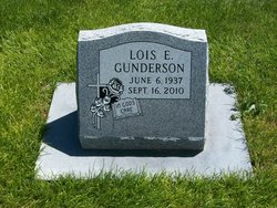
Lois Elaine Krohn Gunderson
| Birth | : | 6 Jun 1937 Nebraska, USA |
| Death | : | 16 Sep 2010 Hebron, Thayer County, Nebraska, USA |
| Burial | : | Mount Hope Cemetery, High Bridge, Ashland County, USA |
| Coordinate | : | 46.3859700, -90.7353300 |
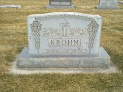
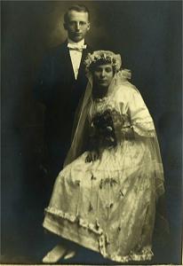
| Description | : | Lois Gunderson, 73, of Hebron, Nebraska and a former Sidney and Bridgeport resident died Thursday evening, September 16, 2010 at the Blue Valley Lutheran Care Home in Hebron. Lois Elaine Gunderson, the daughter the Rev. Dr. Henry F. and Augusta E. (Siegert) Krohn, was born June 6, 1937 in central Nebraska. After graduating from high school she attended college at Winfield, Kansas where she studied business. On November 9, 1962 she married Marion L. Gunderson. They later divorced. Survivors include her sons: Bryan and wife Dawn Gunderson of Muscatine, IA and David Gunderson of Minden, NE; a grandson Jeremy Gunderson;... Read More |
frequently asked questions (FAQ):
-
Where is Lois Elaine Krohn Gunderson's memorial?
Lois Elaine Krohn Gunderson's memorial is located at: Mount Hope Cemetery, High Bridge, Ashland County, USA.
-
When did Lois Elaine Krohn Gunderson death?
Lois Elaine Krohn Gunderson death on 16 Sep 2010 in Hebron, Thayer County, Nebraska, USA
-
Where are the coordinates of the Lois Elaine Krohn Gunderson's memorial?
Latitude: 46.3859700
Longitude: -90.7353300
Family Members:
Parent
Spouse
Siblings
Flowers:
Nearby Cemetories:
1. Mellen Union Cemetery
Mellen, Ashland County, USA
Coordinate: 46.3294800, -90.6621800
2. Maple Grove Cemetery
Marengo, Ashland County, USA
Coordinate: 46.3852997, -90.8606033
3. Old Apostolic Lutheran Cemetery
Marengo, Ashland County, USA
Coordinate: 46.4408640, -90.8473530
4. Saint Johns Lutheran Cemetery
Mellen, Ashland County, USA
Coordinate: 46.3923800, -90.5690100
5. Saint Anne Catholic Cemetery
Sanborn, Ashland County, USA
Coordinate: 46.4294281, -90.9071426
6. Cayuga Union Cemetery
Cayuga, Ashland County, USA
Coordinate: 46.2522011, -90.6802979
7. Moe Cemetery
Mason, Bayfield County, USA
Coordinate: 46.3789200, -90.9498900
8. Birch Lake Cemetery
Mason, Bayfield County, USA
Coordinate: 46.3569603, -90.9666595
9. Greenwood Cemetery
Morse, Ashland County, USA
Coordinate: 46.2224846, -90.6509399
10. Moland Lutheran Church Cemetery
Mason, Bayfield County, USA
Coordinate: 46.4131012, -90.9897995
11. Edgewood Cemetery
Gurney, Iron County, USA
Coordinate: 46.4972000, -90.5077972
12. Mount Hope Cemetery
Ashland, Ashland County, USA
Coordinate: 46.5621986, -90.9039001
13. Saint Agnes Cemetery
Ashland, Ashland County, USA
Coordinate: 46.5614014, -90.9075012
14. B'Nai Israel Cemetery
Ashland, Ashland County, USA
Coordinate: 46.5600014, -90.9116974
15. Bad River Cemetery
Odanah, Ashland County, USA
Coordinate: 46.5992100, -90.7208900
16. Greenwood Cemetery
Upson, Iron County, USA
Coordinate: 46.3778000, -90.4094009
17. Calvary Cemetery
Upson, Iron County, USA
Coordinate: 46.3774986, -90.4080963
18. Mason Cemetery
Mason, Bayfield County, USA
Coordinate: 46.4401800, -91.0555800
19. Lake View Cemetery
Saxon, Iron County, USA
Coordinate: 46.5010986, -90.4227982
20. Clam Lake Cemetery
Clam Lake, Ashland County, USA
Coordinate: 46.1664009, -90.9058990
21. Grand View Cemetery
Grand View, Bayfield County, USA
Coordinate: 46.3650017, -91.1091003
22. Benoit Cemetery
Benoit, Bayfield County, USA
Coordinate: 46.5026016, -91.0794983
23. Mount Hope Cemetery
Glidden, Ashland County, USA
Coordinate: 46.1431800, -90.5717200
24. Most Precious Blood Cemetery
Glidden, Ashland County, USA
Coordinate: 46.1395226, -90.5726700

