

Lois Gay Sigler Lester
| Birth | : | 9 Sep 1948 Iola, Allen County, Kansas, USA |
| Death | : | 25 Sep 2014 Neosho County, Kansas, USA |
| Burial | : | Fairview Cemetery, Mildred, Allen County, USA |
| Coordinate | : | 38.0238020, -95.1401740 |
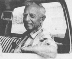
| Description | : | Lois G. Lester (September 9, 1948 - September 25, 2014) Lois Gay Lester, 66, of rural Erie, Kansas, passed away on Thursday, Sept. 25, 2014, surrounded by her family at home. Lois was born Sept. 9, 1948, in Iola, Kansas, the daughter of Dale and Donna (Clay) Sigler. She grew up in Iola, graduating from Iola High School in 1966. On Oct. 7, 1966, Lois married Jerry L. Lester in Wichita, Kansas. They made their home in Iola, Chanute and Sedan before settling in the country west of Stark. Lois was a homemaker with a passion for genealogy. She... Read More |
frequently asked questions (FAQ):
-
Where is Lois Gay Sigler Lester's memorial?
Lois Gay Sigler Lester's memorial is located at: Fairview Cemetery, Mildred, Allen County, USA.
-
When did Lois Gay Sigler Lester death?
Lois Gay Sigler Lester death on 25 Sep 2014 in Neosho County, Kansas, USA
-
Where are the coordinates of the Lois Gay Sigler Lester's memorial?
Latitude: 38.0238020
Longitude: -95.1401740
Family Members:
Parent

Flowers:


Nearby Cemetories:
1. Fairview Cemetery
Mildred, Allen County, USA
Coordinate: 38.0238020, -95.1401740
2. Osage Valley Cemetery
Mildred, Allen County, USA
Coordinate: 38.0313988, -95.0969009
3. Stanley Cemetery
Bayard, Allen County, USA
Coordinate: 37.9944200, -95.0970400
4. Gillham Cemetery
Allen County, USA
Coordinate: 37.9795100, -95.1103500
5. Kincaid Cemetery
Kincaid, Anderson County, USA
Coordinate: 38.0917015, -95.1513977
6. Mount Zion Cemetery
Kincaid, Anderson County, USA
Coordinate: 38.1046982, -95.1864014
7. Boulware Cemetery
Mapleton, Bourbon County, USA
Coordinate: 38.0264600, -95.0245400
8. Old Blue Mound Cemetery
Blue Mound, Linn County, USA
Coordinate: 38.0636600, -95.0249000
9. Entswood Cemetery
Bronson, Bourbon County, USA
Coordinate: 37.9431480, -95.0603200
10. Lone Elm Cemetery
Lone Elm, Anderson County, USA
Coordinate: 38.0882988, -95.2422028
11. Anderson Cemetery #1
Xenia, Bourbon County, USA
Coordinate: 37.9907700, -95.0025000
12. Pleasant View Cemetery
Blue Mound, Linn County, USA
Coordinate: 38.0952988, -95.0175018
13. Sunny Slope Cemetery
Blue Mound, Linn County, USA
Coordinate: 38.0952988, -95.0149994
14. Stevenson Cemetery
Mapleton, Bourbon County, USA
Coordinate: 38.0210991, -94.9847031
15. Moran Cemetery
Moran, Allen County, USA
Coordinate: 37.9068985, -95.1892014
16. Ozark Cemetery #1
Anderson County, USA
Coordinate: 38.0424200, -95.2992300
17. Bronson Cemetery
Bronson, Bourbon County, USA
Coordinate: 37.8997100, -95.0792500
18. Pleasant Valley Cemetery
Allen County, USA
Coordinate: 38.0093994, -95.3328018
19. Oakwood Cemetery
Centerville, Linn County, USA
Coordinate: 38.1605988, -95.0391998
20. Golden Valley Cemetery
Allen County, USA
Coordinate: 37.8792572, -95.2235718
21. Pleasant View Cemetery
Bronson, Bourbon County, USA
Coordinate: 37.8996900, -95.0040500
22. Northway Cemetery
Mapleton, Bourbon County, USA
Coordinate: 37.9935989, -94.9321976
23. Sugar Valley Cemetery
Anderson County, USA
Coordinate: 38.1903300, -95.1130200
24. La Harpe Cemetery
La Harpe, Allen County, USA
Coordinate: 37.9067001, -95.3022003