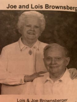
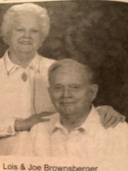
Lois L. Muchmore Brownsberger
| Birth | : | 15 Sep 1923 Appleton City, St. Clair County, Missouri, USA |
| Death | : | 27 Sep 2018 Lowry City, St. Clair County, Missouri, USA |
| Burial | : | Appleton City Cemetery, Appleton City, St. Clair County, USA |
| Coordinate | : | 38.1747017, -94.0235977 |
| Plot | : | Ward 8, Lot 28 |
| Description | : | Lois L. Brownsberger, age 95, of Clinton, passed away Thursday, September 27, 2018 at Truman Lake Manor, Lowry City, MO. Lois was born September 15, 1923 to Archie L. and Lura 'Piepmeier' Muchmore of Appleton, City, MO. After high school she attended Central Missouri State College, now University of Central Missouri, where she received her Bachelor's Degree in Education. Lois married Joseph Henry Brownsberger on March 8, 1945 in New York City, New York while Joe was in the Navy during WWII. In 1946, they returned to Appleton City where together they owned and operated a retail clothing business... Read More |
frequently asked questions (FAQ):
-
Where is Lois L. Muchmore Brownsberger's memorial?
Lois L. Muchmore Brownsberger's memorial is located at: Appleton City Cemetery, Appleton City, St. Clair County, USA.
-
When did Lois L. Muchmore Brownsberger death?
Lois L. Muchmore Brownsberger death on 27 Sep 2018 in Lowry City, St. Clair County, Missouri, USA
-
Where are the coordinates of the Lois L. Muchmore Brownsberger's memorial?
Latitude: 38.1747017
Longitude: -94.0235977
Family Members:
Flowers:
Nearby Cemetories:
1. Appleton City Cemetery
Appleton City, St. Clair County, USA
Coordinate: 38.1747017, -94.0235977
2. Fennewald Cemetery
Appleton City, St. Clair County, USA
Coordinate: 38.2080994, -94.0271988
3. Spring Grove Cemetery
St. Clair County, USA
Coordinate: 38.1250000, -94.0066986
4. Ridgeway Cemetery
St. Clair County, USA
Coordinate: 38.1114006, -93.9931030
5. Meyers Cemetery
Rockville, Bates County, USA
Coordinate: 38.1193650, -94.0815930
6. Montrose Mound Cemetery
Montrose, Henry County, USA
Coordinate: 38.2406150, -93.9805380
7. Blackwell Cemetery
Bates County, USA
Coordinate: 38.1810989, -94.1183014
8. Montrose Cemetery
Montrose, Henry County, USA
Coordinate: 38.2569008, -94.0038986
9. Round Prairie Cemetery
Bates County, USA
Coordinate: 38.1380997, -94.1247025
10. Daller Cemetery
St. Clair County, USA
Coordinate: 38.0988998, -93.9664001
11. Snodgrass Union Cemetery
Bates County, USA
Coordinate: 38.2583008, -94.0761032
12. Ditty Cemetery
St. Clair County, USA
Coordinate: 38.0908012, -93.9664001
13. Saint Mary's Cemetery
Montrose, Henry County, USA
Coordinate: 38.2705320, -93.9932730
14. Myers Cemetery
Hudson, Bates County, USA
Coordinate: 38.2050018, -94.1519012
15. Bean Cemetery
Appleton City, St. Clair County, USA
Coordinate: 38.0960999, -93.9325027
16. Dickison Cemetery
Bates County, USA
Coordinate: 38.2641300, -94.1032650
17. Short Cemetery
St. Clair County, USA
Coordinate: 38.0797005, -93.9464035
18. Rockville Cemetery
Rockville, Bates County, USA
Coordinate: 38.0647011, -94.0663986
19. Harmony Church Cemetery
St. Clair County, USA
Coordinate: 38.1249199, -93.8898163
20. Saint Ludger's Cemetery
Germantown, Henry County, USA
Coordinate: 38.2930450, -94.0252380
21. Westfield Cemetery
St. Clair County, USA
Coordinate: 38.1707993, -93.8677979
22. Teays Chapel Cemetery
Deepwater, Henry County, USA
Coordinate: 38.2188200, -93.8753280
23. Dewees Cemetery
Pleasant Gap, Bates County, USA
Coordinate: 38.1803770, -94.1858160
24. Vickers Cemetery
Montrose, Henry County, USA
Coordinate: 38.2921982, -93.9518967


