

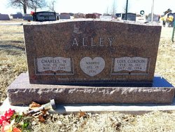
Lois O. Cordon Alley
| Birth | : | 22 Feb 1912 |
| Death | : | 20 Oct 1984 Topeka, Shawnee County, Kansas, USA |
| Burial | : | Onida Cemetery, Onida, Sully County, USA |
| Coordinate | : | 44.7147000, -100.0650000 |
| Plot | : | Section K |
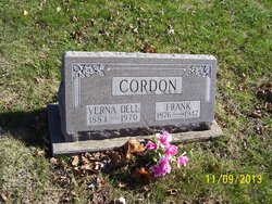
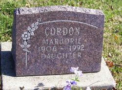
| Description | : | Mrs. Lois O. Alley Services will be at 10 a.m. Tuesday at Mercer Funeral Home, Holton for Mrs. Lois O. Alley, 72, Frankfort. She died late Saturday, Oct. 20, at a Topeka hospital. She formerly taught school five years. Mrs. Alley was born Feb. 22, 1912, the daughter of Frank and Verna B. Keller Cordon. She was graduated from Bancroft High School at Bancroft, and attended Kansas State College at Manhattan two years. She moved to Frankfort five years ago from Holton, where she had lived the previous 11 years. She was a member of Winifred Baptist Church near Frankfort. She was married to Charles... Read More |
frequently asked questions (FAQ):
-
Where is Lois O. Cordon Alley's memorial?
Lois O. Cordon Alley's memorial is located at: Onida Cemetery, Onida, Sully County, USA.
-
When did Lois O. Cordon Alley death?
Lois O. Cordon Alley death on 20 Oct 1984 in Topeka, Shawnee County, Kansas, USA
-
Where are the coordinates of the Lois O. Cordon Alley's memorial?
Latitude: 44.7147000
Longitude: -100.0650000
Family Members:
Parent

Spouse
Siblings
Children

Flowers:


Nearby Cemetories:
1. Onida Cemetery
Onida, Sully County, USA
Coordinate: 44.7147000, -100.0650000
2. Holy Rosary Cemetery
Agar, Sully County, USA
Coordinate: 44.8380000, -100.0616000
3. Schreiber Cemetery
Agar, Sully County, USA
Coordinate: 44.8821983, -100.1196976
4. Pleasant Hill Cemetery
Blunt, Hughes County, USA
Coordinate: 44.5135994, -100.0156021
5. Pleasant Cemetery
Sully County, USA
Coordinate: 44.6927986, -99.7568970
6. Okobojo Cemetery
Sully County, USA
Coordinate: 44.6568985, -100.3647003
7. Byron Township Cemetery
Blunt, Hughes County, USA
Coordinate: 44.4979200, -100.1904700
8. Blair Cemetery
Sully County, USA
Coordinate: 44.8027992, -100.4199982
9. Petro Family Cemetery
Gettysburg, Potter County, USA
Coordinate: 44.9706825, -100.2259903
10. Sacred Heart Cemetery
Gettysburg, Potter County, USA
Coordinate: 44.9982986, -99.9377975
11. Medicine Hill Cemetery
Harrold, Hughes County, USA
Coordinate: 44.5116997, -99.7453003
12. Copp Cemetery
Potter County, USA
Coordinate: 44.9118935, -99.7358236
13. Saint John Catholic Cemetery
Harrold, Hughes County, USA
Coordinate: 44.5127983, -99.7335968
14. Gettysburg Memorial Cemetery
Gettysburg Township, Potter County, USA
Coordinate: 45.0208146, -99.9898400
15. Canning Cemetery
Hughes County, USA
Coordinate: 44.3986890, -100.0278460
16. Gettysburg Cemetery
Gettysburg, Potter County, USA
Coordinate: 45.0149994, -99.9199982
17. Forest City Cemetery (Defunct)
Forest City, Potter County, USA
Coordinate: 45.0239900, -100.2667000
18. Mount Calvary Cemetery
Pierre, Hughes County, USA
Coordinate: 44.4197006, -100.3557968
19. Spring Lake Cemetery
Hyde County, USA
Coordinate: 44.7942009, -99.5610962
20. Riverside Cemetery
Pierre, Hughes County, USA
Coordinate: 44.3608017, -100.3071976
21. Scotty Philip Cemetery
Fort Pierre, Stanley County, USA
Coordinate: 44.4019012, -100.4036026
22. Fort Pierre Chouteau Cemetery
Fort Pierre, Stanley County, USA
Coordinate: 44.3908700, -100.3878300
23. South Dakota State Capitol Grounds
Pierre, Hughes County, USA
Coordinate: 44.3660100, -100.3448000
24. Lebanon Cemetery
Lebanon, Potter County, USA
Coordinate: 45.0635500, -99.7768400