| Birth | : | 31 May 1908 Nebraska, USA |
| Death | : | 18 Sep 1917 Nebraska, USA |
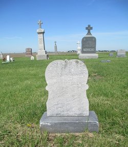
| Burial | : | Saint Anthony Cemetery, Cedar Rapids, Boone County, USA |
| Coordinate | : | 41.5607986, -98.1616974 |
| Description | : | Daughter of Henry and Mary (Rutten) Vanderloop. ``````````` Cedar Rapids Outlook (Cedar Rapids, Nebr.), September 20, 1917, p. 5, col. 3 DIED Loretta, the nine year old child of Mr. and Mrs. Henry Vanderloop died Wednesday morning about five o'clock. The child had been in failing health for several weeks and recently was operated on for peritonitis. She gradually weakened until life was extinct. The funeral will be held tomorrow morning at the St. Anthony church. |
frequently asked questions (FAQ):
-
Where is Loretta Helen Mary Vanderloop's memorial?
Loretta Helen Mary Vanderloop's memorial is located at: Saint Anthony Cemetery, Cedar Rapids, Boone County, USA.
-
When did Loretta Helen Mary Vanderloop death?
Loretta Helen Mary Vanderloop death on 18 Sep 1917 in Nebraska, USA
-
Where are the coordinates of the Loretta Helen Mary Vanderloop's memorial?
Latitude: 41.5607986
Longitude: -98.1616974
Family Members:
Parent
Siblings
Flowers:
Nearby Cemetories:
1. Saint Anthony Cemetery
Cedar Rapids, Boone County, USA
Coordinate: 41.5607986, -98.1616974
2. Sunset Cemetery
Cedar Rapids, Boone County, USA
Coordinate: 41.5611000, -98.1605988
3. Sunrise Cemetery
Cedar Rapids, Boone County, USA
Coordinate: 41.5760994, -98.1278000
4. Enfield Cemetery
Boone County, USA
Coordinate: 41.5391998, -98.2782974
5. Dublin Cemetery
Primrose, Boone County, USA
Coordinate: 41.6463000, -98.2529900
6. Saint Marys Catholic Cemetery
Primrose, Boone County, USA
Coordinate: 41.6465900, -98.2532600
7. Main Cemetery
Belgrade, Nance County, USA
Coordinate: 41.4947014, -98.0425034
8. Redwing Cemetery
Nance County, USA
Coordinate: 41.4446983, -98.1369019
9. Peace Lutheran Cemetery
Belgrade, Nance County, USA
Coordinate: 41.4306984, -98.1434021
10. Naomi Cemetery
Saint Edward, Boone County, USA
Coordinate: 41.5245200, -97.9907000
11. Dennison Cemetery
Albion, Boone County, USA
Coordinate: 41.7182999, -98.1753006
12. Rose Hill Cemetery
Albion, Boone County, USA
Coordinate: 41.6762000, -98.0003900
13. Boone Cemetery
Boone County, USA
Coordinate: 41.6272011, -97.9332962
14. Saint Michael's Cemetery
Spalding, Greeley County, USA
Coordinate: 41.6674995, -98.3675003
15. Saint Michael's Cemetery
Albion, Boone County, USA
Coordinate: 41.6991997, -97.9764023
16. Bonanza-Akron Cemetery
Boone County, USA
Coordinate: 41.7482986, -98.2478027
17. Grand View Cemetery
Spalding, Greeley County, USA
Coordinate: 41.6974983, -98.3593979
18. Calvary Cemetery
Spalding, Greeley County, USA
Coordinate: 41.6958008, -98.3617020
19. Skeedee Cemetery
Nance County, USA
Coordinate: 41.5038986, -97.8850021
20. East O'Connor Cemetery
O'Connor, Greeley County, USA
Coordinate: 41.5106000, -98.4638000
21. Nance County Rural Grave Site
Fullerton, Nance County, USA
Coordinate: 41.3369000, -98.0790000
22. O'Connor Cemetery
O'Connor, Greeley County, USA
Coordinate: 41.5101128, -98.4654999
23. Hillside Cemetery
Wolbach, Greeley County, USA
Coordinate: 41.4005089, -98.3921356
24. Saint Edward Catholic Cemetery
Saint Edward, Boone County, USA
Coordinate: 41.5684800, -97.8424800


