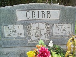
Lottie Elizabeth Milligan Cribb
| Birth | : | 4 Jul 1922 Horry County, South Carolina, USA |
| Death | : | 21 Apr 2001 Georgetown County, South Carolina, USA |
| Burial | : | Templestowe Cemetery and Memorial Gardens, Templestowe, Manningham City, Australia |
| Coordinate | : | -37.7594730, 145.1418370 |
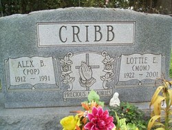
| Inscription | : | Precious Memories Mom |
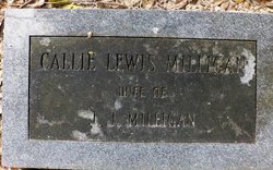
| Description | : | Lottie M. Cribb Lottie Elizabeth Milligan Cribb, 78, of Georgetown, died Saturday, April 21, 2001, at the home of her daughter. Funeral services will be held Monday, April 23, 2001, at 2 p.m. in Ringle Heights Baptist Church. Officiating will be the Rev. Mark Nelson and the Rev. Willie Lowrimore. Burial, under the direction of Graham Funeral Home, will follow in Elmwood Cemetery. Mrs. Cribb was born July 4, 1922, in Horry County, a daughter of the late Jack Milligan and Callie Lewis Milligan. She was employed with Midway Nursery and was a member of Ringle Heights Baptist Church. Surviving are four sons, Billy... Read More |
frequently asked questions (FAQ):
-
Where is Lottie Elizabeth Milligan Cribb's memorial?
Lottie Elizabeth Milligan Cribb's memorial is located at: Templestowe Cemetery and Memorial Gardens, Templestowe, Manningham City, Australia.
-
When did Lottie Elizabeth Milligan Cribb death?
Lottie Elizabeth Milligan Cribb death on 21 Apr 2001 in Georgetown County, South Carolina, USA
-
Where are the coordinates of the Lottie Elizabeth Milligan Cribb's memorial?
Latitude: -37.7594730
Longitude: 145.1418370
Family Members:
Parent
Spouse
Siblings
Children
Flowers:
Nearby Cemetories:
1. Templestowe Cemetery and Memorial Gardens
Templestowe, Manningham City, Australia
Coordinate: -37.7594730, 145.1418370
2. Waldau Cemetery
Doncaster East, Manningham City, Australia
Coordinate: -37.7776130, 145.1455570
3. Eltham Cemetery
Eltham, Nillumbik Shire, Australia
Coordinate: -37.7266370, 145.1504720
4. Andersons Creek Cemetery
Warrandyte, Manningham City, Australia
Coordinate: -37.7463170, 145.2130940
5. Heidelberg Old Cemetery
Heidelberg, Banyule City, Australia
Coordinate: -37.7479500, 145.0656200
6. Box Hill Cemetery
Box Hill, Whitehorse City, Australia
Coordinate: -37.8236980, 145.1346290
7. Warringal Cemetery
Heidelberg, Banyule City, Australia
Coordinate: -37.7524048, 145.0586967
8. St Paschal Friary Cemetery
Box Hill, Whitehorse City, Australia
Coordinate: -37.8255280, 145.1327820
9. Greensborough Cemetery
Greensborough, Banyule City, Australia
Coordinate: -37.7004060, 145.1006880
10. St Katherine's Cemetery
Saint Helena, Banyule City, Australia
Coordinate: -37.6924510, 145.1288510
11. Plenty River Pioneer Children's Cemetery
Greensborough, Banyule City, Australia
Coordinate: -37.6876217, 145.1168695
12. Diamond Creek Cemetery
Diamond Creek, Nillumbik Shire, Australia
Coordinate: -37.6758770, 145.1465020
13. St. Paul's Anglican Memorial Lawn
Ringwood, Maroondah City, Australia
Coordinate: -37.8103347, 145.2311387
14. Preston General Cemetery
Bundoora, Banyule City, Australia
Coordinate: -37.7201480, 145.0405825
15. Our Lady of Perpetual Help Catholic Memorial Wall
Ringwood, Maroondah City, Australia
Coordinate: -37.8158091, 145.2322232
16. Boroondara General Cemetery
Kew, Boroondara City, Australia
Coordinate: -37.8036300, 145.0396300
17. Burwood Cemetery
Burwood, Whitehorse City, Australia
Coordinate: -37.8524906, 145.1005747
18. Northcote Cemetery
Northcote, Darebin City, Australia
Coordinate: -37.7697770, 145.0063030
19. Kangaroo Ground Cemetery
Kangaroo Ground, Nillumbik Shire, Australia
Coordinate: -37.6818430, 145.2368440
20. Yarra Bend Lunatic Asylum Cemetery
Fairfield, Darebin City, Australia
Coordinate: -37.7983900, 145.0113330
21. Christ Church Grounds
Hawthorn, Boroondara City, Australia
Coordinate: -37.8189650, 145.0182680
22. St. Oswald's Church Columbarium
Glen Iris, Stonnington City, Australia
Coordinate: -37.8624400, 145.0708230
23. Hurstbridge Cemetery
Hurstbridge, Nillumbik Shire, Australia
Coordinate: -37.6500015, 145.2166595
24. Coburg Pine Ridge Cemetery
Coburg, Moreland City, Australia
Coordinate: -37.7414741, 144.9825249

