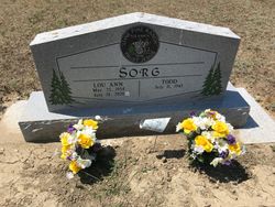
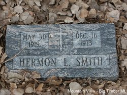
Lou Ann Smith Sorg
| Birth | : | 25 Mar 1954 Big Timber, Sweet Grass County, Montana, USA |
| Death | : | 24 Jul 2020 |
| Burial | : | Vida Cemetery, McCone County, USA |
| Coordinate | : | 47.8333015, -105.4685974 |
| Description | : | Lou Ann was born on March 25, 1954 in Big Timber, Montana to Herman and Betty Smith. She was the sister to an older brother and a younger brother. In August of 1976 Lou Ann married Todd Sorg in Sioux Falls, SD. Lou Ann had a passion for gardening, projects, animals, rocks and most of all people. All whom loved her dearly will never forget her strength, quick wit, never ending pranks, kindness and love for them. She lived a full life as a wonderful mother, gardener, homemaker and wife. Lou Ann walked each... Read More |
frequently asked questions (FAQ):
-
Where is Lou Ann Smith Sorg's memorial?
Lou Ann Smith Sorg's memorial is located at: Vida Cemetery, McCone County, USA.
-
When did Lou Ann Smith Sorg death?
Lou Ann Smith Sorg death on 24 Jul 2020 in
-
Where are the coordinates of the Lou Ann Smith Sorg's memorial?
Latitude: 47.8333015
Longitude: -105.4685974
Family Members:
Parent
Spouse
Flowers:
Nearby Cemetories:
1. Vida Cemetery
McCone County, USA
Coordinate: 47.8333015, -105.4685974
2. Holy Eucharist Cemetery
McCone County, USA
Coordinate: 47.7902985, -105.5994034
3. Prairie Lawn Cemetery
Dawson County, USA
Coordinate: 47.7611008, -105.3422012
4. Cow Creek Cemetery
McCone County, USA
Coordinate: 47.7181015, -105.5117035
5. Sacred Heart Catholic Cemetery
Vida, McCone County, USA
Coordinate: 47.8976000, -105.2840000
6. Riverside Cemetery
McCone County, USA
Coordinate: 47.8972015, -105.2835999
7. Immanuel Lutheran Cemetery
McCone County, USA
Coordinate: 47.6835000, -105.4920000
8. Ervine Cemetery
McCone County, USA
Coordinate: 47.7574997, -105.7577972
9. Nickwall Cemetery
Nickwall, McCone County, USA
Coordinate: 48.0497017, -105.3007965
10. Prairie Elk Cemetery
Wolf Point, Roosevelt County, USA
Coordinate: 47.9040851, -105.8199363
11. Grandview Cemetery
Richland County, USA
Coordinate: 47.9556007, -105.1343994
12. Courchene Cemetery
Wolf Point, Roosevelt County, USA
Coordinate: 48.0993996, -105.5927963
13. Prairie Elk Colony Cemetery
McCone County, USA
Coordinate: 48.0159000, -105.7970000
14. Chicken Hill Cemetery
Roosevelt County, USA
Coordinate: 48.0685997, -105.7193985
15. King Memorial Cemetery
Wolf Point, Roosevelt County, USA
Coordinate: 48.0950012, -105.6524963
16. Greenwood Cemetery
Wolf Point, Roosevelt County, USA
Coordinate: 48.1035995, -105.6500015
17. Chelsea Cemetery
Chelsea, Roosevelt County, USA
Coordinate: 48.1385000, -105.3462000
18. Poplar Cemetery
Poplar, Roosevelt County, USA
Coordinate: 48.1124992, -105.1893997
19. Saint Anns Cemetery
Poplar, Roosevelt County, USA
Coordinate: 48.1385994, -105.2589035
20. Oswego Catholic Cemetery
Oswego, Valley County, USA
Coordinate: 48.0480230, -105.8586070
21. Richey Cemetery
Richey, Dawson County, USA
Coordinate: 47.6542015, -105.0417023
22. Box Elder Cemetery
Poplar, Roosevelt County, USA
Coordinate: 48.1417000, -105.2603000
23. Oswego Presbyterian Cemetery
Oswego, Valley County, USA
Coordinate: 48.0428140, -105.8675410
24. Arnett Cemetery
Dawson County, USA
Coordinate: 47.4542007, -105.3638992


