
| Birth | : | 4 Jun 1877 Kansas, USA |
| Death | : | 15 Apr 1936 |
| Burial | : | Greenwood Cemetery, Clay Center, Clay County, USA |
| Coordinate | : | 39.4011002, -97.1275024 |
| Plot | : | Addition 1, Block 21, Lot 108 |
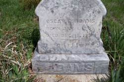
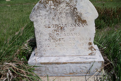
| Description | : | Louella Blanche Adams, daughter of Oscar and Georgia Ann Adams, was born on a farm three miles north of Green, Kansas, on June 4, 1877. Here she grew to young womanhood, attending the schools of that community and forming many friendships that have continued through the years. She was united in marriage to Elmer Peterson on November 5, 1902, and they established their home at Garrison, Kansas. Two daughters, Mildred and Irma, were born into this home, both of whom survive their mother. In January of 1911, the family moved to Onaga where they lived until January of 1935, when... Read More |
frequently asked questions (FAQ):
-
Where is Louella Blanche Adams Peterson's memorial?
Louella Blanche Adams Peterson's memorial is located at: Greenwood Cemetery, Clay Center, Clay County, USA.
-
When did Louella Blanche Adams Peterson death?
Louella Blanche Adams Peterson death on 15 Apr 1936 in
-
Where are the coordinates of the Louella Blanche Adams Peterson's memorial?
Latitude: 39.4011002
Longitude: -97.1275024
Family Members:
Parent
Spouse

Siblings
Children
Flowers:


Nearby Cemetories:
1. Greenwood Cemetery
Clay Center, Clay County, USA
Coordinate: 39.4011002, -97.1275024
2. Saint Peter and Saint Pauls Catholic Cemetery
Clay Center, Clay County, USA
Coordinate: 39.4005450, -97.1236680
3. Clay County Poor Farm Cemetery
Clay Center, Clay County, USA
Coordinate: 39.3772700, -97.0727000
4. Wilson Cemetery
Clay County, USA
Coordinate: 39.3800011, -97.1896973
5. Hayes Cemetery
Clay County, USA
Coordinate: 39.4516983, -97.0811005
6. Republican City Cemetery
Clay Center, Clay County, USA
Coordinate: 39.3431015, -97.1628036
7. Swedish Pleasant Hill Cemetery
Clay Center, Clay County, USA
Coordinate: 39.4735985, -97.1268997
8. Morganville City Cemetery
Morganville, Clay County, USA
Coordinate: 39.4733009, -97.1819000
9. Broughton Cemetery
Clay Center, Clay County, USA
Coordinate: 39.3306007, -97.0535965
10. Swedish Evangelical Lutheran Cemetery
Clay County, USA
Coordinate: 39.4911700, -97.1455100
11. Ebenezer Cemetery
Green, Clay County, USA
Coordinate: 39.3866997, -96.9974976
12. Brethren in Christ Cemetery
Clay County, USA
Coordinate: 39.4810982, -97.0344009
13. Green Cemetery
Green, Clay County, USA
Coordinate: 39.4235992, -96.9882965
14. Norwegian Lutheran Cemetery
Clay Center, Clay County, USA
Coordinate: 39.5027900, -97.1828200
15. Zion Lutheran Cemetery
Clay County, USA
Coordinate: 39.2928009, -97.1557999
16. Idylwilde Cemetery
Clay Center, Clay County, USA
Coordinate: 39.5097900, -97.0713000
17. Idana Cemetery
Idana, Clay County, USA
Coordinate: 39.3574500, -97.2693300
18. Milo Chapman Gravesite
Broughton, Clay County, USA
Coordinate: 39.2888500, -97.0724400
19. Fancy Creek Cemetery
Green, Clay County, USA
Coordinate: 39.4668999, -96.9969025
20. Garfield Center Mission Cemetery
Clay Center, Clay County, USA
Coordinate: 39.5243100, -97.1277500
21. Gilbert Cemetery
Clay County, USA
Coordinate: 39.2853012, -97.0625000
22. Bloom Cemetery
Morganville, Clay County, USA
Coordinate: 39.4519005, -97.2778015
23. Joseph Sender Family Cemetery
Clay County, USA
Coordinate: 39.5090600, -97.0348800
24. Lincoln Cemetery
Clay Center, Clay County, USA
Coordinate: 39.4230995, -97.2930984