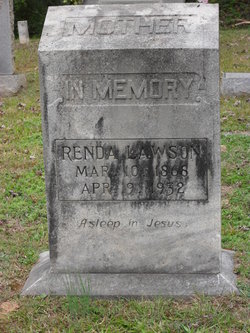
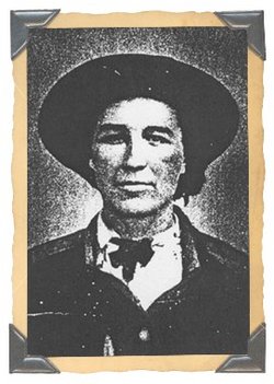
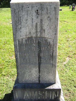
Lourinda Lawson Lawson
| Birth | : | 10 Mar 1868 Stokes County, North Carolina, USA |
| Death | : | 9 Apr 1932 Mount Airy, Surry County, North Carolina, USA |
| Burial | : | St John the Baptist Churchyard, Lowick, Northumberland Unitary Authority, England |
| Coordinate | : | 55.6501470, -1.9826250 |
| Inscription | : | MOTHER |
| Description | : | Daughter of Braxton and Ludusky Tucker Lawson, she married Powell Lawson, son of Jenk Lawson (dead) and Matilda Lawson of Kentucky on 6 Aug 1882 in Peters Creek Township, Stokes County, NC. Cause of death was Influenza with Broncho Pneumonia. |
frequently asked questions (FAQ):
-
Where is Lourinda Lawson Lawson's memorial?
Lourinda Lawson Lawson's memorial is located at: St John the Baptist Churchyard, Lowick, Northumberland Unitary Authority, England.
-
When did Lourinda Lawson Lawson death?
Lourinda Lawson Lawson death on 9 Apr 1932 in Mount Airy, Surry County, North Carolina, USA
-
Where are the coordinates of the Lourinda Lawson Lawson's memorial?
Latitude: 55.6501470
Longitude: -1.9826250
Family Members:
Parent
Spouse
Siblings
Children
Flowers:
Nearby Cemetories:
1. St John the Baptist Churchyard
Lowick, Northumberland Unitary Authority, England
Coordinate: 55.6501470, -1.9826250
2. Kyloe Cemetery
Kyloe, Northumberland Unitary Authority, England
Coordinate: 55.6570310, -1.9191950
3. Saint Nicholas Churchyard
Kyloe, Northumberland Unitary Authority, England
Coordinate: 55.6569000, -1.9188300
4. St. Anne's Churchyard
Ancroft, Northumberland Unitary Authority, England
Coordinate: 55.7000400, -1.9981800
5. St Michael and All Angels Churchyard
Ford, Northumberland Unitary Authority, England
Coordinate: 55.6301700, -2.0895430
6. St Mary & St Michael Churchyard
Doddington, Northumberland Unitary Authority, England
Coordinate: 55.5837211, -2.0083409
7. All Saints Churchyard
Duddo, Northumberland Unitary Authority, England
Coordinate: 55.6859800, -2.0862900
8. St. Mary the Virgin Chapelyard
Etal, Northumberland Unitary Authority, England
Coordinate: 55.6481100, -2.1150200
9. Saint Mary's Churchyard
Belford, Northumberland Unitary Authority, England
Coordinate: 55.5992600, -1.8292900
10. St. Mary the Virgin Parish Churchyard
Holy Island, Northumberland Unitary Authority, England
Coordinate: 55.6694200, -1.8016450
11. St Paul's Churchyard
Branxton, Northumberland Unitary Authority, England
Coordinate: 55.6308820, -2.1726490
12. Holy Cross Churchyard
Chatton, Northumberland Unitary Authority, England
Coordinate: 55.5474907, -1.9105738
13. Flodden Field Cemetery
Branxton, Northumberland Unitary Authority, England
Coordinate: 55.6287730, -2.1765120
14. Our Lady & St. Cuthbert's
Berwick-upon-Tweed, Northumberland Unitary Authority, England
Coordinate: 55.7695760, -1.9994210
15. St Gregory Churchyard
Kirknewton, Northumberland Unitary Authority, England
Coordinate: 55.5658590, -2.1387780
16. Berwick Parish Church
Berwick-upon-Tweed, Northumberland Unitary Authority, England
Coordinate: 55.7721130, -2.0010390
17. Berwick-upon-Tweed Cemetery
Berwick-upon-Tweed, Northumberland Unitary Authority, England
Coordinate: 55.7799800, -2.0107500
18. St. Peter's Parish Church
Chillingham, Northumberland Unitary Authority, England
Coordinate: 55.5273100, -1.9030830
19. St Helen's Churchyard
Cornhill-on-Tweed, Northumberland Unitary Authority, England
Coordinate: 55.6464840, -2.2264990
20. Saint Hilda’s Churchyard
Lucker, Northumberland Unitary Authority, England
Coordinate: 55.5660400, -1.7597400
21. St. Aidan Churchyard
Bamburgh, Northumberland Unitary Authority, England
Coordinate: 55.6079810, -1.7183070
22. St. Michael Churchyard
Ilderton, Northumberland Unitary Authority, England
Coordinate: 55.4904200, -1.9743800
23. Mindrum Churchyard
Mindrum, Northumberland Unitary Authority, England
Coordinate: 55.5937100, -2.2481000
24. St Maurice's Churchyard
Ellingham, Northumberland Unitary Authority, England
Coordinate: 55.5245000, -1.7245300

