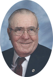
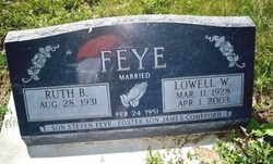
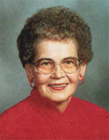
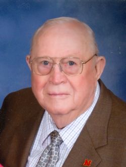
Lowell Walter Feye
| Birth | : | 11 Mar 1928 Columbus, Platte County, Nebraska, USA |
| Death | : | 1 Apr 2003 Columbus, Platte County, Nebraska, USA |
| Burial | : | Stonelick IOOF Cemetery, Stonelick, Clermont County, USA |
| Coordinate | : | 39.1205200, -84.1549100 |
| Description | : | Son of Walter & Florence (Lueschen) Feye. He was baptized and confirmed at St. Paul's Lutheran Church in rural Leigh, Nebraska. He was active in Luther League, was a Luther League sponsor, Sunday school teacher and a church council member. Lowell was elected State Luther League President in 1948. He attended rural grade school at Boheet, District #46, in Sherman Township and graduated from Kramer High School in Columbus in 1945. During High School, Lowell was a member of the Future Farmers of America and was elected State President of that organization in 1946. He also earned the "American Farmer" award from... Read More |
frequently asked questions (FAQ):
-
Where is Lowell Walter Feye's memorial?
Lowell Walter Feye's memorial is located at: Stonelick IOOF Cemetery, Stonelick, Clermont County, USA.
-
When did Lowell Walter Feye death?
Lowell Walter Feye death on 1 Apr 2003 in Columbus, Platte County, Nebraska, USA
-
Where are the coordinates of the Lowell Walter Feye's memorial?
Latitude: 39.1205200
Longitude: -84.1549100
Family Members:
Parent
Spouse
Siblings
Flowers:
Nearby Cemetories:
1. Stonelick IOOF Cemetery
Stonelick, Clermont County, USA
Coordinate: 39.1205200, -84.1549100
2. Boston Methodist Episcopal Church Cemetery
Owensville, Clermont County, USA
Coordinate: 39.1183739, -84.1348038
3. Saint Louis Cemetery
Owensville, Clermont County, USA
Coordinate: 39.1246900, -84.1342600
4. Kidd Family Cemetery
Batavia, Clermont County, USA
Coordinate: 39.1020241, -84.1463470
5. Rapp Cemetery
Belfast, Clermont County, USA
Coordinate: 39.1434900, -84.1529200
6. Saint Philomena Church Cemetery
Stonelick Township, Clermont County, USA
Coordinate: 39.1277618, -84.1848450
7. Daniel South Family Cemetery
Owensville, Clermont County, USA
Coordinate: 39.1378000, -84.1301830
8. Thomas South Cemetery
Owensville, Clermont County, USA
Coordinate: 39.1413530, -84.1218460
9. Olive Cemetery
Stonelick Township, Clermont County, USA
Coordinate: 39.1563988, -84.1552963
10. Batavia Union Cemetery
Batavia, Clermont County, USA
Coordinate: 39.0778389, -84.1677094
11. Batavia IOOF Cemetery
Batavia, Clermont County, USA
Coordinate: 39.0790780, -84.1735110
12. Hill Family Cemetery
Stonelick, Clermont County, USA
Coordinate: 39.1622490, -84.1826090
13. Mount Zion Cemetery
Craver, Clermont County, USA
Coordinate: 39.1613464, -84.1940231
14. McClure Family Cemetery
Stonelick, Clermont County, USA
Coordinate: 39.1248330, -84.2224500
15. Simpkins Family Cemetery
Williams Corners, Clermont County, USA
Coordinate: 39.1733900, -84.1532700
16. Shumard Cemetery
Stonelick, Clermont County, USA
Coordinate: 39.1685000, -84.1202500
17. Moore Cemetery
Batavia, Clermont County, USA
Coordinate: 39.0703720, -84.1857880
18. Sharon Cemetery
Monterey, Clermont County, USA
Coordinate: 39.1428000, -84.0867000
19. Dial Family Cemetery
Olive Branch, Clermont County, USA
Coordinate: 39.0823670, -84.2118670
20. Prickett Cemetery
Newtonsville, Clermont County, USA
Coordinate: 39.1756700, -84.1188800
21. Perintown United Methodist Church Cemetery
Perintown, Clermont County, USA
Coordinate: 39.1374512, -84.2339783
22. Gibson Burial Ground
Elk Lick, Clermont County, USA
Coordinate: 39.0574060, -84.1687360
23. Olive Branch Cemetery
Olive Branch, Clermont County, USA
Coordinate: 39.0850000, -84.2261800
24. Plainview Cemetery
Newtonsville, Clermont County, USA
Coordinate: 39.1796989, -84.1177979

