
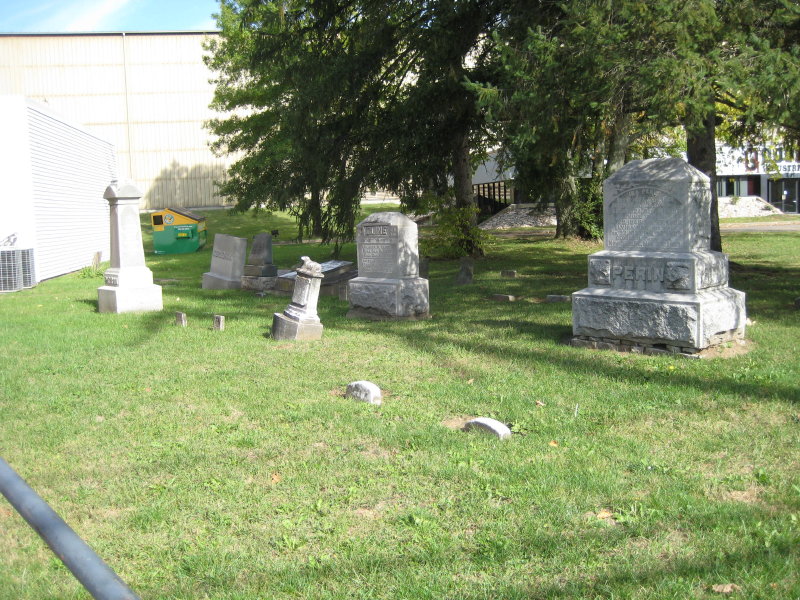
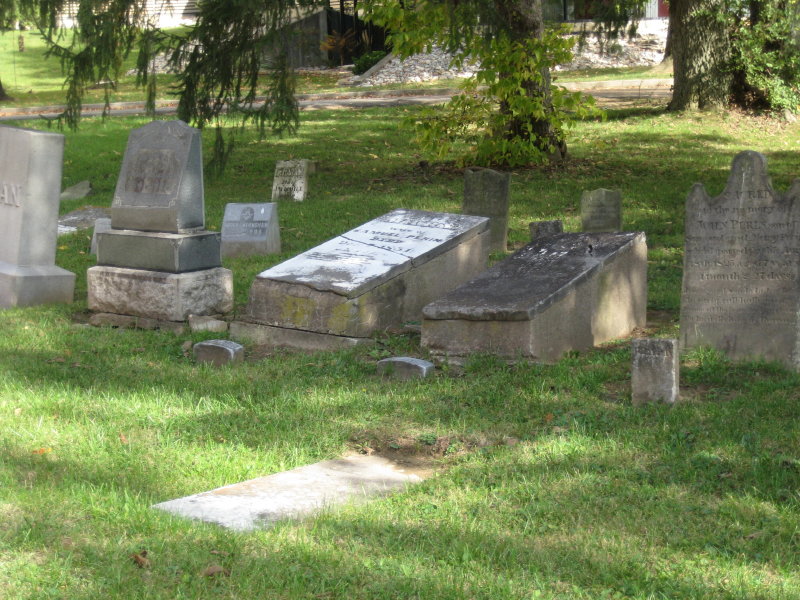
| Memorials | : | 34 |
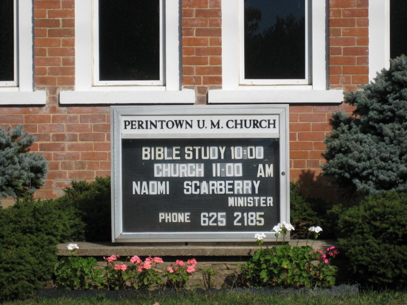
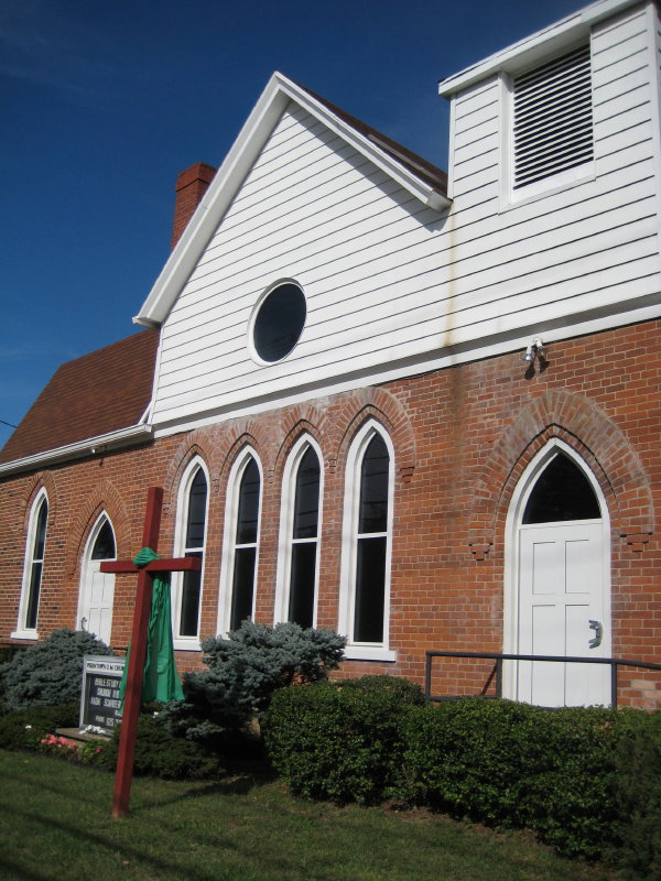
| Location | : | Perintown, Clermont County, USA |
| Coordinate | : | 39.1374512, -84.2339783 |
| Description | : | Take St. Rt. 50 out of Milford towards Owensville. Past the traffic light at Wolfpen-Pleasant Hill Road you will come to the town of Perintown - go past the traffic light at Round Bottom Road, the cemetery is on the left. The only church located in the town. Easy access. Small parking lot in front of church. |
frequently asked questions (FAQ):
-
Where is Perintown United Methodist Church Cemetery?
Perintown United Methodist Church Cemetery is located at Perintown, Clermont County ,Ohio ,USA.
-
Perintown United Methodist Church Cemetery cemetery's updated grave count on graveviews.com?
34 memorials
-
Where are the coordinates of the Perintown United Methodist Church Cemetery?
Latitude: 39.1374512
Longitude: -84.2339783
Nearby Cemetories:
1. McClure Family Cemetery
Stonelick, Clermont County, USA
Coordinate: 39.1248330, -84.2224500
2. Round Bottom Road Cemetery
Perintown, Clermont County, USA
Coordinate: 39.1400170, -84.2568330
3. Tealtown Cemetery
Perintown, Clermont County, USA
Coordinate: 39.1190500, -84.2419830
4. William Jones Cemetery
Summerside, Clermont County, USA
Coordinate: 39.1304900, -84.2657990
5. Eli Davis Family Cemetery
Summerside, Clermont County, USA
Coordinate: 39.1377580, -84.2838960
6. Mount Zion Cemetery
Craver, Clermont County, USA
Coordinate: 39.1613464, -84.1940231
7. Saint Philomena Church Cemetery
Stonelick Township, Clermont County, USA
Coordinate: 39.1277618, -84.1848450
8. Greenlawn Cemetery
Milford, Clermont County, USA
Coordinate: 39.1706009, -84.2758026
9. Hill Family Cemetery
Stonelick, Clermont County, USA
Coordinate: 39.1622490, -84.1826090
10. Olive Branch Cemetery
Olive Branch, Clermont County, USA
Coordinate: 39.0850000, -84.2261800
11. Saint Andrews Cemetery
Milford, Clermont County, USA
Coordinate: 39.1632996, -84.2941971
12. Jesuit Cemetery
Milford, Clermont County, USA
Coordinate: 39.1655400, -84.2932700
13. Dial Family Cemetery
Olive Branch, Clermont County, USA
Coordinate: 39.0823670, -84.2118670
14. Mulberry Cemetery
Milford, Clermont County, USA
Coordinate: 39.1947784, -84.2469864
15. Milford First United Methodist Church Columbarium
Milford, Clermont County, USA
Coordinate: 39.1768880, -84.2910680
16. Saint Thomas Episcopal Church Columbarium
Terrace Park, Hamilton County, USA
Coordinate: 39.1666300, -84.3029760
17. Milford Cemetery
Milford, Clermont County, USA
Coordinate: 39.1795550, -84.2908500
18. Covalt Cemetery
Terrace Park, Hamilton County, USA
Coordinate: 39.1671400, -84.3028080
19. Rapp Cemetery
Belfast, Clermont County, USA
Coordinate: 39.1434900, -84.1529200
20. Stonelick IOOF Cemetery
Stonelick, Clermont County, USA
Coordinate: 39.1205200, -84.1549100
21. Olive Cemetery
Stonelick Township, Clermont County, USA
Coordinate: 39.1563988, -84.1552963
22. Graceland Memorial Gardens
Milford, Clermont County, USA
Coordinate: 39.1963997, -84.1999969
23. Brown Family Cemetery
Top-of-the-Ridge, Clermont County, USA
Coordinate: 39.1968980, -84.2695320
24. Marriott Cemetery (Defunct)
Ancor, Hamilton County, USA
Coordinate: 39.1442610, -84.3187690