
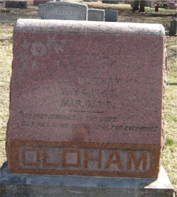
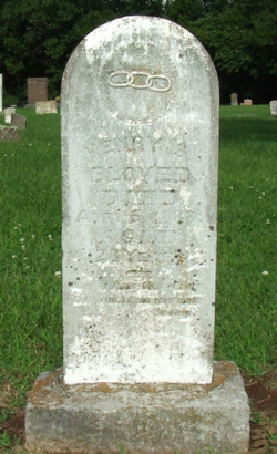
Lucinda Bloyed Shanks Oldham
| Birth | : | 4 May 1849 West Fork, Washington County, Arkansas, USA |
| Death | : | 4 Mar 1910 West Fork, Washington County, Arkansas, USA |
| Burial | : | Big Prairie-Everett Cemetery, Big Prairie, Newaygo County, USA |
| Coordinate | : | 43.5200005, -85.6836014 |
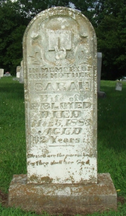
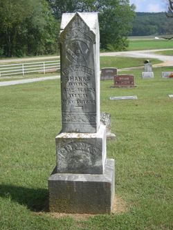
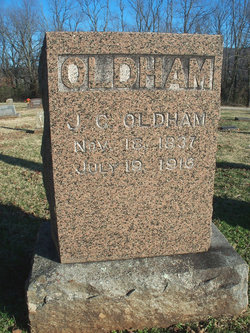
| Description | : | Lucinda Oldham (nee Bloyed), age 60, died March 4, 1910 at West Fork, Arkansas. She was born May 4, 1849, at West Fork, the daughter of Peter and Sarah Ann (Tennison) Bloyed. She had lived in this area all her life. She was married twice: 1) Walter Emerson Shanks, married September 3, 1871, in Washington County. 2) Joseph Calhoun "J.C." Oldham, married September 25, 1899 in Washington County. She is survived by her husband, J. C. Oldham.. Funeral Services were conducted by the Reverand M. M. Combs of Roby, Texas Burial... Read More |
frequently asked questions (FAQ):
-
Where is Lucinda Bloyed Shanks Oldham's memorial?
Lucinda Bloyed Shanks Oldham's memorial is located at: Big Prairie-Everett Cemetery, Big Prairie, Newaygo County, USA.
-
When did Lucinda Bloyed Shanks Oldham death?
Lucinda Bloyed Shanks Oldham death on 4 Mar 1910 in West Fork, Washington County, Arkansas, USA
-
Where are the coordinates of the Lucinda Bloyed Shanks Oldham's memorial?
Latitude: 43.5200005
Longitude: -85.6836014
Family Members:
Parent
Spouse
Siblings
Flowers:


Nearby Cemetories:
1. Big Prairie-Everett Cemetery
Big Prairie, Newaygo County, USA
Coordinate: 43.5200005, -85.6836014
2. Saint Marys Catholic Cemetery
Croton, Newaygo County, USA
Coordinate: 43.4677780, -85.6633330
3. Amish Cemetery
White Cloud, Newaygo County, USA
Coordinate: 43.5731010, -85.7217026
4. Paulsen Family Cemetery
White Cloud, Newaygo County, USA
Coordinate: 43.5767059, -85.7205392
5. Croton Township Cemetery
Croton, Newaygo County, USA
Coordinate: 43.4394700, -85.6783800
6. Saint Joseph Cemetery
White Cloud, Newaygo County, USA
Coordinate: 43.5501671, -85.7900925
7. White Cloud Cemetery
White Cloud, Newaygo County, USA
Coordinate: 43.5527992, -85.7917023
8. Culp Cemetery
Croton Township, Newaygo County, USA
Coordinate: 43.4537900, -85.6078400
9. West Aetna Cemetery
Aetna Township, Mecosta County, USA
Coordinate: 43.5367660, -85.5623060
10. Stearns Prairie Cemetery
Croton Township, Newaygo County, USA
Coordinate: 43.4543991, -85.5980988
11. Goodwell Cemetery
Goodwell Township, Newaygo County, USA
Coordinate: 43.5992012, -85.6235962
12. Oak Grove Cemetery
Croton Township, Newaygo County, USA
Coordinate: 43.4061012, -85.6430969
13. Newaygo Cemetery
Newaygo, Newaygo County, USA
Coordinate: 43.4247220, -85.7927780
14. Christian Plains Cemetery
Croton Township, Newaygo County, USA
Coordinate: 43.4100200, -85.6028200
15. Surrerar Cemetery
Newaygo, Newaygo County, USA
Coordinate: 43.3949680, -85.7028540
16. Fairview Cemetery
Mecosta Township, Mecosta County, USA
Coordinate: 43.5891991, -85.5335999
17. Bouton Family Farm Burial Site
Reynolds Township, Montcalm County, USA
Coordinate: 43.4294960, -85.5555570
18. Saint Bartholomew Catholic Cemetery
Newaygo, Newaygo County, USA
Coordinate: 43.4238610, -85.8101750
19. Zions Cemetery
Mecosta Township, Mecosta County, USA
Coordinate: 43.5696983, -85.5100021
20. Sherman Township Cemetery
Fremont, Newaygo County, USA
Coordinate: 43.5195630, -85.8704930
21. Merrill Township Cemetery
Brohman, Newaygo County, USA
Coordinate: 43.6650000, -85.6770000
22. Woodville Cemetery
Woodville, Newaygo County, USA
Coordinate: 43.6677780, -85.6808330
23. Garfield Township Cemetery
Newaygo, Newaygo County, USA
Coordinate: 43.4257400, -85.8601410
24. Lincoln Township Cemetery
Newaygo, Newaygo County, USA
Coordinate: 43.5972400, -85.8792200