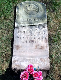
| Birth | : | 1839 Ohio, USA |
| Death | : | 5 Dec 1890 Bourbon County, Kansas, USA |
| Burial | : | Walnut Hill Cemetery, Uniontown, Bourbon County, USA |
| Coordinate | : | 37.8852997, -94.9250031 |
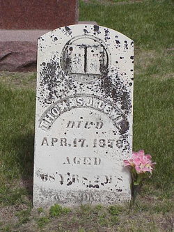
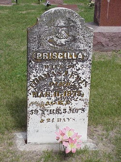
| Description | : | Lucretia Lewis, a verified descendent of Mayflower pilgrim Edward Doty, was born in Hamilton County Ohio between 1836-1839 to Thomas Jefferson Lewis and Priscilla Rude. Lucretia’s father joined the Mormon Church in 1834 and served as Joseph Smith’s bodyguard prior to his assassination in 1844. The Lewis family broke from the teaching of the Mormon church and joined with others to create a revised version of the religion and relocated to Preparation, Iowa. Lucretia married her first husband, Henry J. Kinning Sr, in 1858 and welcomed daughter Helen Mathilda in 1859 and son Henry Lewis Kinning, Jr in 1864. Henry... Read More |
frequently asked questions (FAQ):
-
Where is Lucretia Lewis Kinning Mattocks Mulkins's memorial?
Lucretia Lewis Kinning Mattocks Mulkins's memorial is located at: Walnut Hill Cemetery, Uniontown, Bourbon County, USA.
-
When did Lucretia Lewis Kinning Mattocks Mulkins death?
Lucretia Lewis Kinning Mattocks Mulkins death on 5 Dec 1890 in Bourbon County, Kansas, USA
-
Where are the coordinates of the Lucretia Lewis Kinning Mattocks Mulkins's memorial?
Latitude: 37.8852997
Longitude: -94.9250031
Family Members:
Parent
Spouse
Siblings
Children
Flowers:
Nearby Cemetories:
1. Walnut Hill Cemetery
Uniontown, Bourbon County, USA
Coordinate: 37.8852997, -94.9250031
2. Turkey Creek Cemetery
Uniontown, Bourbon County, USA
Coordinate: 37.8959200, -94.9655000
3. Woods Cemetery
Redfield, Bourbon County, USA
Coordinate: 37.8488998, -94.8957977
4. Anderson Cemetery No. 2
Uniontown, Bourbon County, USA
Coordinate: 37.9211080, -94.9615930
5. Uniontown Cemetery
Uniontown, Bourbon County, USA
Coordinate: 37.8492270, -94.9653630
6. Pleasant View Cemetery
Bronson, Bourbon County, USA
Coordinate: 37.8996900, -95.0040500
7. Mount Zion Cemetery
Redfield, Bourbon County, USA
Coordinate: 37.8181000, -94.9152985
8. Mount Orum Cemetery
Redfield, Bourbon County, USA
Coordinate: 37.8120880, -94.8978424
9. Dayton Cemetery
Bourbon County, USA
Coordinate: 37.9571991, -94.8707962
10. Centerville Cemetery
Devon, Bourbon County, USA
Coordinate: 37.8996582, -94.8195419
11. Hatch Cemetery
Uniontown, Bourbon County, USA
Coordinate: 37.8316994, -95.0121994
12. Marion Cemetery
Redfield, Bourbon County, USA
Coordinate: 37.7971992, -94.9246979
13. Marmaton Cemetery
Redfield, Bourbon County, USA
Coordinate: 37.8199100, -94.8319400
14. Morris Cemetery
Mapleton, Bourbon County, USA
Coordinate: 37.9805984, -94.8930969
15. Deeds-Bower-Bauer Cemetery
Mapleton, Bourbon County, USA
Coordinate: 37.9837570, -94.8871918
16. Northway Cemetery
Mapleton, Bourbon County, USA
Coordinate: 37.9935989, -94.9321976
17. Avondale Cemetery
Bourbon County, USA
Coordinate: 37.9536018, -94.8139038
18. Entswood Cemetery
Bronson, Bourbon County, USA
Coordinate: 37.9431480, -95.0603200
19. Anderson Cemetery #1
Xenia, Bourbon County, USA
Coordinate: 37.9907700, -95.0025000
20. Bronson Cemetery
Bronson, Bourbon County, USA
Coordinate: 37.8997100, -95.0792500
21. West Plains Cemetery
Devon, Bourbon County, USA
Coordinate: 37.8781013, -94.7680969
22. Mapleton Cemetery
Mapleton, Bourbon County, USA
Coordinate: 38.0227300, -94.8796500
23. Stevenson Cemetery
Mapleton, Bourbon County, USA
Coordinate: 38.0210991, -94.9847031
24. Hall Family Cemetery
Marmaton Township, Bourbon County, USA
Coordinate: 37.8257279, -94.7591375

