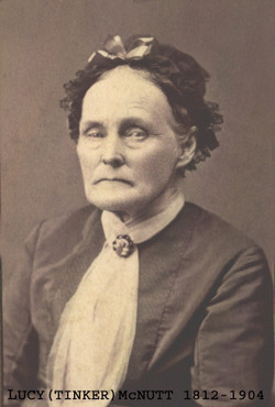
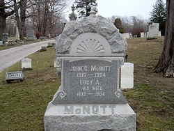
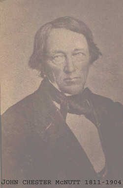
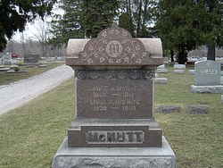
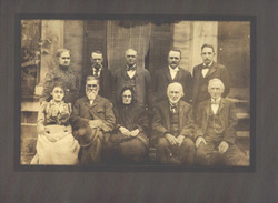
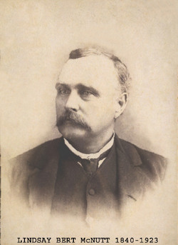
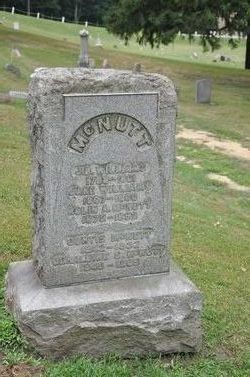
Lucy Ann Tinker McNutt
| Birth | : | 1 May 1812 Blandford, Hampden County, Massachusetts, USA |
| Death | : | 28 Jan 1904 Saybrook, Ashtabula County, Ohio, USA |
| Burial | : | Pilot Mound Cemetery, Pilot Mound, Boone County, USA |
| Coordinate | : | 42.1636200, -94.0282600 |
| Description | : | Mrs. Lucy Ann, wife of John C. McNutt, died at 2:30 Thursday afternoon as a result of injured sustained Monday in fall, which occurred, in her bedroom. So serious was the injury that it was feared from the first that, owing tophysical infirmities of old age, the victim would not be able to recover and the outcome therefore was not unexpected. Mrs. McNutt was one of the oldest residents of this section in years and point of continuous residence. She was anative of the Bay State, Massachusetts, where she was born on May 1, 1812, being therefore in... Read More |
frequently asked questions (FAQ):
-
Where is Lucy Ann Tinker McNutt's memorial?
Lucy Ann Tinker McNutt's memorial is located at: Pilot Mound Cemetery, Pilot Mound, Boone County, USA.
-
When did Lucy Ann Tinker McNutt death?
Lucy Ann Tinker McNutt death on 28 Jan 1904 in Saybrook, Ashtabula County, Ohio, USA
-
Where are the coordinates of the Lucy Ann Tinker McNutt's memorial?
Latitude: 42.1636200
Longitude: -94.0282600
Family Members:
Parent
Spouse
Siblings
Children
Flowers:
Nearby Cemetories:
1. Pilot Mound Cemetery
Pilot Mound, Boone County, USA
Coordinate: 42.1636200, -94.0282600
2. Runyan Cemetery
Pilot Mound, Boone County, USA
Coordinate: 42.1749992, -94.0015030
3. Schlicht Cemetery
Fraser, Boone County, USA
Coordinate: 42.1444200, -93.9780100
4. Lawn Cemetery
Boone County, USA
Coordinate: 42.1771011, -94.0867996
5. Linn Cemetery
Pilot Mound, Boone County, USA
Coordinate: 42.2045330, -93.9970230
6. White Cemetery
Boone County, USA
Coordinate: 42.1777992, -93.9636002
7. Union Cemetery
Boxholm, Boone County, USA
Coordinate: 42.1369019, -94.0852966
8. Mineral Ridge Cemetery
Ridgeport, Boone County, USA
Coordinate: 42.1749992, -93.9266968
9. Renner Cemetery
Boone County, USA
Coordinate: 42.1380420, -94.1256570
10. Maas Cemetery
Boone County, USA
Coordinate: 42.0908012, -94.0618973
11. Swedish Lutheran Church Cemetery
Dayton, Webster County, USA
Coordinate: 42.2175000, -94.1065000
12. Hickory Grove Cemetery
Boone County, USA
Coordinate: 42.1074982, -93.9507980
13. Boone County Poor Farm Cemetery
Boone County, USA
Coordinate: 42.1591100, -93.9159000
14. Hardin Township Cemetery
Hardin Township, Webster County, USA
Coordinate: 42.2411003, -93.9708023
15. Buckley Cemetery
Boone, Boone County, USA
Coordinate: 42.0999810, -93.9418960
16. Bluff Creek Cemetery
Boone, Boone County, USA
Coordinate: 42.0774994, -93.9796982
17. Maple Grove Cemetery
Boxholm, Boone County, USA
Coordinate: 42.0793690, -94.0859890
18. Christ the King Catholic Cemetery
Dayton, Webster County, USA
Coordinate: 42.2601929, -94.0727539
19. Grand Ridge Cemetery
Beaver, Boone County, USA
Coordinate: 42.0786018, -94.1157990
20. Dayton Cemetery
Dayton, Webster County, USA
Coordinate: 42.2675000, -94.0755000
21. Bass Point Cemetery
Boone, Boone County, USA
Coordinate: 42.0992012, -93.8957977
22. Saint Johns Catholic Cemetery
Ogden, Boone County, USA
Coordinate: 42.0344000, -94.0407000
23. Glenwood Cemetery
Ogden, Boone County, USA
Coordinate: 42.0340000, -94.0440000
24. Bass Cemetery
Dayton, Webster County, USA
Coordinate: 42.2966995, -94.0149994

