
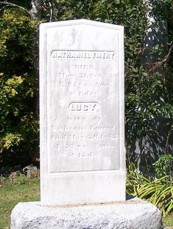
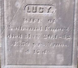
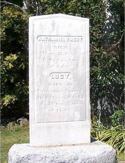
Lucy Crockett Emery
| Birth | : | 3 Aug 1772 |
| Death | : | 20 May 1832 |
| Burial | : | Hillcrest Cemetery, Parry Sound, Parry Sound District, Canada |
| Coordinate | : | 45.3541700, -80.0239200 |
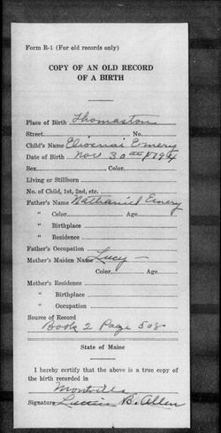
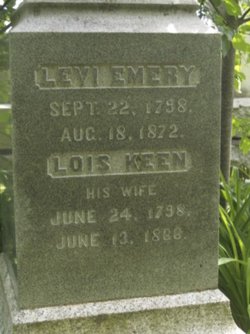
| Description | : | Born August 3, 1772, died May 20, 1832 @ 59 yrs, 9 months and 17 days. Tribute written for Lucy Crockett Emery Lucy is the daughter of Nathaniel and Eunice (Cooper) Crockett. She was born in Fox Islands (now Vinalhaven), Lincoln county, Maine and is the first of fourteen children. Children of Nathaniel and Eunice: i Lucy ii David iii Euncie iv Margaret "Peggy" v Thomas vi Jonathan vii Abigail "Nabby" viii Lydia ix Jane x Nathaniel xi Asa xii Enos xiii Mary "Polly" xiv James Lucy married Nathaniel Emery on December 26, 1791. Together they had six children: i Anna ii Elioenai (or Elona) iii Tristram iv Levi v Thomas vi Asa Lucy died in 1832 and shares a stone with her... Read More |
frequently asked questions (FAQ):
-
Where is Lucy Crockett Emery's memorial?
Lucy Crockett Emery's memorial is located at: Hillcrest Cemetery, Parry Sound, Parry Sound District, Canada.
-
When did Lucy Crockett Emery death?
Lucy Crockett Emery death on 20 May 1832 in
-
Where are the coordinates of the Lucy Crockett Emery's memorial?
Latitude: 45.3541700
Longitude: -80.0239200
Family Members:
Parent
Spouse
Siblings
Children

Flowers:


Nearby Cemetories:
1. Hillcrest Cemetery
Parry Sound, Parry Sound District, Canada
Coordinate: 45.3541700, -80.0239200
2. Wasauksing First Nation New
Parry Island First Nation, Parry Sound District, Canada
Coordinate: 45.3226360, -80.0679300
3. Nobel United Church Cemetery
Nobel, Parry Sound District, Canada
Coordinate: 45.4049470, -80.0661660
4. Wasauksing First Nation Cemetery
Parry Island First Nation, Parry Sound District, Canada
Coordinate: 45.3100700, -80.0832530
5. Foley Memorial Cemetery
Foley, Parry Sound District, Canada
Coordinate: 45.3034000, -79.9471600
6. Sylvan Acres Cemetery
Waubamik, Parry Sound District, Canada
Coordinate: 45.4527300, -79.9746500
7. Hurdville Cemetery
Hurdville, Parry Sound District, Canada
Coordinate: 45.4330280, -79.9133890
8. Carling Cemetery
Carling, Parry Sound District, Canada
Coordinate: 45.4265060, -80.1940630
9. Thompson Cemetery
McKellar, Parry Sound District, Canada
Coordinate: 45.4885510, -79.9353680
10. Christie Memorial Cemetery
Orrville, Parry Sound District, Canada
Coordinate: 45.3761830, -79.8124070
11. United Church Cemetery
McKellar, Parry Sound District, Canada
Coordinate: 45.5074400, -79.9176600
12. St. Stephen's Cemetery
Broadbent, Parry Sound District, Canada
Coordinate: 45.4668500, -79.8290250
13. Islanders Around Bateau Family Memorials
Georgian Bay, Muskoka District Municipality, Canada
Coordinate: 45.3020418, -80.2926485
14. Humphrey-Conger Union Cemetery
Seguin, Parry Sound District, Canada
Coordinate: 45.1937120, -79.7893240
15. Dorothy Meyers Burial Site
Moon River, Muskoka District Municipality, Canada
Coordinate: 45.1111704, -79.9387148
16. Seguin Falls Cemetery
Seguin Falls, Parry Sound District, Canada
Coordinate: 45.4362495, -79.6823644
17. Rosseau Anglican Church of The Redeemer Cemetery
Seguin, Parry Sound District, Canada
Coordinate: 45.2807900, -79.6780750
18. Dunchurch-Fairholme Cemetery
Dunchurch, Parry Sound District, Canada
Coordinate: 45.5963989, -79.9045702
19. Dufferin Methodist Cemetery
Spence, Parry Sound District, Canada
Coordinate: 45.4846896, -79.6830158
20. Humphrey-Rosseau Union Cemetery
Rosseau, Parry Sound District, Canada
Coordinate: 45.2653530, -79.6509330
21. MacTier Union Cemetery
MacTier, Muskoka District Municipality, Canada
Coordinate: 45.1178500, -79.7577800
22. Foot's Bay Cemetery
Muskoka, Muskoka District Municipality, Canada
Coordinate: 45.1179700, -79.7574300
23. Christ Church Anglican - Gregory
Minett, Muskoka District Municipality, Canada
Coordinate: 45.1621900, -79.6546550
24. St. John's Cemetery
Morinus, Muskoka District Municipality, Canada
Coordinate: 45.1754420, -79.6290780