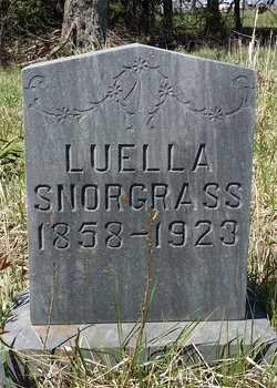
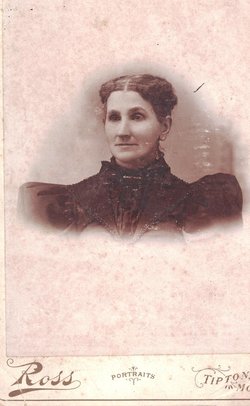
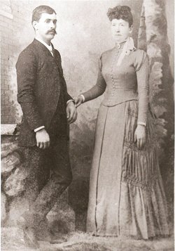
Luella A. “Ella” Hunter Snorgrass
| Birth | : | 3 Oct 1858 Missouri, USA |
| Death | : | 3 Mar 1923 Sedalia, Pettis County, Missouri, USA |
| Burial | : | Goshen Center Cemetery, Goshen, Litchfield County, USA |
| Coordinate | : | 41.8321991, -73.2331009 |
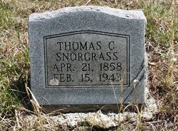
| Description | : | Ella was a daughter of Fannie E. (Davis) and William Hunter. Her father was born in the state of Kentucky. Ella married Thomas Charles Snorgrass. She was a housewife and they were living at 601 West Pettis Street in Sedalia, Missouri, at the time of her death. She was 64 years old when she was accidentally struck and killed by a Missouri Pacific switch engine in Sedalia, Missouri. Her death certificate has her birth date as October 3, 1859, and the date of her death as March 3, 1923. The tombstone has her birth year as... Read More |
frequently asked questions (FAQ):
-
Where is Luella A. “Ella” Hunter Snorgrass's memorial?
Luella A. “Ella” Hunter Snorgrass's memorial is located at: Goshen Center Cemetery, Goshen, Litchfield County, USA.
-
When did Luella A. “Ella” Hunter Snorgrass death?
Luella A. “Ella” Hunter Snorgrass death on 3 Mar 1923 in Sedalia, Pettis County, Missouri, USA
-
Where are the coordinates of the Luella A. “Ella” Hunter Snorgrass's memorial?
Latitude: 41.8321991
Longitude: -73.2331009
Family Members:
Parent
Spouse
Siblings
Children
Flowers:
Nearby Cemetories:
1. Goshen Center Cemetery
Goshen, Litchfield County, USA
Coordinate: 41.8321991, -73.2331009
2. Saint Thomas Cemetery
Goshen, Litchfield County, USA
Coordinate: 41.8352127, -73.2291870
3. Bentley Cemetery
Goshen, Litchfield County, USA
Coordinate: 41.8210869, -73.2316971
4. Old Middle Street Cemetery
Goshen, Litchfield County, USA
Coordinate: 41.8181000, -73.2205963
5. East Street Cemetery
Goshen, Litchfield County, USA
Coordinate: 41.8434260, -73.2020870
6. West Goshen Cemetery
West Goshen, Litchfield County, USA
Coordinate: 41.8133011, -73.2636032
7. Collins Cemetery
Goshen, Litchfield County, USA
Coordinate: 41.8238983, -73.1928024
8. Oviatt Family Cemetery
Goshen, Litchfield County, USA
Coordinate: 41.8777000, -73.2292000
9. West Torrington Cemetery
Torrington, Litchfield County, USA
Coordinate: 41.8241997, -73.1669006
10. Benedict Cemetery
Torrington, Litchfield County, USA
Coordinate: 41.8633790, -73.1664500
11. Beach Cemetery
Goshen, Litchfield County, USA
Coordinate: 41.8979645, -73.2154236
12. Cornwall Cemetery
Cornwall, Litchfield County, USA
Coordinate: 41.8461876, -73.3242874
13. Sedgwick Cemetery
Cornwall, Litchfield County, USA
Coordinate: 41.8925018, -73.2817001
14. Milton Cemetery
Litchfield, Litchfield County, USA
Coordinate: 41.7691994, -73.2782974
15. Small Pox Burying Ground
Cornwall, Litchfield County, USA
Coordinate: 41.8724300, -73.3165500
16. Cornwall Hollow Cemetery
Cornwall Hollow, Litchfield County, USA
Coordinate: 41.8974991, -73.2823868
17. Allen Cemetery
Cornwall, Litchfield County, USA
Coordinate: 41.8568993, -73.3283005
18. Newfield Cemetery
Torrington, Litchfield County, USA
Coordinate: 41.8591995, -73.1367035
19. North Cornwall Cemetery
Cornwall, Litchfield County, USA
Coordinate: 41.8754616, -73.3203583
20. Southeast Cemetery
Cornwall, Litchfield County, USA
Coordinate: 41.7877998, -73.3197021
21. Hall Meadow Cemetery
Goshen, Litchfield County, USA
Coordinate: 41.9028015, -73.1781006
22. Headquarters Cemetery
Litchfield, Litchfield County, USA
Coordinate: 41.7517014, -73.2643967
23. Wilcox Cemetery
Cornwall, Litchfield County, USA
Coordinate: 41.9132080, -73.2735596
24. Wright Cemetery
Cornwall, Litchfield County, USA
Coordinate: 41.8732986, -73.3356018

