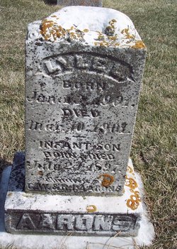
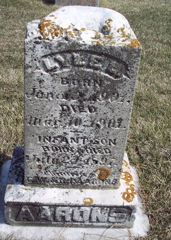
Lyle L Aarons
| Birth | : | 3 Jan 1903 Carroll County, Iowa, USA |
| Death | : | 10 Mar 1903 Carroll County, Iowa, USA |
| Burial | : | Pinecrest Memorial Park, Sandpoint, Bonner County, USA |
| Coordinate | : | 48.2797203, -116.5869370 |
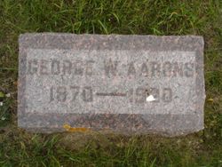
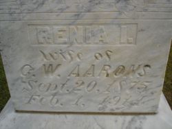
| Description | : | Lyle was the son of George W Aarons & Renia I Vincent. March 23, 1903 - Carroll Sentinel - The infant child of Geo. Aarons, who has been living on the Trowbridge farm east of town, died Thursday after an illness of several weeks. The funeral took place Friday and the remains were interred in in the East Liberty cemetery. |
frequently asked questions (FAQ):
-
Where is Lyle L Aarons's memorial?
Lyle L Aarons's memorial is located at: Pinecrest Memorial Park, Sandpoint, Bonner County, USA.
-
When did Lyle L Aarons death?
Lyle L Aarons death on 10 Mar 1903 in Carroll County, Iowa, USA
-
Where are the coordinates of the Lyle L Aarons's memorial?
Latitude: 48.2797203
Longitude: -116.5869370
Family Members:
Parent
Siblings
Flowers:
Nearby Cemetories:
1. Pinecrest Memorial Park
Sandpoint, Bonner County, USA
Coordinate: 48.2797203, -116.5869370
2. Lakeview Cemetery
Sandpoint, Bonner County, USA
Coordinate: 48.2619019, -116.5661011
3. Colburn Cemetery
Colburn, Bonner County, USA
Coordinate: 48.3918000, -116.5384900
4. Gamlin Lake Cemetery
Sagle, Bonner County, USA
Coordinate: 48.2186127, -116.4194412
5. Pack River Cemetery
Bonner County, USA
Coordinate: 48.3675620, -116.4404120
6. Westmond Cemetery
Westmond, Bonner County, USA
Coordinate: 48.1464005, -116.5986023
7. Drake Cemetery
Bonner County, USA
Coordinate: 48.1180500, -116.5402700
8. Gold Creek Cemetery
Bonner County, USA
Coordinate: 48.4000015, -116.4160995
9. Seneacquoteen Cemetery
Sandpoint, Bonner County, USA
Coordinate: 48.1510000, -116.7592000
10. Old Hope Cemetery
Hope, Bonner County, USA
Coordinate: 48.2530500, -116.3157300
11. Hope Cemetery
East Hope, Bonner County, USA
Coordinate: 48.2449989, -116.2966995
12. Cloudledge Cemetery
East Hope, Bonner County, USA
Coordinate: 48.2345670, -116.2772340
13. Owen Family Cemetery
East Hope, Bonner County, USA
Coordinate: 48.2160100, -116.2790200
14. Evergreen Cemetery
Priest River, Bonner County, USA
Coordinate: 48.1907959, -116.9042740
15. Clara Cemetery
Bonner County, USA
Coordinate: 48.0344009, -116.4486008
16. McArthur Cemetery
Boundary County, USA
Coordinate: 48.5246000, -116.4350000
17. Clark Fork Cemetery
Clark Fork, Bonner County, USA
Coordinate: 48.1610000, -116.1690000
18. Newport Cemetery
Newport, Pend Oreille County, USA
Coordinate: 48.1747017, -117.0669022
19. Mountain View Cemetery
Athol, Kootenai County, USA
Coordinate: 47.9484000, -116.7218500
20. Greenwood Cemetery
Spirit Lake, Kootenai County, USA
Coordinate: 47.9636002, -116.8582993
21. Holy Myrrhbearers Orthodox Church Parish Cemetery
Bonners Ferry, Boundary County, USA
Coordinate: 48.6190260, -116.3598830
22. Blanchard Cemetery
Blanchard, Bonner County, USA
Coordinate: 48.0168991, -116.9805984
23. Spring Valley Mennonite Cemetery
Newport, Pend Oreille County, USA
Coordinate: 48.0859800, -117.0796400
24. Cabinet Cemetery
Bonner County, USA
Coordinate: 48.0826000, -116.0681000

