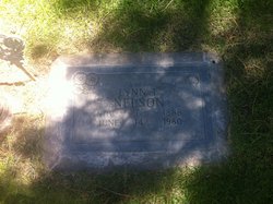
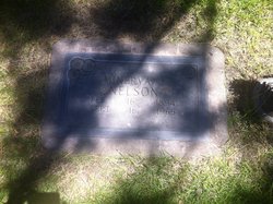
Lynn Leroy “Bud” Nelson
| Birth | : | 6 Nov 1888 Norton County, Kansas, USA |
| Death | : | 14 Jun 1980 Sutherland, Lincoln County, Nebraska, USA |
| Burial | : | St. Mary's Churchyard, North Stoke, South Oxfordshire District, England |
| Coordinate | : | 51.5714910, -1.1228080 |
| Description | : | Buried June 16,1980 Lot 167 Section D Space- 01 Lynn Leroy “Bud” Nelson Nov 6, 1888-June 14, 1980 Lynn"Bud"Nelson, 91, of 900 E. Sixth, a former Lincoln County assessor, died Saturday morning in a Sutherland nursing home. He was born Nov 6, 1888 in Morris County, Kansas. He moved to the North Platte area from Manhattan, Kansas in 1934 and had lived here since. Mr Nelson was in the hide and fur business prior to becoming Lincoln County assessor. He retired from the assessor's job in 1965. He was a member of the Walla Walla Walla Lodge No,... Read More |
frequently asked questions (FAQ):
-
Where is Lynn Leroy “Bud” Nelson's memorial?
Lynn Leroy “Bud” Nelson's memorial is located at: St. Mary's Churchyard, North Stoke, South Oxfordshire District, England.
-
When did Lynn Leroy “Bud” Nelson death?
Lynn Leroy “Bud” Nelson death on 14 Jun 1980 in Sutherland, Lincoln County, Nebraska, USA
-
Where are the coordinates of the Lynn Leroy “Bud” Nelson's memorial?
Latitude: 51.5714910
Longitude: -1.1228080
Family Members:
Parent
Spouse
Siblings
Flowers:
Nearby Cemetories:
1. St. Mary's Churchyard
North Stoke, South Oxfordshire District, England
Coordinate: 51.5714910, -1.1228080
2. St. John the Baptist Church (Defunct)
Mongwell, South Oxfordshire District, England
Coordinate: 51.5860980, -1.1233580
3. St. Mary the Virgin Cemetery
Ipsden, South Oxfordshire District, England
Coordinate: 51.5674164, -1.0866686
4. St. Mary's Churchyard
Cholsey, South Oxfordshire District, England
Coordinate: 51.5788078, -1.1589500
5. St John the Baptist
Moulsford, South Oxfordshire District, England
Coordinate: 51.5531050, -1.1482640
6. St Andrew Churchyard
South Stoke, South Oxfordshire District, England
Coordinate: 51.5479065, -1.1377167
7. St. Leonard's Churchyard
Wallingford, South Oxfordshire District, England
Coordinate: 51.5972711, -1.1230712
8. St. Mary-le-More Churchyard
Wallingford, South Oxfordshire District, England
Coordinate: 51.5993878, -1.1249488
9. St Mary Magdalene Churchyard
Crowmarsh Gifford, South Oxfordshire District, England
Coordinate: 51.5992169, -1.1139564
10. Saint Peter's Churchyard
Wallingford, South Oxfordshire District, England
Coordinate: 51.6005819, -1.1215970
11. All Hallows Graveyard
Wallingford, South Oxfordshire District, England
Coordinate: 51.6020520, -1.1242267
12. Wallingford Cemetery
Wallingford, South Oxfordshire District, England
Coordinate: 51.6058200, -1.1232000
13. St. John the Baptist South Moreton
South Moreton, South Oxfordshire District, England
Coordinate: 51.5881630, -1.1895850
14. Saint James Churchyard
Brightwell cum Sotwell, South Oxfordshire District, England
Coordinate: 51.6120200, -1.1549800
15. St Michael's Cemetery
Aston Tirrold, South Oxfordshire District, England
Coordinate: 51.5730994, -1.1967145
16. South Moreton Strict Baptist Chapel
South Moreton, South Oxfordshire District, England
Coordinate: 51.5900300, -1.1924310
17. St. Leonard's Churchyard
Woodcote, South Oxfordshire District, England
Coordinate: 51.5348117, -1.0731299
18. St. Helen's Churchyard
Benson, South Oxfordshire District, England
Coordinate: 51.6200200, -1.1127400
19. St. Helen Churchyard Extension
Benson, South Oxfordshire District, England
Coordinate: 51.6201400, -1.1121200
20. St. Mary Churchyard
Streatley, West Berkshire Unitary Authority, England
Coordinate: 51.5240170, -1.1449500
21. St. Agatha New Churchyard
Brightwell cum Sotwell, South Oxfordshire District, England
Coordinate: 51.6131480, -1.1665480
22. Benson War Memorial
Benson, South Oxfordshire District, England
Coordinate: 51.6207890, -1.1108700
23. Whitehill Burial Ground
Goring, South Oxfordshire District, England
Coordinate: 51.5214730, -1.1180180
24. All Saints Churchyard
Aston Upthorpe, South Oxfordshire District, England
Coordinate: 51.5715900, -1.2037500


